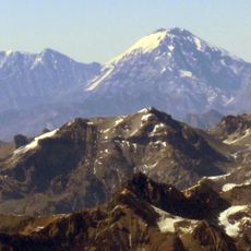
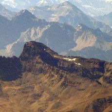
Mercedario, Mountain summit in San Juan Province, Argentina
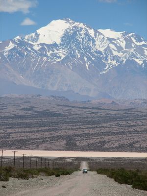
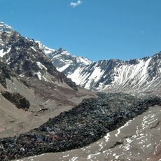
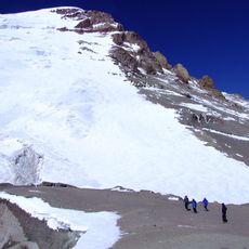
Cerro Mercedario is a high mountain peak in San Juan Province located in the central Andes of Argentina. It rises prominently from the surrounding landscape and displays the rugged, exposed rock formations typical of this alpine region.
The peak was first summited in 1934 during a European mountaineering expedition, marking the beginning of modern ascents. Archaeological evidence discovered later suggested that indigenous peoples had reached high elevations in this region long before.
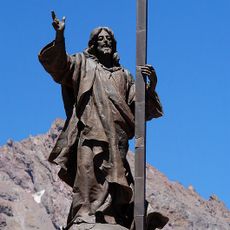
The mountain holds significance in regional traditions and carries a name reflecting its importance to local communities. Today, visitors can sense this connection through how people from surrounding areas regard and speak about the peak.
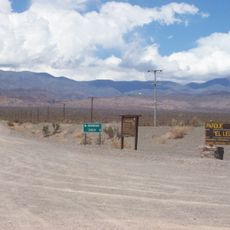
Climbing conditions are most favorable during the southern summer months when weather patterns are most stable. Visitors should prepare for extended approaches and work with local guides or established routes to navigate safely through the terrain.
The mountain sits slightly removed from better-known climbing routes and draws fewer mountaineers than nearby famous peaks. This location gives it a quieter character with fewer visitors compared to more celebrated neighboring summits.
GPS coordinates: -31.97927,-70.11309
Latest update: December 7, 2025 20:46
Puente del Inca
96.2 km
Christ the Redeemer of the Andes
94.3 km
Aconcagua Provincial Park
92.3 km
El Leoncito National Park
73.3 km
Leoncito Astronomical Complex
79.8 km
Barreal Blanco
64.9 km
Los cafes del Diego
96.6 km
Polish Glacier
75.8 km
Félix Aguilar Observatory
76.9 km
Las Bóvedas De Uspallata
98 km
Puente sobre el Río Picheuta
96.4 km
El Bato Dam
85.4 km
Solar Submillimeter Telescope
79.7 km
Iglesia de la Merced, Petorca
82.9 km
Polarization Emission of Millimeter Activity at the Sun
79.7 km
Cementerio de los andinistas
96.4 km
Capilla Nuestra Señora del Carmen (Calingasta)
97.2 km
Capilla de Lo Vicuña
89 km
Túnel Curvo
98 km
Putaendo
92 km
Cerro Ameghino
73.1 km
Túnel Recto
98.6 km
Cerro Parva del Inca
87.2 km
The vaults
98.9 km
Sección Puente del Inca -- Punto Inicial
96.2 km
Bóvedas de San Martín
98 km
Restos del molino hidráulico, hornos de fundición, muros,acequias, túnel y todos los elementos prehispánicos que circundan las bóvedas de Uspallata
98 km
Casa donde nació José Antonio Salinas
91.7 kmVisited this place? Tap the stars to rate it and share your experience / photos with the community! Try now! You can cancel it anytime.
Discover hidden gems everywhere you go!
From secret cafés to breathtaking viewpoints, skip the crowded tourist spots and find places that match your style. Our app makes it easy with voice search, smart filtering, route optimization, and insider tips from travelers worldwide. Download now for the complete mobile experience.
A unique approach to discovering new places❞
— Le Figaro
All the places worth exploring❞
— France Info
A tailor-made excursion in just a few clicks❞
— 20 Minutes