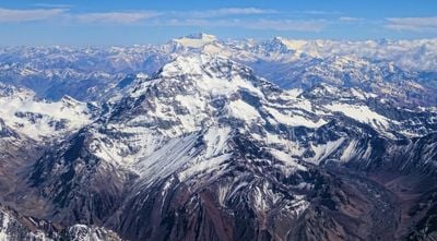
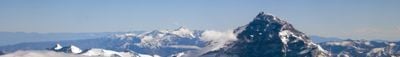
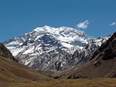
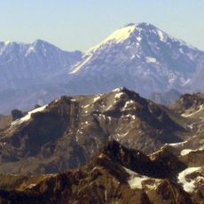
Aconcagua, Mountain in Las Heras Department, Mendoza Province, Argentina.
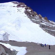
Aconcagua rises to 22,837 feet (6,962 meters) above sea level, making it the highest mountain in South America and the tallest peak in both the Southern and Western Hemispheres.
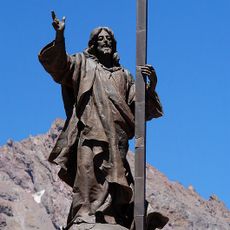
The first documented ascent of Aconcagua occurred in 1897 when Swiss mountaineer Matthias Zurbriggen reached the summit, although indigenous peoples had long regarded the mountain as a sacred landmark.
The mountain's name derives from the Quechua words meaning stone sentinel, reflecting its cultural importance to indigenous communities who viewed it as a spiritual site for centuries.
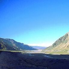
Climbing season runs from November 15 to March 15 during the Southern Hemisphere summer, and climbers must obtain permits and allow 15 to 20 days for proper acclimatization to the extreme altitude.
Aconcagua is composed primarily of sedimentary rock layers including sandstone and shale, and it is recognized as one of the Seven Summits representing the highest point on each continent.
Location: Las Heras Department
Elevation above the sea: 6,962 m
Made from material: sedimentary rock
Part of: Seven Summits
GPS coordinates: -32.65315,-70.01196
Latest update: November 28, 2025 11:23
Photo license: CC0
Argentina extends across multiple climate zones and contains numerous geological formations. The country encompasses high mountain ranges in the Andes, salt flats in the northwest, rock formations in Patagonia, and extensive grasslands. These areas display the region's geological history and the adaptation of human settlements to different environments. The sites include volcanic craters, thermal springs, canyons, and historic villages. Many of these locations lie away from main routes and require several hours of travel. The regions document pre-Columbian cultures, colonial history, and traditional ways of life that continue today.
Puente del Inca
21.5 km
Christ the Redeemer of the Andes
19.9 km
Aconcagua Provincial Park
23.7 km
Uspallata Pass
20 km
Polish Glacier
451 m
Iglesia de las Carmelitas Descalzas, Los Andes
58.9 km
Nevado del Plomo
50.4 km
Nevado Juncal
44.2 km
Iglesia de San Antonio de Padua (El Almendral)
64.7 km
Las Bóvedas De Uspallata
63.6 km
Estadio Regional de Los Andes
59.2 km
Puente sobre el Río Picheuta
46.3 km
Río Blanco National Reserve
43.3 km
Cementerio de los andinistas
22.1 km
Cerro Blanco (Mendoza)
61.3 km
Edificio de la Gobernación de Los Andes
58.4 km
Museo y Centro Cultural Presidente Pedro Aguirre Cerda
61.4 km
Cerro Ameghino
4.5 km
Casa de Domingo Faustino Sarmiento
61.5 km
Mine d'Andina
60.5 km
Ex Railway Station Andes
58.4 km
Cerro Parva del Inca
19 km
Cerro Vallecitos
65 km
The vaults
61.6 km
Casa de Domingo Faustino Sarmiento
61.8 km
Bóvedas de San Martín
63.6 km
Sección Puente del Inca -- Punto Inicial
21.5 km
Casa donde nació el Presidente Pedro Aguirre Cerda
61.8 kmVisited this place? Tap the stars to rate it and share your experience / photos with the community! Try now! You can cancel it anytime.
Discover hidden gems everywhere you go!
From secret cafés to breathtaking viewpoints, skip the crowded tourist spots and find places that match your style. Our app makes it easy with voice search, smart filtering, route optimization, and insider tips from travelers worldwide. Download now for the complete mobile experience.
A unique approach to discovering new places❞
— Le Figaro
All the places worth exploring❞
— France Info
A tailor-made excursion in just a few clicks❞
— 20 Minutes