Chest opened
+${chestReward.xp} XP
Explorer
NOUVEAU ×${chestReward.collectible.quantity}
tapez pour fermer

See the monuments around you in AR Open chests in the app

Around Us is built for your phone — point your camera at the streets and discover the monuments and places around you in augmented reality. Around Us is built for your phone — chests unlock when you walk, explore and capture nearby places.

•

Enable Location

We need your location to show you interesting places around you

Discover nearby places

Find interesting locations and hidden gems around you

Precise directions

Get accurate directions and distances to places

Your location is never shared with other users. It's only used when you tap the location button.

Apachita

Log in to your account

Start exploring — it's free

Trusted by 92,653 travelers worldwide

Continue with Google
Continue with Apple
or

We will send you a code to connect

By continuing, you accept our Terms and Conditions and our Privacy Policy

Check your inbox

We've sent a pincode in your inbox. Please enter the code below.

Apachita

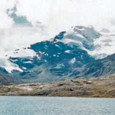
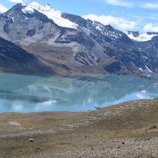
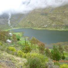
Apachita, Mountain summit in Carabaya Province, Peru.

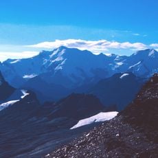
Apachita is a mountain summit in Carabaya Province in the Peruvian Andes rising to 5,168 meters above sea level. It stands between the peaks of Ariquma and Wiluyuq Urqu, shaping the geography of this high-altitude region.

The name apachita comes from Quechua and Aymara, meaning a resting place, and such cairns were built along the Inca road on difficult slopes. Over time they became boundary markers, and travellers left stones with coca leaves, tobacco or fermented drinks for Pachamama and the apus. Some authors instead link them to dividing and measuring territory, or to stone carried for watchposts.

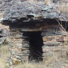
The word apachita comes from Quechua and Aymara and means "place of rest". Travellers still leave coca leaves, tobacco, fermented drinks or flowers on the cairn and say the word while placing them; removing stones is considered sacrilege. The concrete plaque in front reads APACHETA (Altar Sagrado de Piedra).

Visitors need specialized high-altitude equipment and time to acclimatize due to the extreme conditions at this elevation. Good preparation and physical fitness are important for handling the strain of thin air.

The summit's name comes from the Quechua and Aymara word apachita, meaning "place of rest". The cairn of piled stones shown in the photograph is an apacheta, an offering to Pachamama and the mountain deities, the apus, left by travellers on hard stretches of the Inca road. Removing its stones is considered sacrilege.

The community of curious travelers

AroundUs brings together thousands of curated places, local tips, and hidden gems, enriched daily by 92,653 contributors worldwide.

Start exploring
Elevation above the sea
5,168 m
GPS coordinates
-14.28486,-69.80826
Latest update
October 24, 2026 09:38
Reviews
Share your experience

No review yet

Discussions
Start a discussion...

No discussion yet

« Apachita - Mountain summit in Carabaya Province, Peru » is provided by Around Us (aroundus.com). Images and texts are derived from Wikimedia project under a Creative Commons license. You are allowed to copy, distribute, and modify copies of this page, under the conditions set by the license, as long as this note is clearly visible.

Discover hidden gems everywhere you go!

From secret cafés to breathtaking viewpoints, skip the crowded tourist spots and find places that match your style. Our app makes it easy with voice search, smart filtering, route optimization, and insider tips from travelers worldwide. Download now for the complete mobile experience.

Around Us App Screenshot
❝

A unique approach to discovering new places❞

— Le Figaro

❝

All the places worth exploring❞

— France Info

❝

A tailor-made excursion in just a few clicks❞

— 20 Minutes

Around Us
Travel Guide & Maps
Download

Send to your phone

QR Code
1

Open the camera app on your mobile.

2

Point at the QR code with your camera. A notification will appear.

3

Tap the notification to open the link.