Pichanaqui District, Administrative district in Chanchamayo Province, Peru.
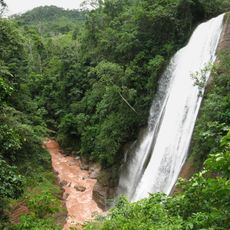
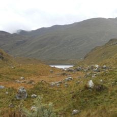
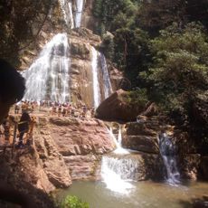
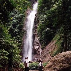
Pichanaqui District is an administrative area in Chanchamayo Province located in Peru's central highlands region. The district covers forested terrain with river valleys, characterized by dense vegetation and a mountainous landscape.
The district was officially established in 1977 following the need to resettle communities after a major earthquake struck the region in 1947. This founding represented a fresh start for people rebuilding their lives in the area.
The area takes pride in its coffee cultivation, which shapes daily life and economic activity across the region. You can see coffee plantations everywhere and feel how central this crop is to local identity and work.
The district sits in a mountainous region with dense rainforest, so expect wet conditions especially during warmer months. Sturdy footwear and rain-resistant clothing are essential for exploring the area.
The region receives significantly more rainfall during summer months compared to the dry season, creating a striking contrast in weather patterns. This seasonal variation shapes how vegetation grows and how people plan their farming activities.
Location: Chanchamayo Province
Capital city: Pichanaqui
Elevation above the sea: 525 m
Shares border with: Río Tambo District, Río Negro District, Satipo District, Pampa Hermosa District, Vitoc District, Perené District, Puerto Bermúdez
GPS coordinates: -10.92467,-74.87680
Latest update: December 7, 2025 09:22
Yanachaga–Chemillén National Park
74.9 km
Huaytapallana
111.2 km
Huagapo
106.5 km
Chacamarca Historical Sanctuary
123.8 km
Velo de la Novia, Perené
26.6 km
Colegio de Propaganda Fide de Santa Rosa de Ocopa
115.1 km
Pampa Hermosa National Sanctuary
67.1 km
Tunanmarka
118.5 km
Pui Pui Protection Forest
43.6 km
Catarata Bayoz
27 km
Yanesha Communal Reserve
73.7 km
Torre Torre
130.7 km
San Matías–San Carlos Protection Forest
42.6 km
Catarata El Tirol
55.1 km
Saint Anne Church (Tarma)
104.4 km
Tarmatambo
107.6 km
Oxapampa-Ashaninka-Yanesha
49.5 km
Río Shullcas
132.9 km
Iglesia de la Merced
132.2 km
Huaytapallana Regional Conservation Area
110.6 km
Capilla Cristo Pobre
116.5 km
Puente Centenario
132.1 km
Waqurunchu
123.5 km
Estadio Mariscal Castilla
130.7 km
Iglesia Matriz Santa Rosa de Oxapampa
69.6 km
Casa del pintor Guillermo Guzmán Manzaneda
132 km
Tunanmarca
118.5 km
Wawi Wawi
123.3 kmVisited this place? Tap the stars to rate it and share your experience / photos with the community! Try now! You can cancel it anytime.
Discover hidden gems everywhere you go!
From secret cafés to breathtaking viewpoints, skip the crowded tourist spots and find places that match your style. Our app makes it easy with voice search, smart filtering, route optimization, and insider tips from travelers worldwide. Download now for the complete mobile experience.
A unique approach to discovering new places❞
— Le Figaro
All the places worth exploring❞
— France Info
A tailor-made excursion in just a few clicks❞
— 20 Minutes