Cutervo National Park, National park in Cutervo Province, Cajamarca, Peru
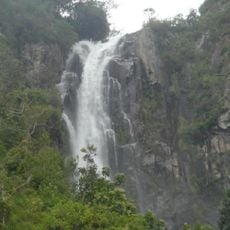
Cutervo National Park covers 8,214 hectares of Peru's northern Andes in Cajamarca, split into a northern sector of 2,429.54 hectares and a southern sector of 5,784.69 hectares. It protects wet montane forests, high-elevation grasslands above 3,000 m, rivers and small lakes, with elevations from 1,550 to 3,500 m; the Cordillera de Tarros is its highest point and holds several caves and stream sources.
Cutervo National Park was created by Law 13694, promulgated on 8 September 1961 and effective on 20 September, with an initial area of 2,500 hectares. Biologist Salomón Vílchez Murga, then a deputy for Cajamarca, pushed the bill through Congress after an earlier proposal by the Federación Cultural de Cutervo-Lima had been dismissed. Law 28860 expanded the park to 8,214 hectares on 3 August 2006, and a buffer zone was added in 2007.
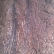
The park's name comes from the Cutervo Province and its districts, including Pimpingos, San Andrés de Cutervo and Santo Domingo de la Capilla. The El Perolito archaeological site inside the park shows pre-Columbian human occupation of the area.
The park is most accessible during drier months when trails are in better condition for hiking. Visitors should wear sturdy footwear and prepare for changing weather conditions at higher elevations.
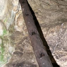
The caves' underground streams are home to Astroblepus rosei, a catfish found in the park's subterranean waters. The palm forests' fruit is the oilbirds' main food source, and the Cordillera de Tarros, the park's highest point, is the origin of several streams.
The community of curious travelers
AroundUs brings together thousands of curated places, local tips, and hidden gems, enriched daily by 92,815 contributors worldwide.