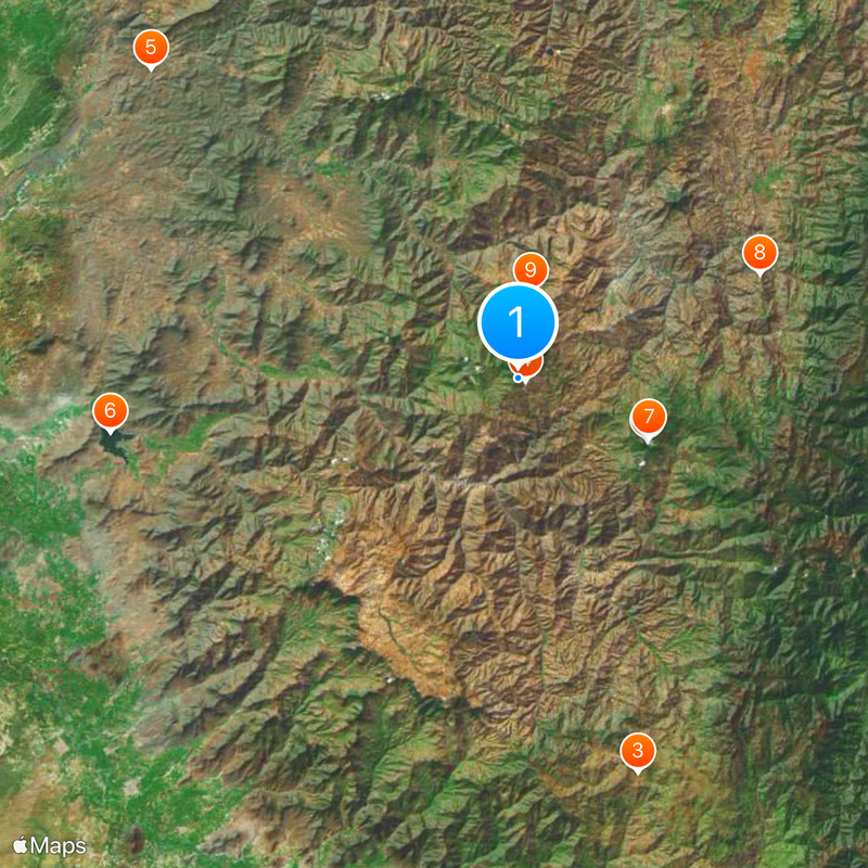
Ayabaca Province, Administrative province in northwestern Piura, Peru
Ayabaca Province is an administrative division in northwestern Piura that covers mountainous terrain divided into ten districts. The landscape rises through the western Andes, creating a varied terrain where settlements and farmland sit at different elevations.
The province was established in 1865 and takes its name from Quechua words referring to sacred places. This naming heritage reflects a long connection between the region and the ancient civilizations that once inhabited these highlands.
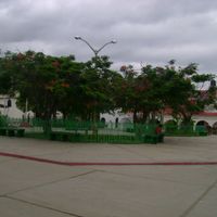
The town of Ayabaca sits in the high Andes with traditional adobe houses and narrow streets where locals speak both Spanish and Quechua. The main plaza reflects everyday community life, with markets and gatherings that show how mountain residents adapt to the altitude and cooler climate.
The region has cool temperatures ranging from 10 to 19 degrees Celsius (50 to 66 degrees Fahrenheit), with most rainfall falling between December and March. Visitors should bring layers and warm clothing, and roads through these mountains can be rough and require careful driving.
The sanctuary at Aypate, roughly 50 kilometers east, displays structures built by the Inca and even older sacred sites from earlier civilizations. The location draws visitors interested in seeing archaeological traces of these early cultures.
Location: Piura Department
Capital city: Ayabaca
Shares border with: Huancabamba Province, Morropón Province, Piura Province, Sullana Province
GPS coordinates: -4.63700,-79.72400
Latest update: December 7, 2025 10:02
Tumbes Mangals National Sanctuary
148.7 km
Podocarpus National Park
89.5 km
Pómac Forest Historical Sanctuary
204.5 km
Batán Grande
204.2 km
Laquipampa Wildlife Refuge
192.6 km
Arenillas Ecological Reserve
130.9 km
Yacurí National Park
40.6 km
Basilica of El Cisne
93.5 km
Bernal Municipal Stadium
144.4 km
Narihualá
129.5 km
Poechos Reservoir
86.6 km
Estadio Miguel Grau
116.7 km
Tumbes National Reserve
104.3 km
Pongo de Rentema
162.8 km
Cathedral of Loja-Parroquia El Sagrario
92 km
Casa Museo Gran Almirante Grau
118 km
Paquisha
140.3 km
Puente Bolognesi
118 km
Iglesia San Martín de Tours de Sechura
159.2 km
Our Lady of Mercy Cathedral, Machala
154.5 km
Iglesia San Juan Bautista, Catacaos
127.9 km
Church of Our Lady of the Pillar
984 m
Jardín botánico Reinaldo Espinosa
67.4 km
Cerro de Arcos
123.4 km
St. Nicholas Cathedral, Tumbes
144.3 km
Macará River
60.7 km
Tren Crucero
93.9 km
Cataratas Numparket
181.2 kmVisited this place? Tap the stars to rate it and share your experience / photos with the community! Try now! You can cancel it anytime.
Discover hidden gems everywhere you go!
From secret cafés to breathtaking viewpoints, skip the crowded tourist spots and find places that match your style. Our app makes it easy with voice search, smart filtering, route optimization, and insider tips from travelers worldwide. Download now for the complete mobile experience.
A unique approach to discovering new places❞
— Le Figaro
All the places worth exploring❞
— France Info
A tailor-made excursion in just a few clicks❞
— 20 Minutes