Piura Department, Administrative region in northwestern Peru.
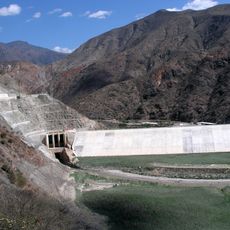
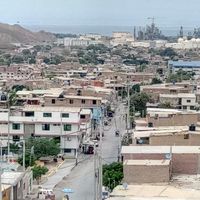
Piura Department is an administrative region in northwestern Peru that stretches from the Pacific coast to the foothills of the Andes and includes eight provinces. The landscape shifts from sandy plains and desert strips along the coast to green valleys and hills inland.
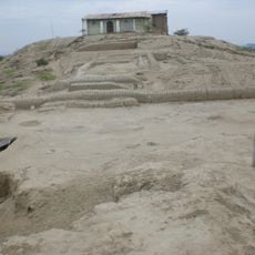
Spanish settlers founded the first town on Peruvian soil here in 1532, laying the groundwork for later colonial rule in the region. Administrative boundaries were adjusted several times over the centuries until the current structure was established in the 20th century.
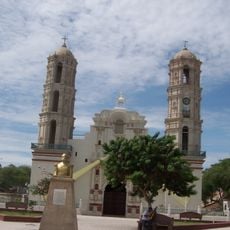
Coastal towns bear Spanish names and plazas with arcaded walkways, while in the countryside goat herders and fishermen make their living using methods passed down over centuries. Markets sell dried seafood, woven baskets, and locally made straw hats crafted by artisans in small workshops.
An airport near the capital connects the region to Lima and other Peruvian cities through daily domestic flights. Coastal towns are accessible via paved roads, while mountain villages sometimes require unpaved routes.
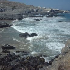
Two ocean currents meet here and create unusual temperature differences along the coast that strongly influence climate and fish stocks. Desert foxes and iguanas live in the sand, though they are rarely seen during the day.
Location: Peru
Capital city: Piura
Shares border with: Tumbes Department, Cajamarca Department, Lambayeque Department, Loja Province
GPS coordinates: -4.99000,-80.41000
Latest update: December 15, 2025 00:12
El Angolo Game Reserve
86.7 km
Laquipampa Wildlife Refuge
182.9 km
Yacurí National Park
120.1 km
Bernal Municipal Stadium
62.8 km
Narihualá
45.7 km
Poechos Reservoir
37.3 km
Estadio Miguel Grau
32.1 km
Limón Dam
158.4 km
Illescas Reserved Zone
133.5 kmAypate
97.7 kmTabaconas Namballe National Sanctuary
130.3 km
Casa Museo Gran Almirante Grau
33.4 km
Puente Bolognesi
33.5 kmCaxas
91.8 km
Iglesia San Martín de Tours de Sechura
78 km
Iglesia San Juan Bautista, Catacaos
44 kmApurlec
160.9 kmMuseo Municipal Vicús
33.2 km
Church of Our Lady of the Pillar
86.3 kmParque ecológico Kurt Beer
37.4 kmDry Forest of Salitral-Huarmaca Regional Conservation Area
83.2 kmHuacrupe-La Calera Forest Regional Conservation Area
106.3 kmInka Tampu, Cajamarca
169.9 kmEl Chaupe, Cunía and Chinchiquilla Forest Regional Conservation Area
132.8 kmCementerio San Teodoro
32.7 kmMoyán-Palacio Forest Regional Conservation Area
149 km
Macará River
83.9 kmReservorio San Lorenzo
40.8 kmVisited this place? Tap the stars to rate it and share your experience / photos with the community! Try now! You can cancel it anytime.
Discover hidden gems everywhere you go!
From secret cafés to breathtaking viewpoints, skip the crowded tourist spots and find places that match your style. Our app makes it easy with voice search, smart filtering, route optimization, and insider tips from travelers worldwide. Download now for the complete mobile experience.
A unique approach to discovering new places❞
— Le Figaro
All the places worth exploring❞
— France Info
A tailor-made excursion in just a few clicks❞
— 20 Minutes