Cañar Province

Log in to your account

AroundUs is a community-driven map of interesting places, built by curious explorers like you. It grows with every review, story, and photo you share.
Connect to save your favorite spots, contribute locations, and create personalized routes.
Continue with Google
Continue with Apple
Continue with X
Continue with Facebook
Continue with email
By continuing, you accept our Terms and Conditions and our Privacy Policy
Create an account
Add to collection
Map
Suggest a change
Share

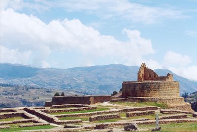
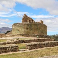
Cañar Province, Province with Inca ruins in southern Ecuador

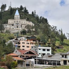
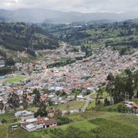
Cañar Province is an administrative region in the southern highlands of Ecuador that stretches from tropical valleys to cool mountain plateaus. Smaller towns and villages sit along winding roads that pass through farmland, eucalyptus forests, and open grasslands.

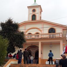
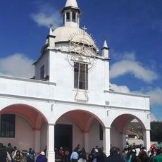
The region was formally established as a province in 1880 after previously belonging to larger administrative units. Before Spanish colonial rule, the area was home to the Cañari and later became part of the Inca Empire, whose structures remain standing.

The province takes its name from the Cañari people, whose descendants still live in communities around Ingapirca and across the highlands. Local families share stories of ancient trade routes and often speak Kichwa alongside Spanish, especially during ceremonies and festivals in village squares.

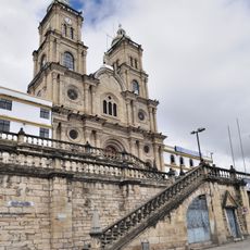
The capital Azogues serves as the central hub for accommodation and services, with regional buses linking smaller towns and communities. Mountain roads can become slippery during rain, so checking weather conditions before driving to higher elevations is advisable.

Markets in several communities sell finely woven straw hats, often mistakenly called Panama hats, even though they originate from Ecuador. The region also produces Zhumir, a traditional drink made from sugar cane and bottled at home distilleries, consumed at village celebrations.

Location: Ecuador

Inception: November 3, 1880

Capital city: Azogues

Elevation above the sea: 2,342 m

Shares border with: Chimborazo Province, Guayas Province, Azuay Province, Morona-Santiago Province

Website: http://gobiernodelcanar.gob.ec

GPS coordinates: -2.53333,-79.00000

Latest update: December 13, 2025 17:41

Photos
Reviews

Visited this place? Tap the stars to rate it and share your experience / photos with the community! Try now! You can cancel it anytime.

« Cañar Province - Province with Inca ruins in southern Ecuador » is provided by Around Us (aroundus.com). Images and texts are derived from Wikimedia project under a Creative Commons license. You are allowed to copy, distribute, and modify copies of this page, under the conditions set by the license, as long as this note is clearly visible.

Discover hidden gems everywhere you go!

From secret cafés to breathtaking viewpoints, skip the crowded tourist spots and find places that match your style. Our app makes it easy with voice search, smart filtering, route optimization, and insider tips from travelers worldwide. Download now for the complete mobile experience.

Around Us App Screenshot

A unique approach to discovering new places

Le Figaro

All the places worth exploring

France Info

A tailor-made excursion in just a few clicks

20 Minutes