Isla de los Estados, Remote island reserve in Tierra del Fuego, Argentina.
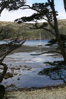
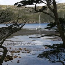
Isla de los Estados is a remote island in Tierra del Fuego, Argentina, stretching about 65 kilometers in length and roughly 15 kilometers across at its widest point. Deep bays indent the coastline, while mountain peaks in the interior rise to approximately 823 meters.
Spanish explorers first reached the island in 1526, mapping these southern waters during early colonial expansion. Dutch navigators later renamed it Staten Landt in 1615, establishing their own claim to knowledge of these remote lands.
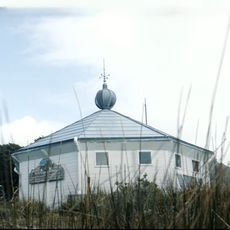
The San Juan del Salvamento Lighthouse shaped how people imagined life at the world's end, inspiring a famous novel about survival in extreme conditions. Visitors can see how this remote outpost became a symbol of human presence in the southern ocean.
Visiting requires special permission from Argentine authorities before departure. Organized expeditions typically depart from Ushuaia, the gateway port for reaching these southern islands.
The island hosts one of the southernmost breeding grounds for Magellanic penguins in the world. This remote location receives exceptional rainfall, creating a harsh environment where wildlife has adapted to extreme conditions.
The community of curious travelers
AroundUs brings together thousands of curated places, local tips, and hidden gems, enriched daily by 60,000 contributors worldwide.