Cachoeira do Sul, Agricultural municipality in Rio Grande do Sul, Brazil.
Cachoeira do Sul is a municipality in Rio Grande do Sul that spreads across agricultural lands in southern Brazil. The town sits at an average elevation of 68 meters and forms a pattern of fields, houses, and local facilities.
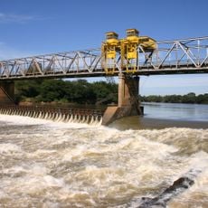
The settlement was founded in 1820 as a Portuguese outpost and grew into a regional agricultural center. Rice farming came to define the landscape and the area's economic life.
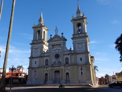
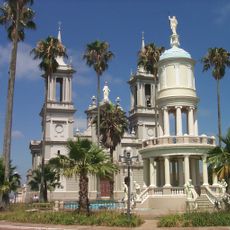
The Cathedral Nossa Senhora da Conceição shapes the town center as its spiritual heart and reflects the deep religious roots of the community. It serves as a gathering place for local life and remains central to how residents mark their year.
The climate remains moderate year-round, with cool winter months and warm summer weeks that make the seasons clearly distinct. Visitors should prepare for variable weather, as changes between January and June are quite noticeable.
The Joaquim Vidal Stadium brings together two local soccer teams that play regularly before crowds and show the community's passion for the sport. This venue hosts neighborhood rivals and displays the energy that soccer can spark in small towns.
The community of curious travelers
AroundUs brings together thousands of curated places, local tips, and hidden gems, enriched daily by 60,000 contributors worldwide.