Los Cardones National Park
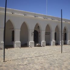
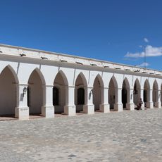
Los Cardones National Park, National park in Salta Province, Argentina
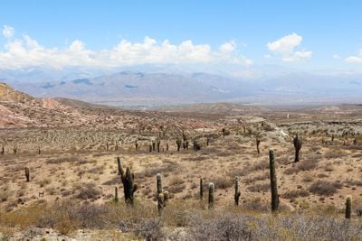
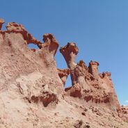
Los Cardones National Park is a mountain reserve of about 64,000 hectares with elevations ranging from 2,600 to over 5,200 meters, composed of dry terrain with sparse vegetation. The landscape includes rocky slopes, open plateaus, and narrow valleys that run south to north through the region.
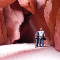
The reserve was established in 1996 to protect a landscape containing rock paintings from pre-Hispanic peoples. Fossilized dinosaur footprints from the age of dinosaurs have also been discovered in the mountain formations.
Shepherds move through these mountains following routes passed down through generations, grazing their herds on designated lands that shape the landscape. This pastoral tradition remains visible in how the valleys are used and inhabited today.
The main route passes through Provincial Route 33, which runs through the mountain region and has several stops for public buses. Visitors should wear sturdy footwear and be prepared for thinner air at higher elevations.
The giant cacti that give this place its name can reach up to 15 meters tall and live over 300 years in this arid mountain setting. These slow-growing plants are among the most distinctive features visitors encounter while walking through the reserve.
Location: Salta Province
Inception: November 20, 1996
Operator: Administración Parques Nacionales
Website: https://argentina.gob.ar/interior/ambiente/parquesnacionales/loscardones
GPS coordinates: -25.12533,-66.18167
Latest update: December 13, 2025 23:43
Northwest Argentina is a region where deserts, wine regions and Andean valleys coexist. Salt flats, striking rock formations, pre-Columbian sites and traditional mountain villages define this landscape. The terrain shifts between bare highlands, colorful mountain ranges and green valleys where small...
Cuevas de Acsibi
27.2 km
Archaeological Museum of Cachi
2.1 km
Areas del Pueblo de Seclantas
21.4 km
Iglesia de San José en Cachi
2.1 km
Areas del Pueblo de Cachi
2.1 km
Museo Arqueológico Pío Pablo Díaz
2.1 km
Ojo del Condor
25.7 km
Marino mancinelli
34.5 km
Ovnipuerto Cachi
3.1 km
Mirador
37.3 km
Abra Piedra de Molino
33.2 km
Cuesta del Obispo
33.7 km
Mirador del Valle Encantado
34.5 km
Mirador norte Cachi
2.4 km
Capilla del Cementerio de Seclantás
23.8 km
Scenic viewpoint
20.8 km
Mirador Oeste
1.1 km
Ascenso al Mirador de la Cruz
3.4 km
Mirador Nevado de Cachi
17.8 km
Cuesta del Obispo
33.5 km
Scenic viewpoint
52.9 km
Mirador de la Cruz
3.7 km
Scenic viewpoint
1.8 km
Bienvenidos al Parque National
18.5 km
Scenic viewpoint
18.4 km
Scenic viewpoint
43.7 km
Scenic viewpoint
34.1 km
Scenic viewpoint
39 kmVisited this place? Tap the stars to rate it and share your experience / photos with the community! Try now! You can cancel it anytime.
Discover hidden gems everywhere you go!
From secret cafés to breathtaking viewpoints, skip the crowded tourist spots and find places that match your style. Our app makes it easy with voice search, smart filtering, route optimization, and insider tips from travelers worldwide. Download now for the complete mobile experience.
A unique approach to discovering new places❞
— Le Figaro
All the places worth exploring❞
— France Info
A tailor-made excursion in just a few clicks❞
— 20 Minutes