See the monuments around you in AROpen chests in the app
Around Us is built for your phone — point your camera at the streets and discover the monuments and places around you in augmented reality.Around Us is built for your phone — chests unlock when you walk, explore and capture nearby places.
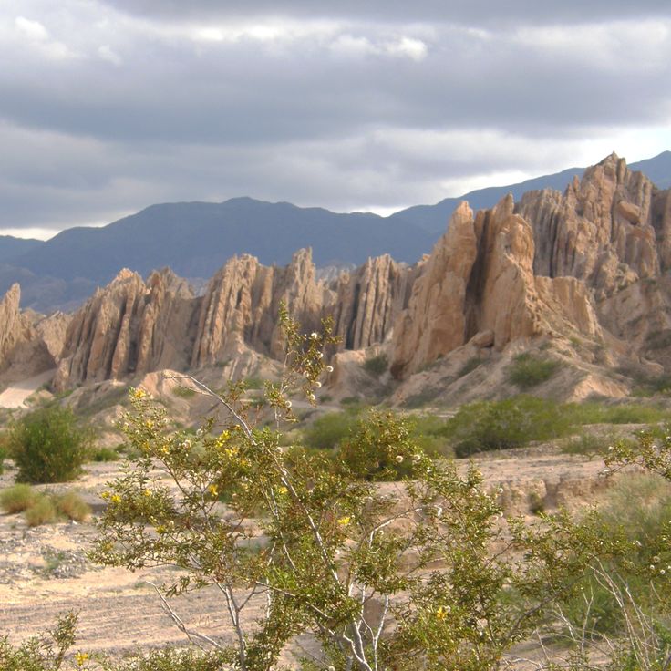
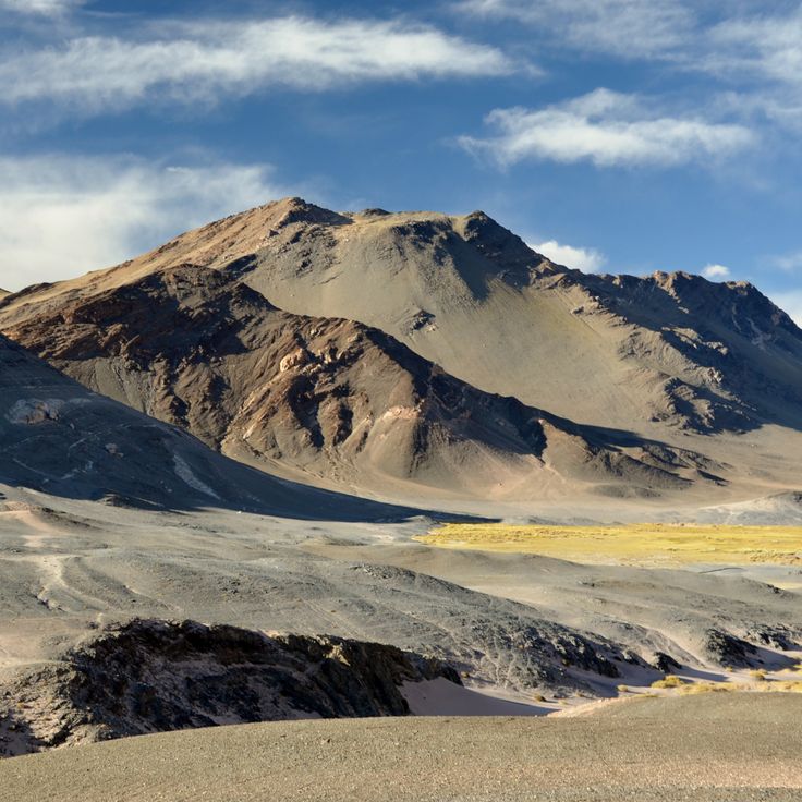
Northwest Argentina is a region where deserts, wine regions and Andean valleys coexist. Salt flats, striking rock formations, pre-Columbian sites and traditional mountain villages define this landscape. The terrain shifts between bare highlands, colorful mountain ranges and green valleys where small communities have lived and worked for generations.
The region offers numerous places to explore. Visitors can walk through Quebrada de las Conchas, where red and orange rocks form dramatic canyons, or stand before the vast salt plains of Salinas Grandes. Those interested in archaeology can visit the Ruinas de Quilmes, remains of a pre-Columbian settlement, or see rock paintings in Cueva de las Manos de Acsibi.
Villages like Iruya, Yavi and Purmamarca showcase mountain life. Some travelers explore Laguna Diamante with its turquoise waters or drive over the Abra del Acay, a high mountain pass with sweeping views. Thermal springs in Fiambalá and hiking routes through the Valles Calchaquíes appeal to active visitors. Colonial churches in the city of Salta and small chapels in remote villages tell the story of the region's past.
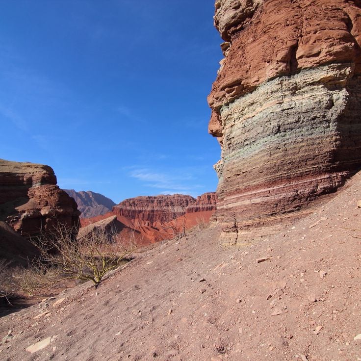
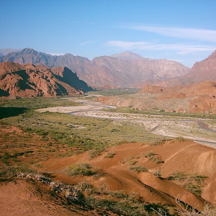
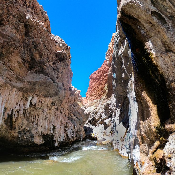
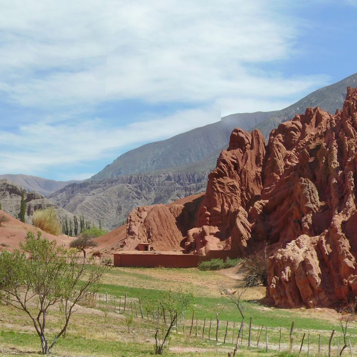
The Quebrada de las Conchas is a red canyon located in Salta in northwest Argentina. This canyon extends for 60 kilometers and displays rock layers from different geological periods. The Quebrada de las Conchas is part of the region's natural landscapes, which combine desert areas, wine regions and Andean valleys. The canyon shows the geological diversity of northwest Argentina through its distinctive red rock walls and layered formations.
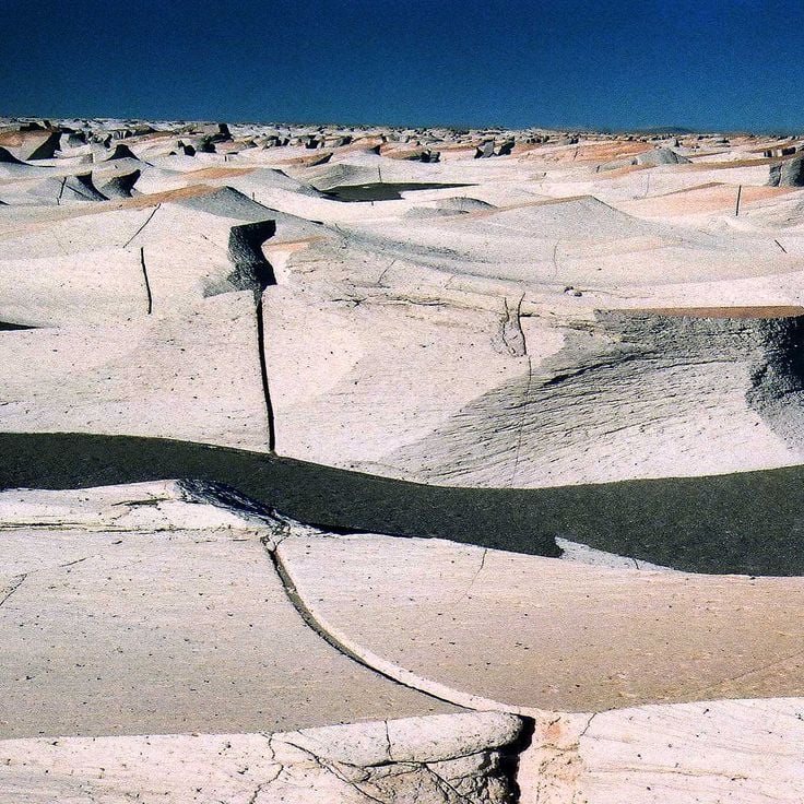
Campo de Piedra Pómez in northwest Argentina displays the geological features that define this landscape. This volcanic formation spreads across the Puna plateau and consists of white pumice stone blocks. Walking through this place gives you a sense of the natural forces that shaped the Andes and their valleys.
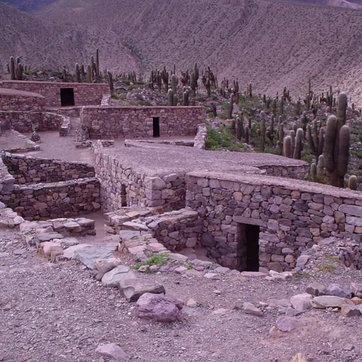
Ruinas de Quilmes in Tucumán is an archaeological site that fits within the landscape of northwest Argentina, a region shaped by deserts, wine areas and Andean valleys. This 9th century settlement once housed up to 5000 people of the Quilmes people who built and lived in stone structures. The ruins show how this mountain community organized their daily life.
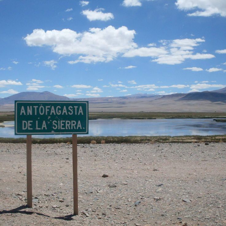
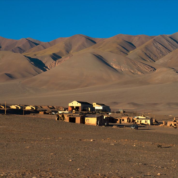
Antofagasta de la Sierra is a mountain village in northwest Argentina situated at 3400 meters elevation. It sits in the Puna region surrounded by volcanoes and salt lakes. The village shows how people live in the Andean valleys where traditional mountain communities adapt to harsh conditions. The dry landscape with its geological formations and rough terrain shapes the character of the area.
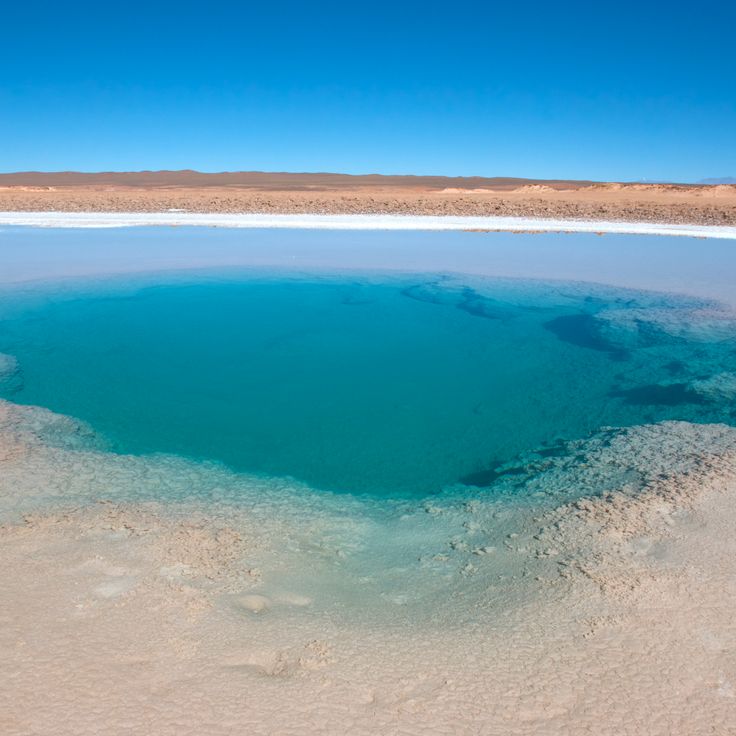
Ojo de Mar is a natural salt basin in northwest Argentina, located in the high plateau of Jujuy province. The water creates reflections of the sky and surrounding landscape, revealing the geological character of this Andean highland. This site exemplifies the salt flats that define the region's distinctive terrain, nestled among the mountain valleys and desert areas that characterize northwest Argentina.
Cueva de las Manos de Acsibi in Salta is a cave with prehistoric hand prints on its walls, surrounded by rock formations in a canyon. It belongs to the natural landscape region of northwest Argentina, which combines desert areas, wine regions and Andean valleys, and also features salt flats, geological formations, pre-Columbian sites and traditional mountain villages.
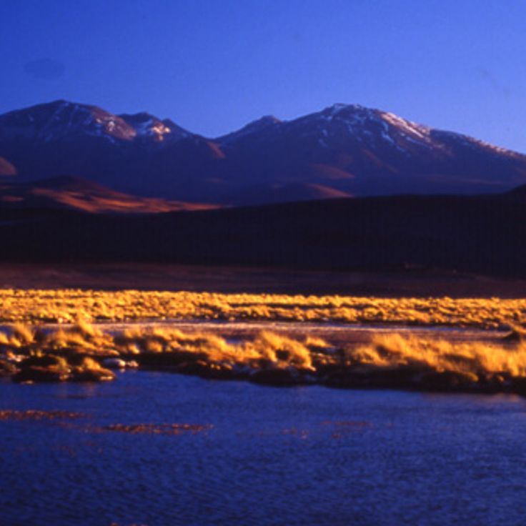
Laguna Diamante is a lake located in the Andes at 4200 meters elevation within a crater ringed by mineral-rich rock formations. The water's color shifts with the light and surrounding minerals that give the region its character. This lake sits in northwestern Argentina's landscape of salt flats, volcanic features, and mountain villages where traditional ways of life continue in the high valleys.
Abra del Acay is a mountain pass situated in Salta that forms part of northwest Argentina's varied terrain of deserts, wine regions and Andean valleys. At 4895 meters elevation, this pass offers views across the Andes and regional mountain ranges that define the dramatic topography of the area.
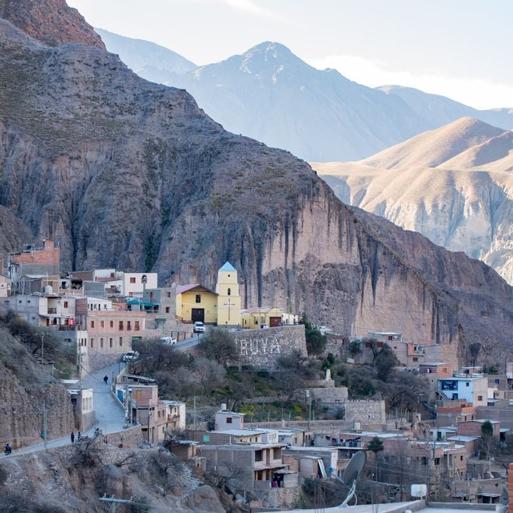
Iruya sits within this collection of northwest mountain landscapes at an elevation of 2780 meters. The village features narrow alleys and stone houses dating from the 18th century. It represents traditional life in the Andes, where old architecture and mountain geography meet.
Tolar Grande sits at 3500 meters elevation in the Puna region and serves as a gateway to the landscapes of northwest Argentina. From this mountain settlement, visitors can access salt flats, volcanoes and red sandstone formations that define the arid and geologically varied terrain of the area.
Yavi is a village in Jujuy that forms part of northwest Argentina's natural landscapes combining desert areas, wine regions and Andean valleys. The village preserves a 17th century church with murals and pre-Columbian archaeological sites in the surrounding area, reflecting the layered history of the Andes and the connection between colonial and indigenous cultures.
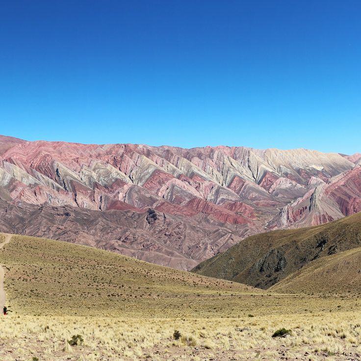
The Serranía del Hornocal is a mountain range in Jujuy that forms part of the natural landscapes of northwest Argentina. The mountain displays geological layers in different colors due to mineral deposits that have accumulated over millions of years. These colorful formations tell the geological story of the Andes in this region.
Valles Calchaquíes are connected valleys in northwest Argentina that exemplify the region's natural diversity. These valleys feature numerous wineries alongside striking red rock formations, situated at altitudes between 1500 and 3000 meters (4900 to 9800 feet). The landscape reveals the geological richness of the Andes while showcasing how local communities live among mountain terrain and agricultural traditions.
Pucará de Tilcara is a pre-Columbian fortress dating to the 12th century, perched on a hilltop in the Jujuy region and representing one of the important archaeological sites of northwest Argentina. The site displays remains of dwellings and defensive walls, offering insight into life in the Andean valleys before Spanish arrival.
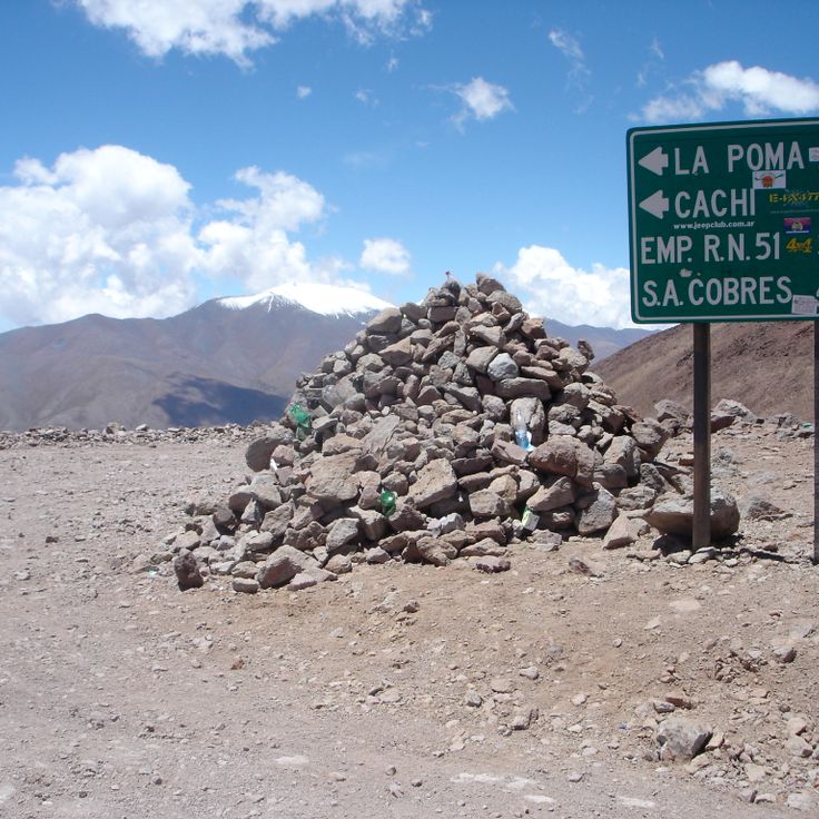
La Poma is a traditional mountain village in northwest Argentina, situated at 3000 meters elevation and surrounded by mountain peaks. The village sits near thermal springs and mineral deposits. It is part of the varied landscape of northwest Argentina, where desert areas, wine regions and Andean valleys coexist.
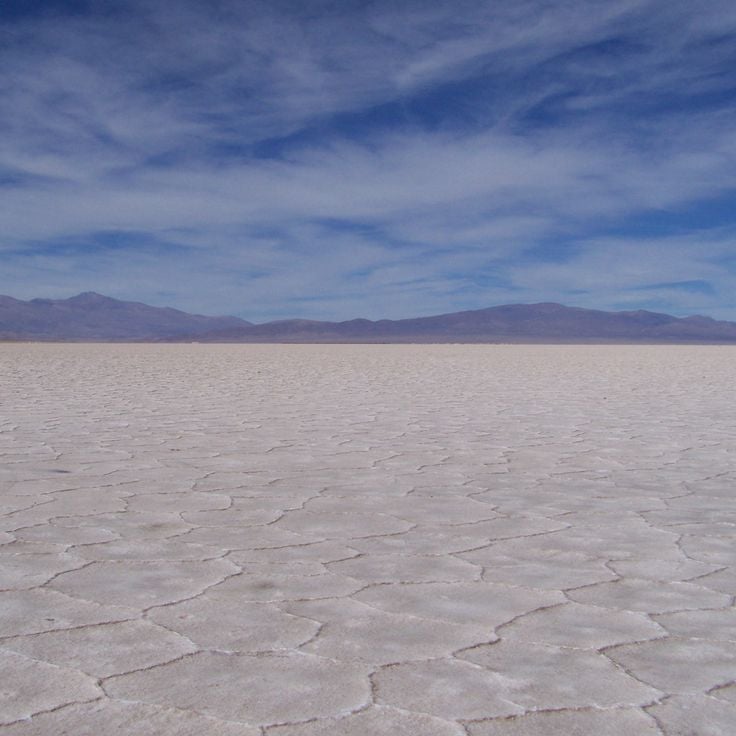
Salinas Grandes is a vast salt flat in the Puna region of Jujuy, showcasing the white, crystalline surface typical of these high-altitude formations in northwest Argentina. This salt deposit formed over millions of years through the evaporation of salt water in the extreme highland climate. Walking across this flat expanse at high elevation, visitors experience the stark beauty and wide horizons of the Andean landscape that characterize the region.
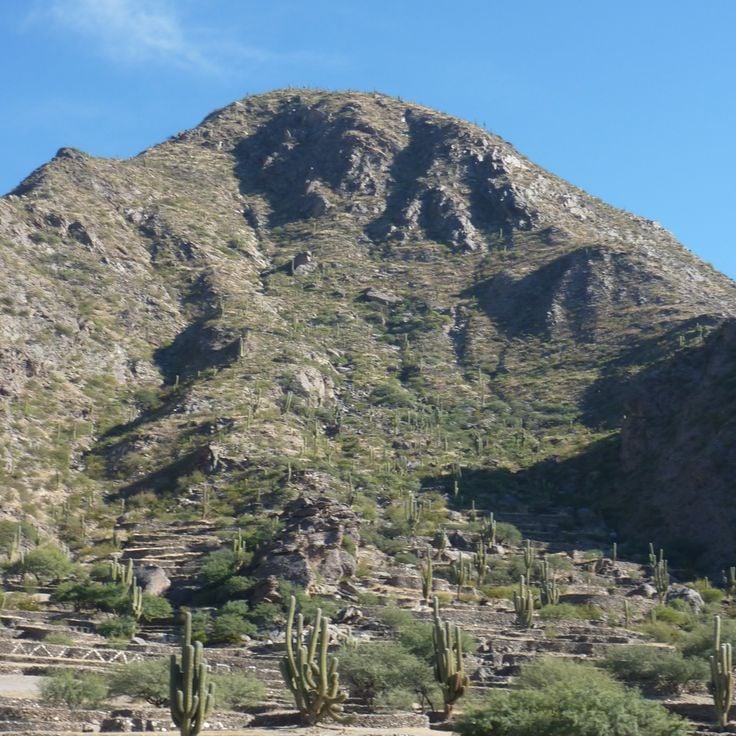
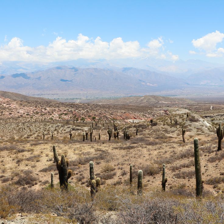
Los Cardones National Park is part of northwest Argentina's natural landscapes and shelters several cactus species found only in this region. The park is home to Andean condors, guanacos, and Andean foxes that inhabit its valleys and highlands.
The Angastaco Natural Area in Salta showcases rock formations of red sandstone shaped by erosion over millions of years. This geological landscape is part of northwest Argentina, a region that combines desert areas, wine regions and Andean valleys. The area sits within a region known for salt flats, geological formations, pre-Columbian sites and traditional mountain villages.
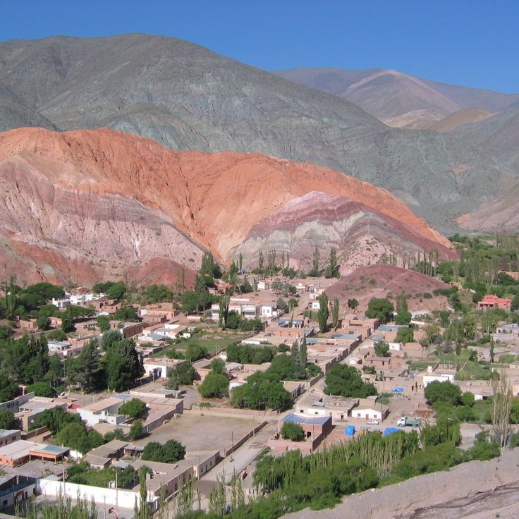
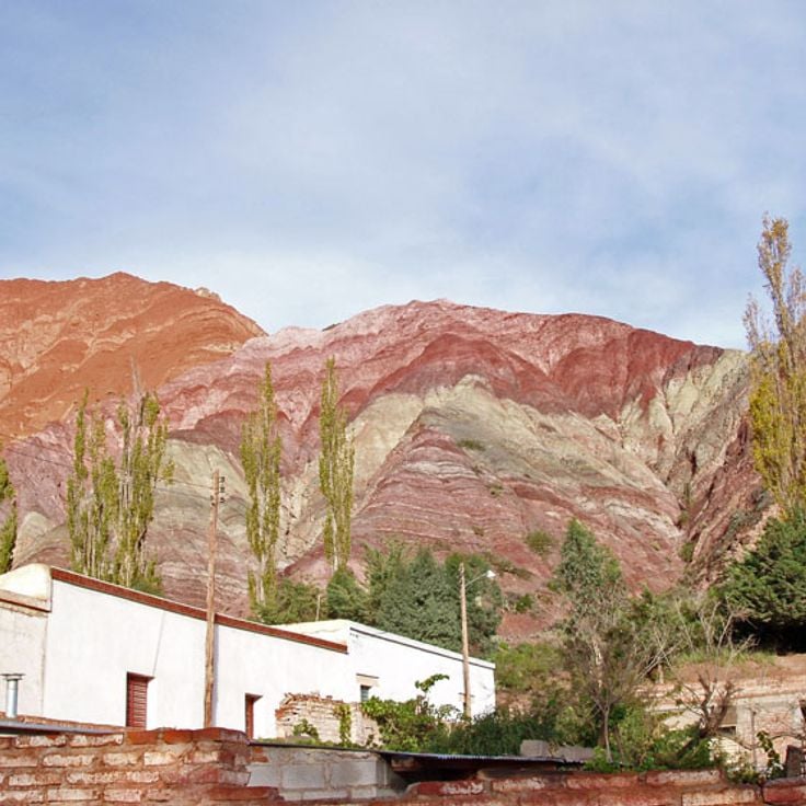
Seven Colors Mountain in Jujuy is part of the natural landscapes of northwest Argentina. The rock layers contain minerals from different geological periods, creating red, orange, purple, brown, green, yellow, and white colorations. This mountain belongs to a region that combines desert areas, wine regions, and Andean valleys.
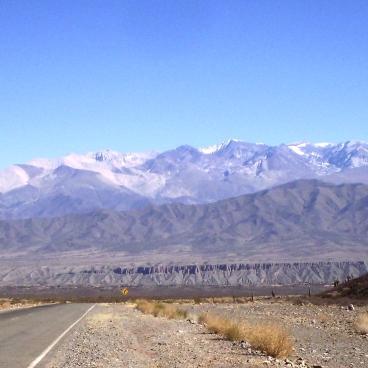
Snowy Cachi rises in northwest Argentina in the Salta region and forms part of the Andes. Reaching 6380 meters, this mountain dominates the landscape with peaks that hold snow throughout the year. The snowy peaks shape the dramatic Andean valleys and provide a striking contrast to the desert areas and wine regions that characterize the region.
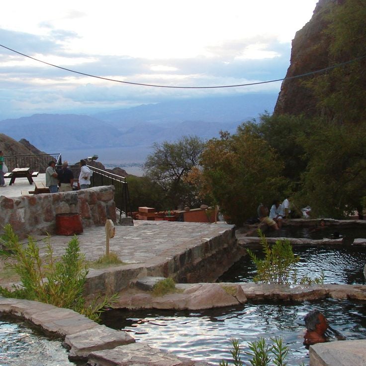
The thermal springs of Fiambalá are natural pools fed by mineral-rich water from the Andes at 4000 meters altitude. They are part of the natural landscapes of northwest Argentina, a region that combines desert areas, wine regions and mountain valleys. The water temperatures range from 25 to 52 degrees Celsius, reflecting the geological diversity of this part of the Andes.
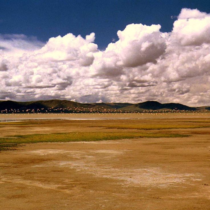
Pozuelos Salt Lake sits within the high desert regions of northwest Argentina, a landscape that combines desert areas, wine regions and Andean valleys. This saline lake rests at 3500 meters elevation and covers a vast expanse of salt flats. The lake attracts flamingos, Andean geese and other water birds that feed and rest on its waters and shores.
The Andean Village is a settlement in northwest Argentina's desert and mountain landscape. Located at 3400 meters elevation, it features traditional stone houses built to withstand the harsh climate. The village sits among an extinct volcano and expansive salt flats, offering a glimpse into how communities adapt to high-altitude desert life.
The Humahuaca Valley is part of northwest Argentina's diverse natural and cultural region, where mountain valleys, desert areas and wine regions come together. This 155 kilometer mountain valley is defined by red and multicolored rock formations and has been inhabited for roughly 10000 years by different human cultures.
Casabindo is a mountain village in the Andean region of northwest Argentina. The village hosts an annual bull festival on August 15 to honor the Virgin Mary. This celebration blends gaucho traditions with religious customs and reflects the living cultures of the Andean valleys in the region.
The Paseo de los Colorados is a 3-kilometer hiking path in Jujuy that circles a mountain and forms part of the natural landscapes of northwest Argentina. The route showcases layers of red sandstone and white limestone that have been exposed by erosion. The mountain's mineral-rich composition creates the colorful geological display that hikers encounter along the trail.
El Peñón is a village of around 200 inhabitants in Catamarca that represents traditional mountain living in northwest Argentina. Situated at 3200 meters altitude in the Andes, the settlement sits among volcanic areas and striking rock formations. The village reflects how people have adapted to life in these high valleys, surrounded by the geological wonders and harsh terrain that define this part of the Andes.
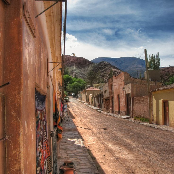
Purmamarca is an Andean village in the Jujuy region that centers on a 17th century colonial church. The village sits surrounded by mountain slopes that display bands of different colors created by mineral deposits. An indigenous market operates in the town, where locals and visitors buy handcrafted goods and regional products. This settlement represents the kind of traditional mountain community found throughout the valleys of northwest Argentina.
The Iglesia San Francisco is located in Salta and represents part of the natural landscapes collection of northwest Argentina. This church from the 16th century combines Spanish colonial architecture with Italian elements and displays a striking red and gold facade. The building stands in the heart of a region that encompasses desert areas, wine regions and mountain valleys.
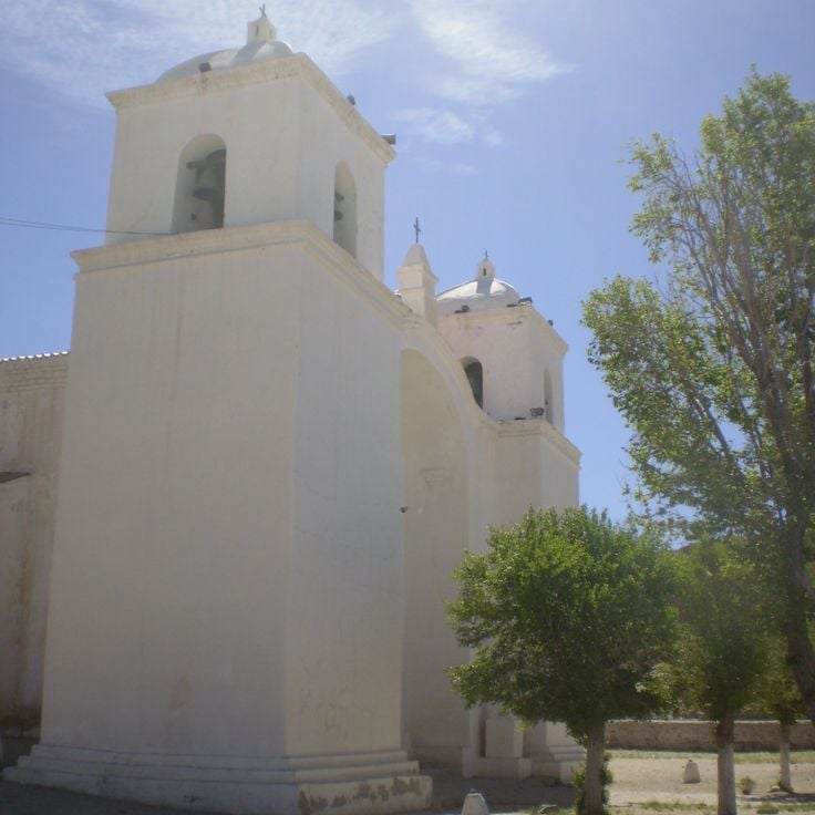
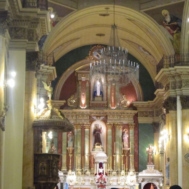
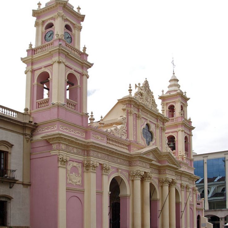
The Catedral Basilica de Salta was built in 1858 and stands as a significant religious building in northwest Argentina's Andean region. It houses colonial artworks, religious sculptures, and the tomb of General Martín Miguel de Güemes. The structure sits at the heart of the traditional mountain town of Salta and reflects the architectural and spiritual history of this wine and valley region.
Cuesta del Obispo is a mountain road in northwest Argentina that connects the cities of Salta and Cachi, climbing to 3348 meters elevation through a series of tight switchbacks. The route cuts through the Andean landscape, revealing desert areas, geological formations and mountain valleys that define this part of Argentina. Travelers follow the winding path as it climbs through changing terrain and reveals the region's natural diversity.
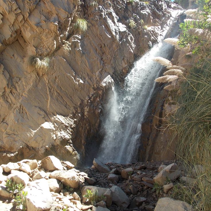
Garganta del Diablo is a deep natural canyon in the Quebrada de Humahuaca with vertical rock walls and a small waterfall. It belongs to the natural landscapes of northwest Argentina, where desert areas, wine regions and Andean valleys meet. This canyon displays the geological diversity of the region, which also includes salt flats, geological formations and traditional mountain villages.
The Quebrada de las Conchas is a red canyon located in Salta in northwest Argentina. This canyon extends for 60 kilometers and displays rock layers from different geological periods. The Quebrada de las Conchas is part of the region's natural landscapes, which combine desert areas, wine regions and Andean valleys. The canyon shows the geological diversity of northwest Argentina through its distinctive red rock walls and layered formations.
Campo de Piedra Pómez in northwest Argentina displays the geological features that define this landscape. This volcanic formation spreads across the Puna plateau and consists of white pumice stone blocks. Walking through this place gives you a sense of the natural forces that shaped the Andes and their valleys.
Ruinas de Quilmes in Tucumán is an archaeological site that fits within the landscape of northwest Argentina, a region shaped by deserts, wine areas and Andean valleys. This 9th century settlement once housed up to 5000 people of the Quilmes people who built and lived in stone structures. The ruins show how this mountain community organized their daily life.
Antofagasta de la Sierra is a mountain village in northwest Argentina situated at 3400 meters elevation. It sits in the Puna region surrounded by volcanoes and salt lakes. The village shows how people live in the Andean valleys where traditional mountain communities adapt to harsh conditions. The dry landscape with its geological formations and rough terrain shapes the character of the area.
Ojo de Mar is a natural salt basin in northwest Argentina, located in the high plateau of Jujuy province. The water creates reflections of the sky and surrounding landscape, revealing the geological character of this Andean highland. This site exemplifies the salt flats that define the region's distinctive terrain, nestled among the mountain valleys and desert areas that characterize northwest Argentina.
Cueva de las Manos de Acsibi in Salta is a cave with prehistoric hand prints on its walls, surrounded by rock formations in a canyon. It belongs to the natural landscape region of northwest Argentina, which combines desert areas, wine regions and Andean valleys, and also features salt flats, geological formations, pre-Columbian sites and traditional mountain villages.
Laguna Diamante is a lake located in the Andes at 4200 meters elevation within a crater ringed by mineral-rich rock formations. The water's color shifts with the light and surrounding minerals that give the region its character. This lake sits in northwestern Argentina's landscape of salt flats, volcanic features, and mountain villages where traditional ways of life continue in the high valleys.
Abra del Acay is a mountain pass situated in Salta that forms part of northwest Argentina's varied terrain of deserts, wine regions and Andean valleys. At 4895 meters elevation, this pass offers views across the Andes and regional mountain ranges that define the dramatic topography of the area.
Iruya sits within this collection of northwest mountain landscapes at an elevation of 2780 meters. The village features narrow alleys and stone houses dating from the 18th century. It represents traditional life in the Andes, where old architecture and mountain geography meet.
Tolar Grande sits at 3500 meters elevation in the Puna region and serves as a gateway to the landscapes of northwest Argentina. From this mountain settlement, visitors can access salt flats, volcanoes and red sandstone formations that define the arid and geologically varied terrain of the area.
Yavi is a village in Jujuy that forms part of northwest Argentina's natural landscapes combining desert areas, wine regions and Andean valleys. The village preserves a 17th century church with murals and pre-Columbian archaeological sites in the surrounding area, reflecting the layered history of the Andes and the connection between colonial and indigenous cultures.
The Serranía del Hornocal is a mountain range in Jujuy that forms part of the natural landscapes of northwest Argentina. The mountain displays geological layers in different colors due to mineral deposits that have accumulated over millions of years. These colorful formations tell the geological story of the Andes in this region.
Valles Calchaquíes are connected valleys in northwest Argentina that exemplify the region's natural diversity. These valleys feature numerous wineries alongside striking red rock formations, situated at altitudes between 1500 and 3000 meters (4900 to 9800 feet). The landscape reveals the geological richness of the Andes while showcasing how local communities live among mountain terrain and agricultural traditions.
Pucará de Tilcara is a pre-Columbian fortress dating to the 12th century, perched on a hilltop in the Jujuy region and representing one of the important archaeological sites of northwest Argentina. The site displays remains of dwellings and defensive walls, offering insight into life in the Andean valleys before Spanish arrival.
La Poma is a traditional mountain village in northwest Argentina, situated at 3000 meters elevation and surrounded by mountain peaks. The village sits near thermal springs and mineral deposits. It is part of the varied landscape of northwest Argentina, where desert areas, wine regions and Andean valleys coexist.
Salinas Grandes is a vast salt flat in the Puna region of Jujuy, showcasing the white, crystalline surface typical of these high-altitude formations in northwest Argentina. This salt deposit formed over millions of years through the evaporation of salt water in the extreme highland climate. Walking across this flat expanse at high elevation, visitors experience the stark beauty and wide horizons of the Andean landscape that characterize the region.
Los Cardones National Park is part of northwest Argentina's natural landscapes and shelters several cactus species found only in this region. The park is home to Andean condors, guanacos, and Andean foxes that inhabit its valleys and highlands.
The Angastaco Natural Area in Salta showcases rock formations of red sandstone shaped by erosion over millions of years. This geological landscape is part of northwest Argentina, a region that combines desert areas, wine regions and Andean valleys. The area sits within a region known for salt flats, geological formations, pre-Columbian sites and traditional mountain villages.
Seven Colors Mountain in Jujuy is part of the natural landscapes of northwest Argentina. The rock layers contain minerals from different geological periods, creating red, orange, purple, brown, green, yellow, and white colorations. This mountain belongs to a region that combines desert areas, wine regions, and Andean valleys.
Snowy Cachi rises in northwest Argentina in the Salta region and forms part of the Andes. Reaching 6380 meters, this mountain dominates the landscape with peaks that hold snow throughout the year. The snowy peaks shape the dramatic Andean valleys and provide a striking contrast to the desert areas and wine regions that characterize the region.
The thermal springs of Fiambalá are natural pools fed by mineral-rich water from the Andes at 4000 meters altitude. They are part of the natural landscapes of northwest Argentina, a region that combines desert areas, wine regions and mountain valleys. The water temperatures range from 25 to 52 degrees Celsius, reflecting the geological diversity of this part of the Andes.
Pozuelos Salt Lake sits within the high desert regions of northwest Argentina, a landscape that combines desert areas, wine regions and Andean valleys. This saline lake rests at 3500 meters elevation and covers a vast expanse of salt flats. The lake attracts flamingos, Andean geese and other water birds that feed and rest on its waters and shores.
The Andean Village is a settlement in northwest Argentina's desert and mountain landscape. Located at 3400 meters elevation, it features traditional stone houses built to withstand the harsh climate. The village sits among an extinct volcano and expansive salt flats, offering a glimpse into how communities adapt to high-altitude desert life.
The Humahuaca Valley is part of northwest Argentina's diverse natural and cultural region, where mountain valleys, desert areas and wine regions come together. This 155 kilometer mountain valley is defined by red and multicolored rock formations and has been inhabited for roughly 10000 years by different human cultures.
Casabindo is a mountain village in the Andean region of northwest Argentina. The village hosts an annual bull festival on August 15 to honor the Virgin Mary. This celebration blends gaucho traditions with religious customs and reflects the living cultures of the Andean valleys in the region.
The Paseo de los Colorados is a 3-kilometer hiking path in Jujuy that circles a mountain and forms part of the natural landscapes of northwest Argentina. The route showcases layers of red sandstone and white limestone that have been exposed by erosion. The mountain's mineral-rich composition creates the colorful geological display that hikers encounter along the trail.
El Peñón is a village of around 200 inhabitants in Catamarca that represents traditional mountain living in northwest Argentina. Situated at 3200 meters altitude in the Andes, the settlement sits among volcanic areas and striking rock formations. The village reflects how people have adapted to life in these high valleys, surrounded by the geological wonders and harsh terrain that define this part of the Andes.
Purmamarca is an Andean village in the Jujuy region that centers on a 17th century colonial church. The village sits surrounded by mountain slopes that display bands of different colors created by mineral deposits. An indigenous market operates in the town, where locals and visitors buy handcrafted goods and regional products. This settlement represents the kind of traditional mountain community found throughout the valleys of northwest Argentina.
The Iglesia San Francisco is located in Salta and represents part of the natural landscapes collection of northwest Argentina. This church from the 16th century combines Spanish colonial architecture with Italian elements and displays a striking red and gold facade. The building stands in the heart of a region that encompasses desert areas, wine regions and mountain valleys.
The Catedral Basilica de Salta was built in 1858 and stands as a significant religious building in northwest Argentina's Andean region. It houses colonial artworks, religious sculptures, and the tomb of General Martín Miguel de Güemes. The structure sits at the heart of the traditional mountain town of Salta and reflects the architectural and spiritual history of this wine and valley region.
Cuesta del Obispo is a mountain road in northwest Argentina that connects the cities of Salta and Cachi, climbing to 3348 meters elevation through a series of tight switchbacks. The route cuts through the Andean landscape, revealing desert areas, geological formations and mountain valleys that define this part of Argentina. Travelers follow the winding path as it climbs through changing terrain and reveals the region's natural diversity.
Garganta del Diablo is a deep natural canyon in the Quebrada de Humahuaca with vertical rock walls and a small waterfall. It belongs to the natural landscapes of northwest Argentina, where desert areas, wine regions and Andean valleys meet. This canyon displays the geological diversity of the region, which also includes salt flats, geological formations and traditional mountain villages.