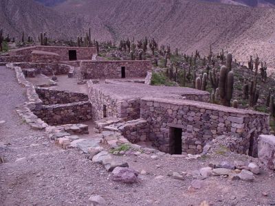
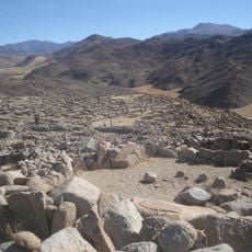
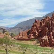
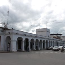
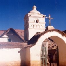
Pucará de Tilcara, Ancient fortress in Tilcara, Argentina
Pucará de Tilcara is a stone fortress positioned on a hilltop at high elevation, containing separate areas for living quarters, storage facilities, and ceremonial activities. The layout reveals how structures were built close together and designed to fit the sloping terrain.
The Omaguaca people built this fortified settlement around 1100 as a military stronghold in this mountainous region. Centuries later, it became a significant post when the Inca expanded into the area during the 1400s.
The site bears the name of the Omaguaca people who built it, and their way of life remains visible in how spaces were arranged and used. Walking through, you notice how residential and ceremonial areas were separated to serve different purposes in daily life.
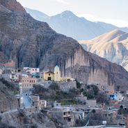
The climb to reach the fortress is steep, so wear sturdy shoes and allow extra time for the uphill walk. An attached archaeological museum at the base lets you examine objects found at the site and learn more about the region's history.
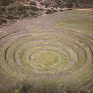
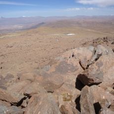
Inhabitants carved terraced fields into the hillside to grow crops despite the steep terrain. These ingenious irrigation systems reveal how people managed to farm in this harsh high-altitude setting.
Location: Tilcara
Inception: 1100
GPS coordinates: -23.58861,-65.40278
Latest update: December 6, 2025 16:00
Argentina extends across multiple climate zones and contains numerous geological formations. The country encompasses high mountain ranges in the Andes, salt flats in the northwest, rock formations in Patagonia, and extensive grasslands. These areas display the region's geological history and the adaptation of human settlements to different environments. The sites include volcanic craters, thermal springs, canyons, and historic villages. Many of these locations lie away from main routes and require several hours of travel. The regions document pre-Columbian cultures, colonial history, and traditional ways of life that continue today.
Quebrada de Humahuaca
43.6 km
Tren a las Nubes
132.3 km
Polvorilla viaduct
123 km
Monument to the Heroes of Independence
43.1 km
Reserva de biosfera de Yungas
77.4 km
Tastil
111.4 km
Palacio de Gobierno de Jujuy
67.4 km
Catedral Basílica de San Salvador de Jujuy (Cathedral Basilica of the Holy Saviour)
67.3 km
Cerro Tuzgle
121.3 km
Large Latin American Millimeter Array
128.1 km
Palacio de la Legislatura de Salta
133 km
Q&U Bolometric Interferometer for Cosmology
128.1 km
Cabildo de Humahuaca
43.2 km
Doctor Luis Güemes Stadium
132.6 km
Finca Castañares
127.2 km
Fuerte de Cobos
131.6 km
Capilla de la Inmaculada Concepción
18.2 km
Anfiteatro Eduardo Falú
132.6 km
Campo de San Lorenzo
125.7 km
Paseo de los Colorados
20.6 km
Humahuaca Cathedral
43.2 km
Biblioteca Popular José Ingenieros
84.3 km
Capilla de Purmamarca
20.2 km
Capilla de Tilcara
1.7 km
Iglesia y Convento San Francisco
67.2 km
Cabildo de la ciudad de San Salvador de Jujuy
67.2 km
Iglesia de Susques
100.7 km
Garganta Del Diablo
3 kmReviews
Visited this place? Tap the stars to rate it and share your experience / photos with the community! Try now! You can cancel it anytime.
Discover hidden gems everywhere you go!
From secret cafés to breathtaking viewpoints, skip the crowded tourist spots and find places that match your style. Our app makes it easy with voice search, smart filtering, route optimization, and insider tips from travelers worldwide. Download now for the complete mobile experience.
A unique approach to discovering new places❞
— Le Figaro
All the places worth exploring❞
— France Info
A tailor-made excursion in just a few clicks❞
— 20 Minutes