Paseo de los Colorados, Scenic route near Purmamarca, Argentina
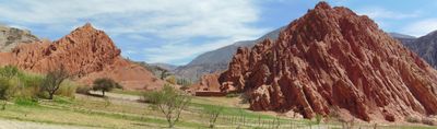
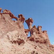
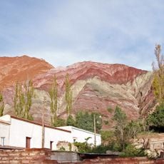
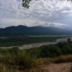
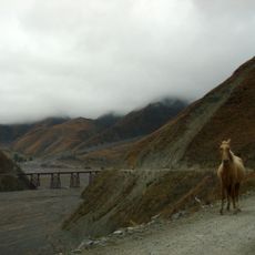
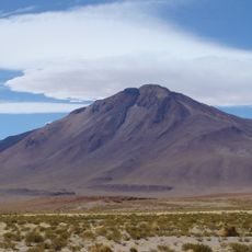
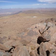
Paseo de los Colorados is a scenic route near Purmamarca that winds through hills where mineral deposits in the sedimentary rocks create red, orange, and yellow tones. The path stretches about three kilometers through these colored formations, offering changing views as you walk.
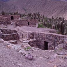
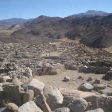
Indigenous communities settled in this region during pre-Columbian times and used the natural rock formations as geographical markers for their territories. The landscape shaped travel routes and movement patterns for these early inhabitants over many centuries.
The route connects the heart of Purmamarca to a traditional market where local artisans display textiles, pottery, and handcrafted items from the Jujuy region. People in the area have used this space for generations to showcase their craftsmanship.
The path is straightforward to walk but takes about two hours to complete and can get hot under direct sun. Visit in the morning between May and October when it is cooler and the light is better for taking photos.
Minerals in the hills continue to shift through natural erosion, meaning the color tones and rock patterns subtly differ with the seasons. This makes each visit slightly different depending on when you walk the path.
Location: Purmamarca
GPS coordinates: -23.74975,-65.50165
Latest update: December 6, 2025 19:05
Northwest Argentina is a region where deserts, wine regions and Andean valleys coexist. Salt flats, striking rock formations, pre-Columbian sites and traditional mountain villages define this landscape. The terrain shifts between bare highlands, colorful mountain ranges and green valleys where small...
Quebrada de Humahuaca
63.2 km
Tren a las Nubes
114.7 km
Pucará de Tilcara
20.6 km
Calilegua National Park
68.8 km
Polvorilla viaduct
105.7 km
Monument to the Heroes of Independence
62.7 km
Reserva de biosfera de Yungas
97.9 km
Quebrada del Toro
114.6 km
Tastil
90.9 km
Palacio de Gobierno de Jujuy
52.8 km
Catedral Basílica de San Salvador de Jujuy
52.6 km
Cerro Tuzgle
105.1 km
Large Latin American Millimeter Array
110.6 km
Q&U Bolometric Interferometer for Cosmology
110.5 km
Cabildo de Humahuaca
62.7 km
Finca Castañares
109.8 km
Capilla de la Inmaculada Concepción
38.5 km
Anfiteatro Eduardo Falú
114.8 km
Campo de San Lorenzo
107.6 km
Humahuaca Cathedral
62.7 km
Biblioteca Popular José Ingenieros
92.6 km
Iglesia y Convento San Francisco
52.5 km
Capilla de Tilcara
22.3 km
Capilla de Purmamarca
402 m
Cabildo de la ciudad de San Salvador de Jujuy
52.6 km
Museo De Bellas Artesfundación Hugo Irureta
22.1 km
Iglesia de Susques
96.6 km
Garganta Del Diablo
21.7 kmVisited this place? Tap the stars to rate it and share your experience / photos with the community! Try now! You can cancel it anytime.
Discover hidden gems everywhere you go!
From secret cafés to breathtaking viewpoints, skip the crowded tourist spots and find places that match your style. Our app makes it easy with voice search, smart filtering, route optimization, and insider tips from travelers worldwide. Download now for the complete mobile experience.
A unique approach to discovering new places❞
— Le Figaro
All the places worth exploring❞
— France Info
A tailor-made excursion in just a few clicks❞
— 20 Minutes