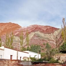
Salinas Grandes, Salt pan in Jujuy and Salta provinces, Argentina
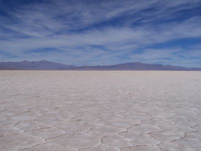
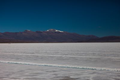
Salinas Grandes is a salt pan in Jujuy and Salta provinces in northwestern Argentina, spreading over more than 200 square kilometers at roughly 3400 meters elevation. The pale surface forms an almost flat expanse bordered by low ridges of dried salt crust and reflecting the open sky above the high plateau.
Local groups discovered and worked the salt deposits here many centuries ago, developing techniques to harvest the mineral and trade it across mountain routes. The practice continued through shifts in regional control and the later arrival of new roads that opened the area to broader movement.
People in this region have built their livelihoods around the salt harvest for generations, passing down knowledge of how to shape shallow basins and time their work with the sun and weather. Walking across the surface reveals clusters of low walls that mark family plots where workers scoop the dried crystals by hand and stack them into rough piles before transport.
The salt surface sits along National Route 52, which links Argentina to Chile and is most accessible during spring through autumn. Visitors should bring sun protection because the elevation and reflective ground intensify light and temperatures can shift quickly throughout the day.
The crust displays a pattern of hexagonal cells that form when briny water moves beneath the surface and hardens as it meets the air. This network of cracks and ridges repeats for long distances and becomes clearest when the sun sits low and casts shadows across the ground.
The community of curious travelers
AroundUs brings together thousands of curated places, local tips, and hidden gems, enriched daily by 60,000 contributors worldwide.