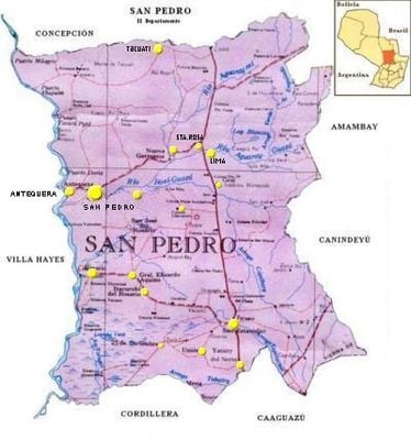
San Pedro Department, Administrative division in central Paraguay.
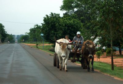
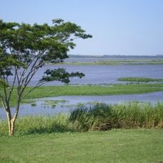
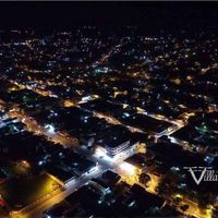
San Pedro Department is an administrative region in central Paraguay featuring rolling hills, rivers, and wooded areas across its landscape. The territory divides into several districts, each with its own local administration and connected by major highways.
The region was established as a separate department in 1841 after Paraguay gained independence from Spain. This administrative division formed as part of the new nation's territorial reorganization following independence.
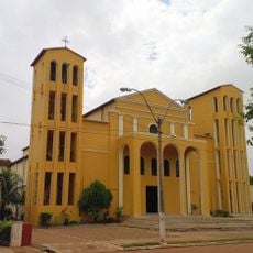
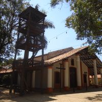
The region reflects indigenous roots and Spanish colonial heritage in its daily customs, local celebrations, and community life. Visitors notice these influences in village architecture and the ways residents mark important occasions throughout the year.
The best time to explore is during the dry season when roads and pathways are easier to travel. Visitors should plan ahead since infrastructure in remote areas is basic and services may be limited in smaller towns.
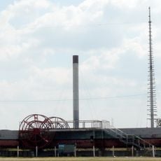
The region is known for large-scale agricultural production, particularly growing soybeans, corn, and tobacco. These crops significantly contribute to Paraguay's economy and shape the landscape and daily rhythms of local communities.
Location: Paraguay
Capital city: San Pedro de Ycuamandiyú
Part of: South America Midwest Integrated Zone
Shares border with: Concepción Department, Amambay Department, Canindeyú, Caaguazú Department, Cordillera Department, Presidente Hayes
GPS coordinates: -24.10000,-57.08333
Latest update: December 14, 2025 19:55
Vapor Cué National Park
128.7 km
Mbaracayú Forest Nature Reserve
166.3 kmParque nacional Estero Milagro
66 km
Cathedral of Concepción, Paraguay
85.4 kmHomenaje a Emiliano R. Fernández
84.9 kmStatue, monument, Work of art
84.9 kmSalto Aguaray
149.3 kmFiguras de antiguas pirámides egipcias
118.1 kmInicio del tramo Carayao
140.5 kmMonumento a los niños mártires de la batalla de Acosta Ñú
128.6 kmLaguna Blanca
87.4 kmCatholic Church of the Immaculate Conception
129.2 kmTeatro Municipal
85.3 kmBalneario el Mangal
75.4 kmSalto Querencia
173.1 kmMercado santani paraguay
89.3 kmMirador Cerro de la Gloria
128.6 kmScenic viewpoint
167.9 kmTobati
130.5 kmScenic viewpoint
85.7 kmScenic viewpoint
165.4 kmWaterfall
165.6 kmSalto Itá Camby
165.4 kmSalto Jaguareté
167.3 kmSalto Querencia
173.1 kmWaterfall
126 kmWaterfall
123.9 kmMonument featuring aircraft, tourist attraction
81.6 kmVisited this place? Tap the stars to rate it and share your experience / photos with the community! Try now! You can cancel it anytime.
Antequera District
Capiíbary
General Elizardo Aquino
General Isidoro Resquín
Guajayvi.
Itacurubí del Rosario
Liberación
Lima
Nueva Germania
San Estanislao
San Pablo District
San Pedro de Ycuamandiyú
San Vicente Pancholo
Santa Rosa del Aguaray
Tacuatí
Unión
Villa del Rosario
Yataity del Norte
Yrybucuá
Veinticinco de Diciembre
Discover hidden gems everywhere you go!
From secret cafés to breathtaking viewpoints, skip the crowded tourist spots and find places that match your style. Our app makes it easy with voice search, smart filtering, route optimization, and insider tips from travelers worldwide. Download now for the complete mobile experience.
A unique approach to discovering new places❞
— Le Figaro
All the places worth exploring❞
— France Info
A tailor-made excursion in just a few clicks❞
— 20 Minutes