São Francisco do Sul

Log in to your account

AroundUs is a community-driven map of interesting places, built by curious explorers like you. It grows with every review, story, and photo you share.
Connect to save your favorite spots, contribute locations, and create personalized routes.
Continue with Google
Continue with Apple
Continue with X
Continue with Facebook
Continue with email
By continuing, you accept our Terms and Conditions and our Privacy Policy
Create an account
Add to collection
Map
Suggest a change
Share

São Francisco do Sul, Historical coastal municipality in Santa Catarina, Brazil

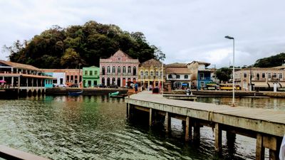
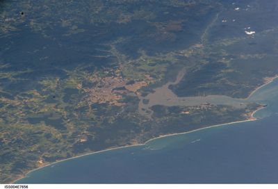
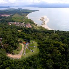
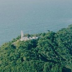
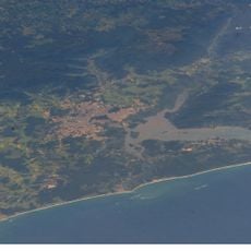
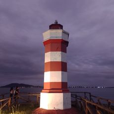
São Francisco do Sul sits on an island at the entrance of Babitonga Bay and connects to the mainland through a bridge. The municipality covers beaches, forested hills, and areas with dense construction around the old port.

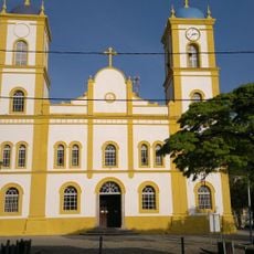
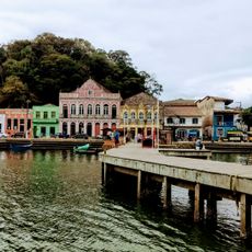
Portuguese settlers founded the town in the mid-1600s and quickly turned it into an anchorage for ships sailing along the Brazilian coast. Over the centuries the municipality grew into a hub for trade in timber, mate, and other goods from the interior.

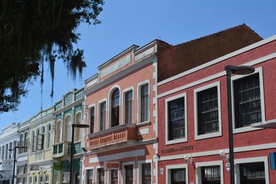
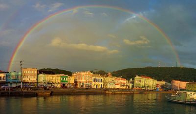
Residents move through the compact downtown for daily errands, while the houses with whitewashed walls and windows painted in bold colors recall the era when the port served as the only link to the outside world. On weekends the lanes fill with visitors who stroll through the shops and sample fresh seafood at the small restaurants.

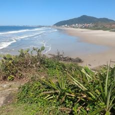
Many streets in the historic center are narrow and paved with cobblestones, so walking is the easiest way to explore that area. Beyond the center paved roads lead to beaches and nature reserves accessible by car or bus.

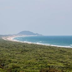
The Acaraí reserve covers more than 6,600 hectares within the municipal boundaries and protects remnants of Atlantic rainforest along with mangrove forests. Trails cross parts of the park and allow encounters with birds, amphibians, and native plants that have become rare elsewhere.

Location: Santa Catarina

Inception: 1658

Elevation above the sea: 12 m

Shares border with: Araquari, Balneário Barra do Sul, Garuva, Itapoá, Joinville

Website: https://saofranciscodosul.sc.gov.br

GPS coordinates: -26.24278,-48.63778

Latest update: December 14, 2025 17:08

Photos
Reviews

Visited this place? Tap the stars to rate it and share your experience / photos with the community! Try now! You can cancel it anytime.

« São Francisco do Sul - Historical coastal municipality in Santa Catarina, Brazil » is provided by Around Us (aroundus.com). Images and texts are derived from Wikimedia project under a Creative Commons license. You are allowed to copy, distribute, and modify copies of this page, under the conditions set by the license, as long as this note is clearly visible.

Discover hidden gems everywhere you go!

From secret cafés to breathtaking viewpoints, skip the crowded tourist spots and find places that match your style. Our app makes it easy with voice search, smart filtering, route optimization, and insider tips from travelers worldwide. Download now for the complete mobile experience.

Around Us App Screenshot

A unique approach to discovering new places

Le Figaro

All the places worth exploring

France Info

A tailor-made excursion in just a few clicks

20 Minutes