São Lourenço da Serra, Municipality in São Paulo metropolitan region, Brazil.
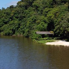
São Lourenço da Serra is a municipality in the São Paulo metropolitan region with dense forests covering much of its landscape and residential development concentrated in northern areas. The terrain transitions from heavily wooded zones in the south to more built-up sections where most inhabitants live.
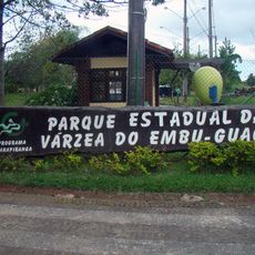
The area was part of Itapecerica da Serra until administrative changes in 1993 led to the creation of a separate municipality. This reorganization reflected broader shifts in how the metropolitan region was divided and governed.
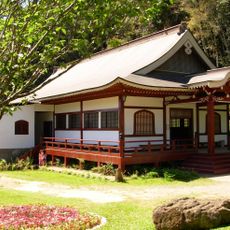
Local life revolves around connections to the surrounding forests and agricultural traditions visible in how residents use the land. These practices shape the character of neighborhoods and community gatherings throughout the year.
The municipality sits at an elevation of around 715 meters and connects to the broader metropolitan area through regional road networks. This position makes it relatively accessible from other population centers in the region.
The municipality protects significant portions of Atlantic Forest that serve as wildlife corridors connecting to other protected areas across the region. These wooded zones allow animals to move freely between distant conservation areas.
Location: São Paulo
Inception: 1993
Elevation above the sea: 715 m
Shares border with: Cotia, Embu-Guaçu, Ibiúna, Itapecerica da Serra, Juquitiba
Website: http://saolourencodaserra.sp.gov.br
GPS coordinates: -23.85278,-46.94278
Latest update: December 23, 2025 22:35
Serra de Paranapiacaba
19 km
Barragem Pedro Beicht
15.1 km
Parque Ecológico Várzea do Embu-Guaçu
13.7 kmReserva Florestal do Morro Grande
17 km
Enkoji
14.3 km
Vila Viking Brasil
18.4 kmÁrvore
21.8 kmCentenário Da Paróquia Santa Cruz
21.8 kmMuseu de Apicultura e Mel do Apiario Embu Cidade das Abelhas
21.1 kmMuseu Histórico e da Memória
18.1 kmTanque de Contenção de Overflow - TQC (TDA4)
3.4 kmMuseu Leonor e Benevides Beraldo
159 mCachoeira do Funil
17.8 kmTúnel 28
12 kmGuarapiranga Golf & Country Club
17.8 kmCachoeira do Funil
17.7 kmUsina Solar
15.7 kmPalco
13 kmTúnel 31
10.9 kmCidade das Abelhas
18.8 kmCruzeiro
19.3 kmJesus Cristo
18.9 kmPortal
13 kmImagem Nossa Senhora de Fátima
13.3 kmCachoeira do Saci
15.9 kmCachoeira do Pocinho
7.8 kmCachoeira do Pocinho
11.5 kmCachoeira da Lagoinha
7.5 kmVisited this place? Tap the stars to rate it and share your experience / photos with the community! Try now! You can cancel it anytime.
Discover hidden gems everywhere you go!
From secret cafés to breathtaking viewpoints, skip the crowded tourist spots and find places that match your style. Our app makes it easy with voice search, smart filtering, route optimization, and insider tips from travelers worldwide. Download now for the complete mobile experience.
A unique approach to discovering new places❞
— Le Figaro
All the places worth exploring❞
— France Info
A tailor-made excursion in just a few clicks❞
— 20 Minutes