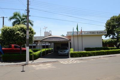
Aparecida do Taboado, Municipal center in Mato Grosso do Sul, Brazil.
The municipality covers 2,750 square kilometers of land in central-western Brazil, featuring agricultural fields and natural vegetation at 392 meters elevation.
The establishment of Aparecida do Taboado as an official municipality occurred on September 28, 1948, marking a new administrative era in Mato Grosso do Sul.
Local festivities and community gatherings throughout the year reflect the agricultural heritage and regional traditions of central-western Brazilian society.
The municipality connects to major Brazilian cities through a network of highways, providing access to both urban centers and agricultural distribution routes.
The Municipal Chamber building stands as a central administrative structure, representing local governance with its distinctive architectural features and formal design.
Location: Mato Grosso do Sul
Inception: September 28, 1948
Elevation above the sea: 392 m
Shares border with: Rubineia, Paranaíba, Inocência, Ilha Solteira, Selvíria, Santa Clara d'Oeste
Website: http://aparecidadotaboado.ms.gov.br/portal
GPS coordinates: -20.08694,-51.09389
Latest update: May 27, 2025 11:42
Rollemberg–Vuolo Road–Railway Bridge
9.2 km
Puente Maurício Joppert
217.9 km
Estádio Municipal José Maria de Campos Maia
184.7 km
Complexo Swift de Educação e Cultura
197.2 km
Porto de Alencastro bridge
48.1 km
Estádio Anísio Haddad
195.2 km
Puente Francisco de Sá
96.1 km
Aguapeí State Park
133.5 km
Avanhandava
193.7 km
Estádio Municipal Pedro Marin Berbel
153.7 km
Lagoa São Paulo Reserve
199.9 km
Palácio do Imperador
75.7 km
Cascalheira
94.8 km
Cisalpina Private Natural Heritage Reserve
153.5 km
Cathedral Our Lady (Votuporanga-SP)
122.6 km
Emperor's Palace (Former military colony)
75.7 km
Estação Ferroviária de Cosmorama
142.1 km
Museu de Arte Primitivista José Antônio da Silva
195.9 km
Red Water Museum
75.7 km
Cemitério de Guararapes SP
139 km
Casa de Cultura Doutor Ariovaldo Correa
184 km
Museu Histórico da Colonização de Pereira Barreto
62.3 km
Araçatuba Central Railroad Locomotive Workshop
141.6 km
House of the Chief Engineer of Araçatuba Central Railroad
141.9 km
Ponte Novo Oriente
64.6 km
Conjunto Ferroviário Central de Araçatuba
141.6 km
Museu Histórico e Pedagógico Marechal Cândido Rondon
141.9 km
Museu Municipal do Folclore de Penápolis
182.2 kmReviews
Visited this place? Tap the stars to rate it and share your experience / photos with the community! Try now! You can cancel it anytime.
Discover hidden gems everywhere you go!
From secret cafés to breathtaking viewpoints, skip the crowded tourist spots and find places that match your style. Our app makes it easy with voice search, smart filtering, route optimization, and insider tips from travelers worldwide. Download now for the complete mobile experience.
A unique approach to discovering new places❞
— Le Figaro
All the places worth exploring❞
— France Info
A tailor-made excursion in just a few clicks❞
— 20 Minutes