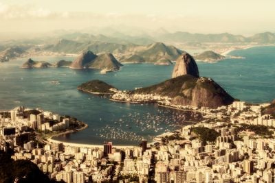
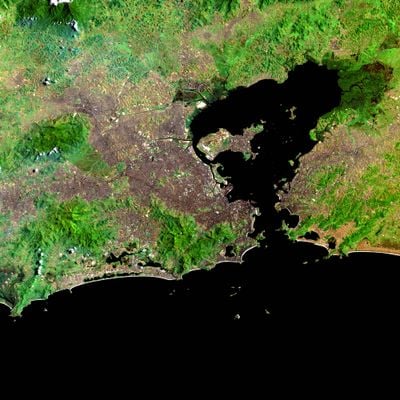
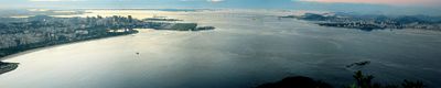
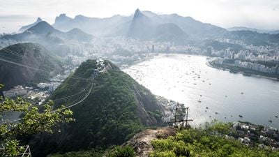
Guanabara Bay, Natural bay in Rio de Janeiro, Brazil
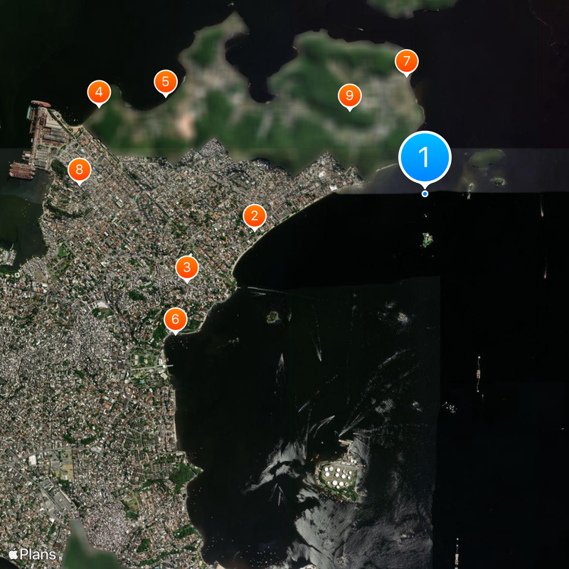
Guanabara Bay is a large natural bay in Rio de Janeiro, Brazil, stretching between the cities of Rio de Janeiro and Niterói. More than 130 islands sit scattered across its waters, and the coastline shifts between rocky cliffs, beaches, and densely built waterfront neighborhoods.
Portuguese explorers reached these waters on the first day of January in 1502 and named the place after the month of their arrival. The bay became the center of colonial settlement, and the city of Rio grew along its shores over the following centuries.
The name comes from the Tupi language and describes a bay that resembles the open sea, reflecting the indigenous roots of the region. Fishing boats and ferries cross these waters daily, and the waterfront neighborhoods hold traditions passed down through generations of coastal communities.
The Rio-Niterói Bridge crosses the waters and offers one of the easiest routes between the two shores for drivers and bus passengers. Ferries also run regularly between Rio and Niterói, providing a slower but pleasant alternative with views of the coastline.
The entrance to the bay sits between Sugarloaf Mountain and several fortresses that stand on both sides of the mouth. These landmarks once served as defense posts and now frame the passage for all incoming ships.
Location: Rio de Janeiro
Part of: South Atlantic Ocean
GPS coordinates: -22.79043,-43.15567
Latest update: December 12, 2025 17:40
Rio de Janeiro is more than a city; it is a living backdrop. Between mountains and sea, the Brazilian metropolis showcases its most famous landscapes: Christ the Redeemer overlooking Guanabara Bay, Sugarloaf shining in the sun, Ipanema and Copacabana beaches where music and sand never sleep. But Rio...
Parish Church of Our Lady of Help
1.6 kmMorro do Barão
2.3 kmPraia das Pelônias
3 kmPraia Grande
2.5 kmPraia de Cocotá
2.6 kmPraia da Moça
1.1 kmMorro dos Bancários
3.1 kmMorro do Quilombo
1 kmIemanjá da Ilha do Governador
1.6 kmMorro do Boqueirão
1.3 kmPraia do Bananal
981 mCaramanchão da Praça Manuel Madruga
2.9 kmMorro das Araras
2.2 kmPraia da Bandeira
2.9 kmPraia Saco da Rosa
3 kmPraia Zumbi
3.1 kmMorro do Bananal
615 mPraia Congonhas do Campo
2.2 kmPraia da Guanabara
1.3 kmLima Barreto na Ilha do Governador
1.5 kmCapitão Nelson Megé
3.1 kmGato-Maracajá, Pedra da Onça
609 mCanhão da Ponta do Tiro
3.2 kmMorro do Matias
2.4 kmCastro Alves da Ilha do Governador
3 kmPraia da Olaria
3 kmManuel Bandeira
3.1 kmMarco do Cocotá
2.7 kmVisited this place? Tap the stars to rate it and share your experience / photos with the community! Try now! You can cancel it anytime.
Discover hidden gems everywhere you go!
From secret cafés to breathtaking viewpoints, skip the crowded tourist spots and find places that match your style. Our app makes it easy with voice search, smart filtering, route optimization, and insider tips from travelers worldwide. Download now for the complete mobile experience.
A unique approach to discovering new places❞
— Le Figaro
All the places worth exploring❞
— France Info
A tailor-made excursion in just a few clicks❞
— 20 Minutes