São José do Rio Preto, Administrative center in northwestern São Paulo, Brazil
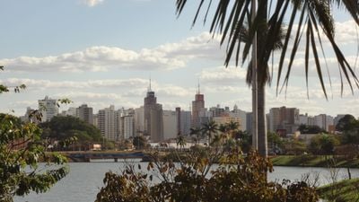
São José do Rio Preto is a city in northwestern São Paulo state, Brazil, spreading across gentle hills at an elevation near 489 meters (1,604 feet). The built environment stretches widely with residential neighborhoods, commercial streets and green spaces in between that follow the terrain.
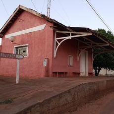
João Bernardino de Seixas Ribeiro founded the settlement in 1852 on land previously inhabited by the Kaingang people. The arrival of the railway in 1912 transformed the place into a trading hub and attracted farmers and merchants from other regions.
The name joins Saint Joseph with the nearby river and reflects the religious roots of early settlers. Today people often call the city simply Rio Preto, an expression of everyday connection residents have with their place.
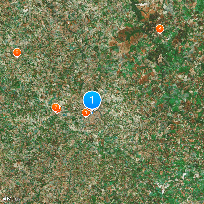
The terrain allows easy navigation with main roads running in a grid and connected by smaller streets. Visitors who need medical services will find several hospitals and clinics located across different parts of the city.
The economy rests almost entirely on services, which account for more than four fifths of income, while industry and other sectors play a smaller role. This pattern sets the city apart from many other inland centers that rely more heavily on agriculture or manufacturing.
Location: São Paulo
Inception: March 19, 1852
Elevation above the sea: 489 m
Shares border with: Ipiguá, Mirassol, Cedral, Onda Verde, Bady Bassitt, Guapiaçu
Website: http://riopreto.sp.gov.br
GPS coordinates: -20.82000,-49.37889
Latest update: December 4, 2025 19:01
Thermas dos Laranjais
49.2 km
Estádio Municipal José Maria de Campos Maia
13.3 km
Complexo Swift de Educação e Cultura
1.5 km
André Matarazzo Museum of Arms, Vehicles and Machines Eduardo
95.1 km
Estádio Anísio Haddad
2.8 km
Balneário de Termas de Ibira
37.9 km
Museu Histórico de Jaboticabal
120.2 km
Avanhandava
92.8 km
Estádio Municipal Pedro Marin Berbel
110.9 km
Our Lady of Carmel Cathedral, Jaboticabal
120.6 km
Museu Eduardo André Matarazzo
95.1 km
Praia do Torres
67.4 km
Recinto Paulo de Lima Correa
88.4 km
Memorial do Peão de Boiadeiro
88.1 km
Cathedral Our Lady (Votuporanga-SP)
76.4 km
Click Park Museu do Sorvete
49.4 km
Estação Ferroviária de Cosmorama
57.2 km
Museu de Arte Primitivista José Antônio da Silva
729 m
Estação Cultura de Bebedouro
95 km
E.E. Professor Julio Ascânio Mallet
104.6 km
Museu Histórico de Lins
102.7 km
Casa de Cultura Doutor Ariovaldo Correa
13.8 km
House of the Chief Engineer of Araçatuba Central Railroad
118.1 km
Araçatuba Central Railroad Locomotive Workshop
118 km
Antiga Estação Ferroviária Suinana
39.6 km
Museu de História e Folclore Maria Olímpia
49.9 km
Conjunto Ferroviário Central de Araçatuba
118 km
Museu Municipal do Folclore de Penápolis
98.1 kmReviews
Visited this place? Tap the stars to rate it and share your experience / photos with the community! Try now! You can cancel it anytime.
Discover hidden gems everywhere you go!
From secret cafés to breathtaking viewpoints, skip the crowded tourist spots and find places that match your style. Our app makes it easy with voice search, smart filtering, route optimization, and insider tips from travelers worldwide. Download now for the complete mobile experience.
A unique approach to discovering new places❞
— Le Figaro
All the places worth exploring❞
— France Info
A tailor-made excursion in just a few clicks❞
— 20 Minutes