Barbacena

Log in to your account

AroundUs is a community-driven map of interesting places, built by curious explorers like you. It grows with every review, story, and photo you share.
Connect to save your favorite spots, contribute locations, and create personalized routes.
By continuing, you accept our Terms and Conditions and our Privacy Policy
Add to collection
Map
Suggest a change
Share

Barbacena, Municipality in Serra da Mantiqueira Mountains, Brazil

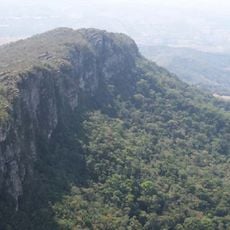
Barbacena sits at 1160 meters (3806 feet) above sea level in the Serra da Mantiqueira range of southeastern Minas Gerais, surrounded by farmland. The town spreads across rolling terrain that offers a mild climate and wide views of the surrounding valleys and peaks.

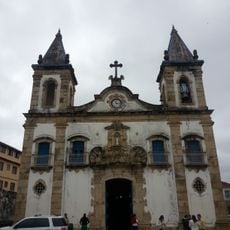
The settlement received municipality status in 1791 and grew through mining and trade activities that served travelers between Rio de Janeiro and the gold fields. By the 19th century it became an important regional center with schools and military facilities that cemented its role in Brazilian life.

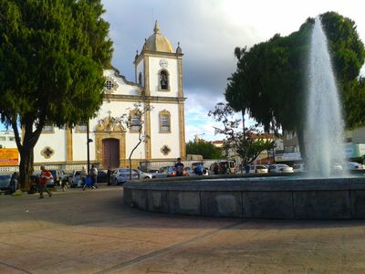
Locals call their home the Garden of Minas Gerais, and you will see gardens with blooming plants throughout streets and parks. This reputation comes from a centuries-old tradition of growing roses that continues today on many farms around town.

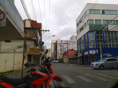
The BR-040 highway connects the town to Rio de Janeiro and Brasília, and local buses run throughout the urban area. Mountain climate can be cool even in summer, especially mornings and evenings, so bring a light jacket.

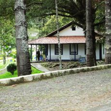
It is home to the Escola Preparatória de Cadetes do Ar, one of the most important military education institutions in Brazil that trains young men and women for the Air Force. Visitors can sometimes see cadets in uniform walking through town, especially near the campus.

Location: Minas Gerais

Inception: 1791

Elevation above the sea: 1,160 m

Shares border with: São João del Rei, Barroso, Antônio Carlos, Alfredo Vasconcelos, Carandaí, Ibertioga, Oliveira Fortes, Santa Bárbara do Tugúrio, Desterro do Melo, Ressaquinha, Prados, Dores de Campos, Santos Dumont

Website: http://barbacena.mg.gov.br

GPS coordinates: -21.22583,-43.77389

Latest update: December 4, 2025 23:41

Reviews

Visited this place? Tap the stars to rate it and share your experience / photos with the community! Try now! You can cancel it anytime.

« Barbacena - Municipality in Serra da Mantiqueira Mountains, Brazil » is provided by Around Us (aroundus.com). Images and texts are derived from Wikimedia project under a Creative Commons license. You are allowed to copy, distribute, and modify copies of this page, under the conditions set by the license, as long as this note is clearly visible.

Discover hidden gems everywhere you go!

From secret cafés to breathtaking viewpoints, skip the crowded tourist spots and find places that match your style. Our app makes it easy with voice search, smart filtering, route optimization, and insider tips from travelers worldwide. Download now for the complete mobile experience.

Around Us App Screenshot

A unique approach to discovering new places

Le Figaro

All the places worth exploring

France Info

A tailor-made excursion in just a few clicks

20 Minutes