Conselheiro Lafaiete, Administrative center in Minas Gerais, Brazil.
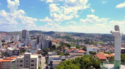
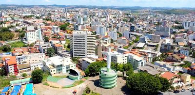
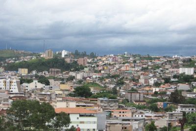
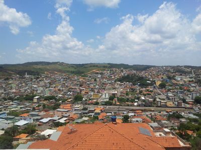
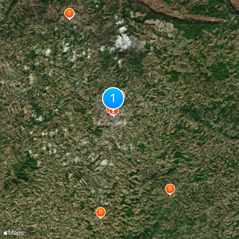
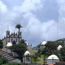
Conselheiro Lafaiete is an administrative division in the state of Minas Gerais in Brazil, sitting on hills in the southeast of the country and surrounded by agricultural land and industrial zones. The urban area spreads over a hilly topography with roads running through residential neighborhoods, commercial zones and green spaces that link to nearby municipalities.
The place began in the late 18th century under the name Queluz as a mining settlement for gold prospectors and grew through railroads in the 19th century. The current name was adopted in 1934 to honor a Brazilian jurist who pushed political reforms forward.
Markets and neighborhoods show traces of the mining past through small shops and workshops that still use traditional craft techniques. Rural customs mix with industrial habits, especially during festivals that recall the railroad history and mining work.
Access is by regional roads that take about an hour and a half from Belo Horizonte, with buses and private vehicles as the main transport options. The terrain is hilly, so bringing comfortable shoes and planning breaks during walks through outer districts is worthwhile.
Workshops for rebuilding locomotives have operated here for over a century and train technicians who repair railcars and engines using old methods. Manganese extraction shapes parts of the surroundings, where waste heaps and small processing plants remain visible on the edge of residential areas.
Location: Minas Gerais
Inception: September 19, 1790
Elevation above the sea: 995 m
Shares border with: Santana dos Montes, Itaverava, Queluzito, São Brás do Suaçuí, Congonhas, Cristiano Otoni, Ouro Branco
Website: http://conselheirolafaiete.mg.gov.br
GPS coordinates: -20.66000,-43.78583
Latest update: December 5, 2025 16:34
Sanctuary of Bom Jesus de Matosinhos
18.7 km
Igreja Matriz de Nossa Senhora do Pilar
42 km
Casa dos Contos
42.3 km
Church of Our Lady of the Rosary
42.1 km
Carmine Church (Ouro Preto)
42.3 km
Pico do Itacolomi
41.4 km
Parque Estadual do Itacolomi
41.9 km
Teatro Municipal
42.3 km
Parish Church of Saint Antony
18.3 km
Dom Bosco School
35.3 km
Museu do Escravo
37.4 km
Museu do Oratório
42.3 km
Casa de Pedra do Gambá
33.9 km
Museu do Chá (Ouro Preto)
37.8 km
Fortim dos Bandeirantes
33.9 km
Solar Baeta Neves
41.8 km
Ponte do Rosário
42 km
Ponte da Barra
42.1 km
Igreja Matriz de Santo Antônio de Itatiaia
26.9 km
Parish Church of Our Lady of the Conception
19.3 km
Museu de Congonhas
18.7 km
Passo do Rosário
42.1 km
Parish Church of Our Lady of Nazareth (Cachoeira do Campo)
36.9 km
Chafariz da Glória
42.1 km
Capela do Senhor do Bonfim
42.1 km
Skeleton's Bridge
31.6 km
Cine Ritz Lafaiete
359 m
Museu da Imagem e Memória
18.8 kmReviews
Visited this place? Tap the stars to rate it and share your experience / photos with the community! Try now! You can cancel it anytime.
Discover hidden gems everywhere you go!
From secret cafés to breathtaking viewpoints, skip the crowded tourist spots and find places that match your style. Our app makes it easy with voice search, smart filtering, route optimization, and insider tips from travelers worldwide. Download now for the complete mobile experience.
A unique approach to discovering new places❞
— Le Figaro
All the places worth exploring❞
— France Info
A tailor-made excursion in just a few clicks❞
— 20 Minutes