Enable Location

We need your location to show you interesting places around you

Discover nearby places

Find interesting locations and hidden gems around you

Precise directions

Get accurate directions and distances to places

Your location is never shared with other users. It's only used when you tap the location button.

Ouro Branco

Log in to your account

Start exploring — it's free

Trusted by 62,573 travelers worldwide

Continue with Google
Continue with Apple
or

We will send you a code to connect

By continuing, you accept our Terms and Conditions and our Privacy Policy

Check your inbox

We've sent a pincode in your inbox. Please enter the code below.

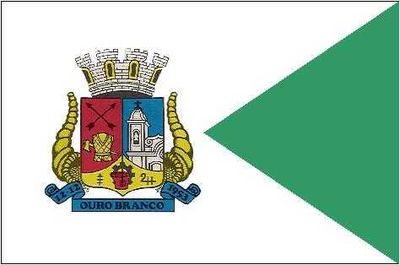
Ouro Branco, Mining municipality in Minas Gerais, Brazil

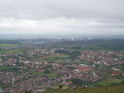
Ouro Branco is a municipality in Minas Gerais positioned at around 1,100 meters elevation across a mountainous landscape dotted with springs and natural rock formations. The town has a campus of the Federal University of São João del-Rei that brings academic facilities and student life to the region.

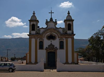
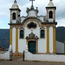
The settlement began in the late 17th century when explorer Miguel Garcia discovered a light-colored gold deposit that inspired the name Ouro Branco. The construction of the Santo Antonio Church over several decades from the early 18th century marked the area's growth as a mining community.

The Santo Antonio de Ouro Branco Church sits at the heart of local religious life, reflecting centuries of devotion through its colonial design and interior details. People gather here for celebrations and daily worship, making it a living center of community identity.

The location sits at about 1,100 meters elevation, which means cooler and often damper weather than lower-altitude areas nearby. Visitors should pack layers and waterproof gear when exploring the surrounding hills and natural formations.

The Serra de Ouro Branco state park protects a large natural area where multiple water springs originate and feed into two different major river systems. This makes the region an important water source for communities far beyond its own boundaries.

The community of curious travelers

AroundUs brings together thousands of curated places, local tips, and hidden gems, enriched daily by 60,000 contributors worldwide.

Start exploring
Location
Elevation above the sea
1,100 m
Shares border with
Congonhas, Itaverava, Ouro Preto, Conselheiro Lafaiete
GPS coordinates
-20.52083,-43.69194
Latest update
December 17, 2025 07:50
« Ouro Branco - Mining municipality in Minas Gerais, Brazil » is provided by Around Us (aroundus.com). Images and texts are derived from Wikimedia project under a Creative Commons license. You are allowed to copy, distribute, and modify copies of this page, under the conditions set by the license, as long as this note is clearly visible.

Discover hidden gems everywhere you go!

From secret cafés to breathtaking viewpoints, skip the crowded tourist spots and find places that match your style. Our app makes it easy with voice search, smart filtering, route optimization, and insider tips from travelers worldwide. Download now for the complete mobile experience.

Around Us App Screenshot

A unique approach to discovering new places

Le Figaro

All the places worth exploring

France Info

A tailor-made excursion in just a few clicks

20 Minutes

Around Us
Travel Guide & Maps
Download

Send to your phone

QR Code
1

Open the camera app on your mobile.

2

Point at the QR code with your camera. A notification will appear.

3

Tap the notification to open the link.