Mestre Álvaro, Mountain summit in Serra, Brazil
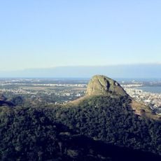
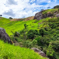
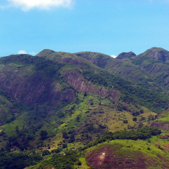
Mestre Álvaro is a semicircular granite massif in Serra rising to 833 m, with an altimetric range of 100 to 850 m across 3,470 ha. Its main trail, well marked but not always clean, climbs past a valley and a waterfall, the old drinking-water source for residents, then crosses windy hilltops before the highest point. The south face holds steeper paths through dense forest to the 800 m rock.
The granite massif appears in 16th-century cartographic documents, when its height and position already made it a reference for maritime navigation along the Espírito Santo coast. Fishermen kept its summit in sight to steer safely, which earned it the name Mestre Álvaro. The mountain later became the landmark around which the municipality of Serra grew.
The name comes from local accounts of a carpenter or teacher named Álvaro who lived on the slope, so people said they were going to the Morro do Mestre Álvaro. Fishermen also call the peak Mestre Álvaro because they steer by keeping its summit in sight. A third version derives it from Monte Alvo, since the top is often under cloud.
The main trail starts from Serra-sede and is well marked but not always clean; the first half climbs steeply beside a valley and a waterfall, the former drinking-water source for locals. Allow about four hours at an easy pace, under two for fit hikers. Access to other trails on the south face is restricted; the south trail is steeper and passes two springs.
Near the summit stands a 9 m² room probably built by the Army, now used as a radio repeater base. An 8-metre steel frame nearby once held a 9 m² aluminium plate visible from the city when it reflected sunlight; its purpose is unknown.
The community of curious travelers
AroundUs brings together thousands of curated places, local tips, and hidden gems, enriched daily by 92,886 contributors worldwide.