Enable Location

We need your location to show you interesting places around you

Discover nearby places

Find interesting locations and hidden gems around you

Precise directions

Get accurate directions and distances to places

Your location is never shared with other users. It's only used when you tap the location button.

Itacoatiara

Log in to your account

Start exploring — it's free

Trusted by 62,840 travelers worldwide

Continue with Google
Continue with Apple
or

We will send you a code to connect

By continuing, you accept our Terms and Conditions and our Privacy Policy

Check your inbox

We've sent a pincode in your inbox. Please enter the code below.

Itacoatiara, River port municipality in Amazonas, Brazil

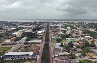
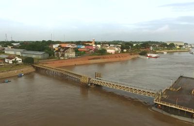
Itacoatiara is a river port town on the Amazon's northern bank, sitting about 176 kilometers east of Manaus. It operates as a major transport hub where goods move between river steamers, cargo boats, and aircraft.

The town began in 1757 when residents relocated from an older settlement to its current location and originally called it Serpa. Over time, the name changed to reflect its growing role as a trading center on the Amazon.

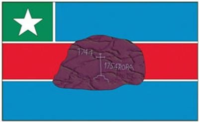
The name comes from Tupi language and refers to painted stones found throughout the region. This connection to the natural landscape shapes how local people relate to their surroundings.

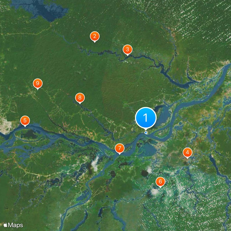
Visitors should prepare for hot, humid tropical weather and expect higher river levels during rainy season. Getting to town works best by small aircraft or by boat traveling downriver from Manaus.

The area holds ancient rock carvings left by earlier people and from which the city took its name. These petroglyphs quietly show how long humans have lived and worked along the Amazon.

The community of curious travelers

AroundUs brings together thousands of curated places, local tips, and hidden gems, enriched daily by 60,000 contributors worldwide.

Start exploring
Location
Inception
April 24, 1874
Elevation above the sea
40 m
Shares border with
Itapiranga, Manaus, Autazes, Boa Vista do Ramos, Careiro da Várzea, Maués, Nova Olinda do Norte, Rio Preto da Eva, Silves, Urucurituba
GPS coordinates
-3.14278,-58.44389
Latest update
December 14, 2025 19:54
« Itacoatiara - River port municipality in Amazonas, Brazil » is provided by Around Us (aroundus.com). Images and texts are derived from Wikimedia project under a Creative Commons license. You are allowed to copy, distribute, and modify copies of this page, under the conditions set by the license, as long as this note is clearly visible.

Discover hidden gems everywhere you go!

From secret cafés to breathtaking viewpoints, skip the crowded tourist spots and find places that match your style. Our app makes it easy with voice search, smart filtering, route optimization, and insider tips from travelers worldwide. Download now for the complete mobile experience.

Around Us App Screenshot

A unique approach to discovering new places

Le Figaro

All the places worth exploring

France Info

A tailor-made excursion in just a few clicks

20 Minutes

Around Us
Travel Guide & Maps
Download

Send to your phone

QR Code
1

Open the camera app on your mobile.

2

Point at the QR code with your camera. A notification will appear.

3

Tap the notification to open the link.