Enable Location

We need your location to show you interesting places around you

Discover nearby places

Find interesting locations and hidden gems around you

Precise directions

Get accurate directions and distances to places

Your location is never shared with other users. It's only used when you tap the location button.

Chapada dos Veadeiros National Park

Log in to your account

Join the adventure

Create your free account and start exploring (like 60k+ others)

We will send you a code to connect

or
Continue with Google
Continue with Apple
By continuing, you accept our Terms and Conditions and our Privacy Policy

Check your inbox

We've sent a pincode in your inbox. Please enter the code below.

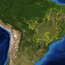
Chapada dos Veadeiros National Park, National park and UNESCO World Heritage Site in Goiás, Brazil

Description

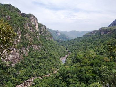
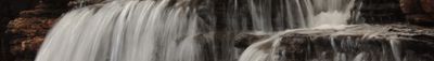
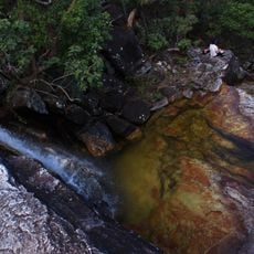
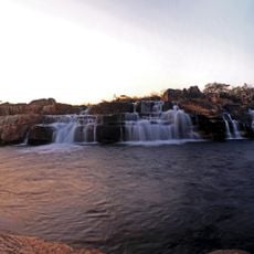
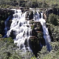
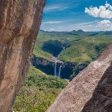
Chapada dos Veadeiros National Park is a protected area on an ancient plateau featuring crystalline rock formations, deep canyons, and several waterfalls. The landscape shows layers of stone that are millions of years old and spreads across varied terrain at different elevations.

History

The park was established in 1961 and protects one of Earth's oldest geological formations. The rock layers formed about 1.8 billion years ago during the planet's early history.

Culture

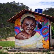
Kalunga communities live in the surrounding area, descendants of people who fled slavery and built their own settlements centuries ago. Their way of life and traditions continue to shape the region today.

Practical

Most visitors explore the area on marked trails guided by experienced guides. Weather conditions vary greatly throughout the year, so it is wise to bring layers and adapt your clothing based on the season.

Did you know?

Photographs taken by space agencies in the 1960s showed this location as one of the brightest natural places on Earth. This brightness comes from large quantities of quartz crystals in the rocks that reflect light in a distinctive way.

Location
Inception
1961
Operator
Instituto Chico Mendes de Conservação da Biodiversidade
Part of
Cerrado
GPS coordinates
-14.08333,-47.66667
Latest update
January 17, 2026 17:10

AroundUs brings together thousands of curated places, local tips, and hidden gems, enriched daily by 60,000 contributors worldwide. Discover all places nearby (Goiás).

Natural areas of central west Brazil: waterfalls, caves, national parks

The central west region of Brazil encompasses states including Goiás, Mato Grosso and Mato Grosso do Sul. These areas contain national parks with hiking trails, waterfalls and cave systems. Chapada dos Veadeiros National Park near Alto Paraíso de Goiás displays cerrado vegetation and rock...

« Chapada dos Veadeiros National Park - National park and UNESCO World Heritage Site in Goiás, Brazil » is provided by Around Us (aroundus.com). Images and texts are derived from Wikimedia project under a Creative Commons license. You are allowed to copy, distribute, and modify copies of this page, under the conditions set by the license, as long as this note is clearly visible.

Discover hidden gems everywhere you go!

From secret cafés to breathtaking viewpoints, skip the crowded tourist spots and find places that match your style. Our app makes it easy with voice search, smart filtering, route optimization, and insider tips from travelers worldwide. Download now for the complete mobile experience.

Around Us App Screenshot

A unique approach to discovering new places

Le Figaro

All the places worth exploring

France Info

A tailor-made excursion in just a few clicks

20 Minutes

Around Us
Travel Guide & Maps
Download

Send to your phone

QR Code
1

Open the camera app on your mobile.

2

Point at the QR code with your camera. A notification will appear.

3

Tap the notification to open the link.