Óbidos, Border city in northern Pará, Brazil
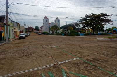
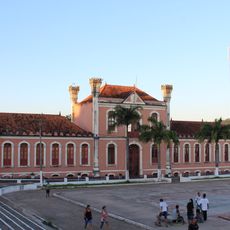
Óbidos is a municipality situated at the narrowest section of the Amazon River in Pará state. Buildings cling to steep riverbanks, with colonial structures facing the water and older areas showing signs of riverside settlement patterns.
Founded in 1697 as a military fort, the settlement was established to monitor river traffic at this geographical chokepoint. This strategic location transformed it into a regional trading and administrative center over the following centuries.
Residents depend on fishing and forest resources for their livelihoods, with handmade boats and crafts visible throughout the town. These traditions shape how people interact with the river and forest that surround them.
The town connects to regional centers mainly by river boat, with a small airport offering occasional flights. Plan travel around river conditions and boat schedules, as water transport is the primary link to other areas.
The Amazon narrows to about 1.6 kilometers wide at this point, creating intense currents and unusual river dynamics. This geographical feature has shaped the site's importance throughout history and remains striking to observe.
Location: Pará
Inception: 1697
Shares border with: Oriximiná, Almeirim, Alenquer, Curuá, Juruti, Santarém
Website: http://obidos.pa.gov.br
GPS coordinates: -1.91778,-55.51778
Latest update: December 7, 2025 10:04
Sipaliwini District
636.5 km
Tumucumaque National Park
519.8 km
Central Suriname Nature Reserve
659.2 km
João Fona cultural centre
105.9 km
Government of Amapá
403.7 km
National Forest Tapajós
184.8 km
Grão-Pará Ecological Station
390.6 km
Maicuru Biological Reserve
390.2 km
Jari Ecological Station
351.2 km
Rio Trombetas Biological Reserve
155 km
Uatumã Sustainable Development Reserve
350.3 km
Tapajós-Arapiuns Extractive Reserve
165.2 km
Forte Gurjão
1.1 km
Rosevelt Piek
587.9 km
Tapawatra Sula
660.3 km
Trombaka Sula
553.1 km
Ingi Pikin sula
601.6 km
Quilombo Cachoeira Porteira
40.4 km
Kantani
472.9 km
Adoemansingie Soela
623.2 km
Kortufutu Sula
602.4 km
Allamandidon
601.6 km
Grandafutu Sula
602.5 km
Grienkasaba Sula
634.9 km
Pruru Sula
608.3 km
Kodobaku Sula
601.5 km
Awaladi
495.3 km
Kotilolo Sula
653.2 kmVisited this place? Tap the stars to rate it and share your experience / photos with the community! Try now! You can cancel it anytime.
Discover hidden gems everywhere you go!
From secret cafés to breathtaking viewpoints, skip the crowded tourist spots and find places that match your style. Our app makes it easy with voice search, smart filtering, route optimization, and insider tips from travelers worldwide. Download now for the complete mobile experience.
A unique approach to discovering new places❞
— Le Figaro
All the places worth exploring❞
— France Info
A tailor-made excursion in just a few clicks❞
— 20 Minutes