Fort of Óbidos, Fort of Pauxis
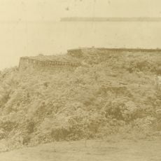
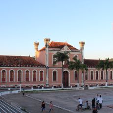
Fort of Óbidos, Fort of Pauxis, Portuguese colonial fortress in Óbidos, Brazil.
The Fort of Óbidos stands on a high riverbank of the Amazon and displays stone walls with colonial military architecture. Its structure shows typical defensive features with reinforced positions and bastions.
It was built in 1697 as Fort Pauxis and served as a Portuguese defensive position protecting the Amazon region from foreign invasions. This fortress marked a strategic turning point in controlling this valuable river route.
Local indigenous groups participated in the construction, blending their traditional building methods with Portuguese military design. This collaboration shaped the fortress in ways you can still observe in how it was built.
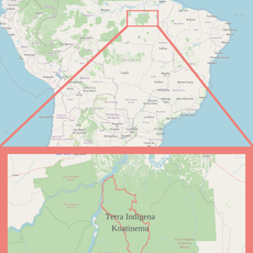
The site is located at coordinates -1.917983, -55.516867 and is accessible for exploring the ruins and surrounding area. Wear sturdy shoes and watch for slippery surfaces during or after rain.
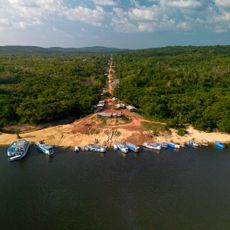
This fortress controlled the narrowest section of the Amazon River, where ships had to pay taxes and undergo inspection during the colonial period. This made it a valuable trade control point for the Portuguese crown.
Location: Óbidos
GPS coordinates: -1.91798,-55.51687
Latest update: December 14, 2025 14:20
Amazon Tall Tower Observatory
388.9 km
Amazônia National Park
316.9 km
João Fona cultural centre
105.8 km
Pau do Presidente
398.7 km
Tapajós hydroelectric complex
310.9 km
Caxiuanã National Forest
454.5 km
Government of Amapá
403.7 km
National Forest Tapajós
184.7 km
Uatumã Biological Reserve
446 km
Jamanxim National Park
427.3 km
Fort of Saint Antony of Gurupá
434.9 km
Terra do Meio Ecological Station
312.2 km
Grão-Pará Ecological Station
390.6 km
Rio Cajari Extractive Reserve
426.4 km
Maicuru Biological Reserve
390.2 km
Jari Ecological Station
351.2 km
Rio Trombetas Biological Reserve
155.1 km
Caverna do Maroaga Environmental Protection Area
482.1 km
Terra Indígena Koatinemo
445.7 km
Uatumã Sustainable Development Reserve
350.4 km
Tapajós-Arapiuns Extractive Reserve
165.2 km
Forte Gurjão
1.2 km
Itaituba II National Forest
399.8 km
Trairão National Forest
332.7 km
Rio Xingu Extractive Reserve
412.4 km
Reserva de Desenvolvimento Sustentável Itatupã-Baquiá
486 km
Quilombo Cachoeira Porteira
40.5 km
Kantani
472.9 kmVisited this place? Tap the stars to rate it and share your experience / photos with the community! Try now! You can cancel it anytime.
Discover hidden gems everywhere you go!
From secret cafés to breathtaking viewpoints, skip the crowded tourist spots and find places that match your style. Our app makes it easy with voice search, smart filtering, route optimization, and insider tips from travelers worldwide. Download now for the complete mobile experience.
A unique approach to discovering new places❞
— Le Figaro
All the places worth exploring❞
— France Info
A tailor-made excursion in just a few clicks❞
— 20 Minutes