Enable Location

We need your location to show you interesting places around you

Discover nearby places

Find interesting locations and hidden gems around you

Precise directions

Get accurate directions and distances to places

Your location is never shared with other users. It's only used when you tap the location button.

Parauapebas

Log in to your account

Start exploring — it's free

Trusted by 61,997 travelers worldwide

Continue with Google
Continue with Apple
or

We will send you a code to connect

By continuing, you accept our Terms and Conditions and our Privacy Policy

Check your inbox

We've sent a pincode in your inbox. Please enter the code below.

Parauapebas, Mining municipality in Pará, Brazil.

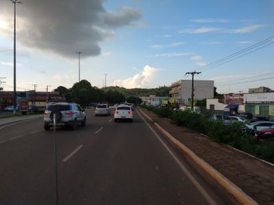
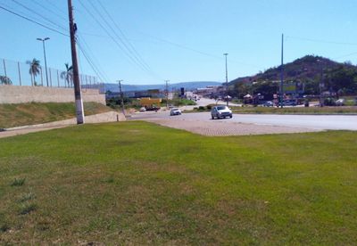
Parauapebas is a municipality in Pará state in northern Brazil, located in a forested area between two large national parks. The urban core spreads along wide streets with residential and commercial districts, industrial facilities on the outskirts, and extensive woodland covering much of the municipal territory.

The founding of Parauapebas took place in 1988 after the discovery of large iron ore deposits in the 1960s, which drew workers from other regions of Brazil. The municipality separated from neighboring Marabá and rapidly developed into one of the main centers for mining in Pará state.

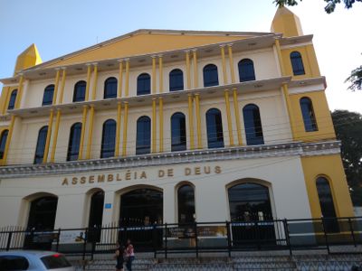
Parauapebas brings together people from different parts of Brazil who came looking for work in the mining industry and brought their regional customs and cuisines. The city shows a mix of northeastern and southern influences in its restaurants, festivals, and weekly markets, where fresh produce sits alongside traditional dishes from several states.

A visit can be combined well with time spent in the surrounding national parks, as both are in the same area and accessible from the city. The local airport offers regular flights to São Luís and other Brazilian cities, while a rail connection also runs to São Luís.

The Parauapebas and Itacaiúnas rivers flow through the municipal area and offer residents and visitors access to water landscapes within the forests. Several waterfalls and natural swimming spots lie near the city and are visited by locals on weekends.

The community of curious travelers

AroundUs brings together thousands of curated places, local tips, and hidden gems, enriched daily by 60,000 contributors worldwide.

Start exploring
Location
Inception
1976
Elevation above the sea
150 m
Shares border with
Marabá, Água Azul do Norte, Canaã dos Carajás, Curionópolis, Ourilândia do Norte, São Félix do Xingu
GPS coordinates
-6.06778,-49.90194
Latest update
December 13, 2025 17:02
« Parauapebas - Mining municipality in Pará, Brazil » is provided by Around Us (aroundus.com). Images and texts are derived from Wikimedia project under a Creative Commons license. You are allowed to copy, distribute, and modify copies of this page, under the conditions set by the license, as long as this note is clearly visible.

Discover hidden gems everywhere you go!

From secret cafés to breathtaking viewpoints, skip the crowded tourist spots and find places that match your style. Our app makes it easy with voice search, smart filtering, route optimization, and insider tips from travelers worldwide. Download now for the complete mobile experience.

Around Us App Screenshot

A unique approach to discovering new places

Le Figaro

All the places worth exploring

France Info

A tailor-made excursion in just a few clicks

20 Minutes

Around Us
Travel Guide & Maps
Download

Send to your phone

QR Code
1

Open the camera app on your mobile.

2

Point at the QR code with your camera. A notification will appear.

3

Tap the notification to open the link.