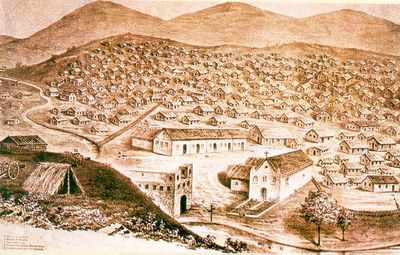
Canudos, Historical municipality in Bahia, Brazil.
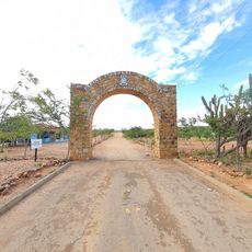
Canudos is a municipality in Bahia state in northeastern Brazil. The area combines settled regions with agricultural lands and contains a state park that preserves historical remains from the late 19th century.
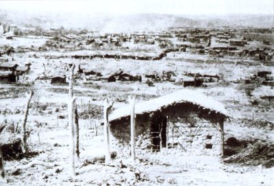
The site was the center of a major conflict between 1896 and 1897 when government forces fought residents led by Antonio Conselheiro. This confrontation resulted in the destruction of the original settlement and transformed the region's history.
The community holds religious ceremonies and gatherings throughout the year to honor those who lost their lives during the conflict. These events remain deeply rooted in local spiritual traditions and collective memory.
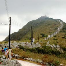
Plan to visit during the cooler months when conditions favor outdoor exploration and bring sturdy footwear and water for walking through the park. The area works best for those interested in spending time hiking and observing the landscape at a leisurely pace.
The original settlement lies submerged beneath the Cocorobó Dam reservoir and becomes visible only when water levels drop during drier periods. This creates a rare opportunity to see structures from the vanished community emerge from the water.
Location: Bahia
Inception: 1893
Elevation above the sea: 402 m
Shares border with: Euclides da Cunha
Website: http://canudos.ba.gov.br
GPS coordinates: -9.90444,-39.14151
Latest update: December 17, 2025 08:25
Bendegó meteorite
27.1 kmRaso da Catarina Ecological Reserve
69.5 km
Canudos State Park
6.2 km
Conjunto Arquitetônico, Urbanístico, Natural e Paisagístico da Serra do Monte Santo
62.5 km
Serra Branca / Raso da Catarina Environmental Protection Area
62.4 kmCocorobó Area of Relevant Ecological Interest
35 kmCocorobó
11.5 kmQuilombo Juazeiro dos Capotes
90.7 kmQuilombo Casinhas
88.4 kmQuilombo Terra da Lua
93.6 kmQuilombo Lage do Antônio
63.9 kmMuseu Memórias de Régis
12.4 kmMuseu do Sertão
63.1 kmO Cajueiro
88.5 kmEuclides da Cunha
68.6 kmParque de vaqueijada
90 kmPedra Riscada
32.4 kmFrei Apolônio de Todi
63.1 kmEstátua de Antônio Conselheiro
63.1 kmPrefeito Pedro Ribeiro
38.1 kmAntônia Ribeiro
86.2 kmMercado Municipal 1
37.8 kmScenic viewpoint
90.5 kmParque de Antenas
90.5 kmGarganta da Baixa do Chico
74.7 kmMirante do Conselheiro
11.2 kmPedra Furada
92.1 kmWaterfall
27.7 kmVisited this place? Tap the stars to rate it and share your experience / photos with the community! Try now! You can cancel it anytime.
Discover hidden gems everywhere you go!
From secret cafés to breathtaking viewpoints, skip the crowded tourist spots and find places that match your style. Our app makes it easy with voice search, smart filtering, route optimization, and insider tips from travelers worldwide. Download now for the complete mobile experience.
A unique approach to discovering new places❞
— Le Figaro
All the places worth exploring❞
— France Info
A tailor-made excursion in just a few clicks❞
— 20 Minutes