Enable Location

We need your location to show you interesting places around you

Discover nearby places

Find interesting locations and hidden gems around you

Precise directions

Get accurate directions and distances to places

Your location is never shared with other users. It's only used when you tap the location button.

Paripiranga

Log in to your account

Join the adventure

Create your free account and start exploring (like 60k+ others)

We will send you a code to connect

or
Continue with Google
Continue with Apple
By continuing, you accept our Terms and Conditions and our Privacy Policy

Check your inbox

We've sent a pincode in your inbox. Please enter the code below.

Paripiranga

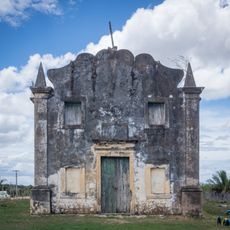
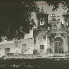
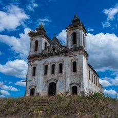
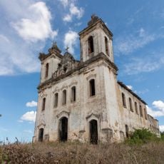
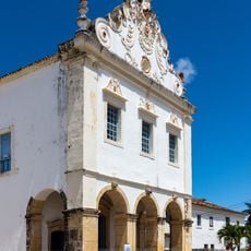
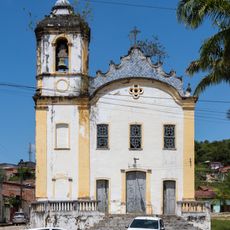
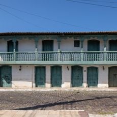
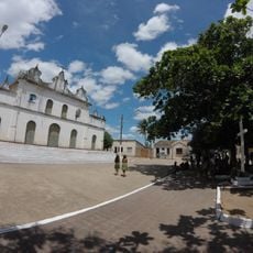
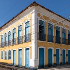
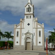
Paripiranga, Municipality in northeastern Bahia, Brazil.

Description

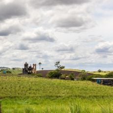
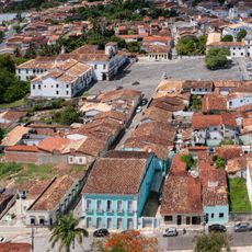
Paripiranga is a municipality in northeastern Bahia, characterized by rural landscapes and agricultural land. It sits inland from the coast and is surrounded by farming areas and natural vegetation.

History

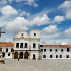
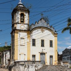
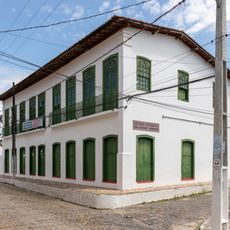
Portuguese colonists founded the original settlement of Malhada Vermelha in the 17th century. The area received its current name through a state decree in 1931.

Culture

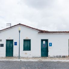
Farming traditions shape daily life here, with corn, pumpkin, and beans grown across rural areas and visible in the landscape. These agricultural practices remain central to how people work and live in the region.

Practical

Visit during the drier season when roads are in better condition for exploration. Plan to spend time walking through rural areas, so wear comfortable shoes and bring sun protection.

Did you know?

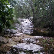
The Furnas da Roça Nova caves hold prehistoric fossils and tell the story of ancient habitation in this region. These underground formations are a natural heritage site that reveals the area's deep past.

GPS coordinates
-10.68289,-37.86215
Latest update
December 7, 2025 20:22

AroundUs brings together thousands of curated places, local tips, and hidden gems, enriched daily by 60,000 contributors worldwide. Discover all places nearby (Paripiranga).

Around this place
São Francisco Square in the Town of São Cristóvão
Brazil

São Francisco Square in the Town of São Cristóvão

80.7 km
Serra de Itabaiana National Park
Brazil

Serra de Itabaiana National Park

57.1 km
Parish Church of Our Lady of Victory
Brazil

Parish Church of Our Lady of Victory

80.5 km
Parque dos Falcões
Brazil

Parque dos Falcões

53.5 km
Chapel of Our Lady of the Conception of Engenho Poxim
Brazil

Chapel of Our Lady of the Conception of Engenho Poxim

72.1 km
Church of Sant'Aninha
Brazil

Church of Sant'Aninha

77.5 km
Chapel of the Nossa Senhora da Penha Sugar Plantation
Brazil

Chapel of the Nossa Senhora da Penha Sugar Plantation

69.1 km
Igreja Matriz do Santuário Nossa Senhora Divina Pastora
Brazil

Igreja Matriz do Santuário Nossa Senhora Divina Pastora

78.1 km
Capela do Engenho Nossa Senhora da Penha
Brazil

Capela do Engenho Nossa Senhora da Penha

69.1 km
Igreja de Nossa Senhora da Conceição dos Pardos (Laranjeiras)
Brazil

Igreja de Nossa Senhora da Conceição dos Pardos (Laranjeiras)

77 km
Primeira Igreja Presbiteriana de Sergipe
Brazil

Primeira Igreja Presbiteriana de Sergipe

77.2 km
Teatro São Pedro
Brazil

Teatro São Pedro

77 km
Capela do Antigo Engenho Jesus, Maria e José
Brazil

Capela do Antigo Engenho Jesus, Maria e José

73.7 km
Igreja da Ordem Terceira do Carmo (São Cristóvão)
Brazil

Igreja da Ordem Terceira do Carmo (São Cristóvão)

80.6 km
Church and Convent of Mount Carmel
Brazil

Church and Convent of Mount Carmel

80.6 km
Architectural and Landscape Ensemble of Laranjeiras, Sergipe
Brazil

Architectural and Landscape Ensemble of Laranjeiras, Sergipe

77.3 km
Sobrado at Rua da Matriz
Brazil

Sobrado at Rua da Matriz

80.6 km
Igreja Matriz do Senhor da Ascensão
Brazil

Igreja Matriz do Senhor da Ascensão

84.3 km
Cine Laser Itabaiana
Brazil

Cine Laser Itabaiana

48.1 km
Parish Church of Divina Pastora
Brazil

Parish Church of Divina Pastora

78.1 km
Architectural, Urban and Landscape Set of São Cristóvão
Brazil

Architectural, Urban and Landscape Set of São Cristóvão

80.7 km
Igreja do Bom Jesus dos Navegantes
Brazil

Igreja do Bom Jesus dos Navegantes

77.6 km
Mother Church of Nossa Senhora da Boa Hora and São Roque (Campo do Brito/SE)
Brazil

Mother Church of Nossa Senhora da Boa Hora and São Roque (Campo do Brito/SE)

41 km
Former Police Station of Laranjeiras
Brazil

Former Police Station of Laranjeiras

77 km
Museu Afro-Brasileiro de Sergipe
Brazil

Museu Afro-Brasileiro de Sergipe

76.9 km
Igreja Matriz de Senhora Santana
Brazil

Igreja Matriz de Senhora Santana

8.5 km
Colégio Estadual Professora Zizinha Guimarães
Brazil

Colégio Estadual Professora Zizinha Guimarães

77.2 km
Casa do Folclore "Zeca de Norberto"
Brazil

Casa do Folclore "Zeca de Norberto"

80.7 km
Show the full map
« Paripiranga - Municipality in northeastern Bahia, Brazil » is provided by Around Us (aroundus.com). Images and texts are derived from Wikimedia project under a Creative Commons license. You are allowed to copy, distribute, and modify copies of this page, under the conditions set by the license, as long as this note is clearly visible.

Discover hidden gems everywhere you go!

From secret cafés to breathtaking viewpoints, skip the crowded tourist spots and find places that match your style. Our app makes it easy with voice search, smart filtering, route optimization, and insider tips from travelers worldwide. Download now for the complete mobile experience.

Around Us App Screenshot

A unique approach to discovering new places

Le Figaro

All the places worth exploring

France Info

A tailor-made excursion in just a few clicks

20 Minutes

Around Us
Travel Guide & Maps
Download

Send to your phone

QR Code
1

Open the camera app on your mobile.

2

Point at the QR code with your camera. A notification will appear.

3

Tap the notification to open the link.