Enable Location

We need your location to show you interesting places around you

Discover nearby places

Find interesting locations and hidden gems around you

Precise directions

Get accurate directions and distances to places

Your location is never shared with other users. It's only used when you tap the location button.

Balsas

Log in to your account

Start exploring — it's free

Trusted by 62,859 travelers worldwide

Continue with Google
Continue with Apple
or

We will send you a code to connect

By continuing, you accept our Terms and Conditions and our Privacy Policy

Check your inbox

We've sent a pincode in your inbox. Please enter the code below.

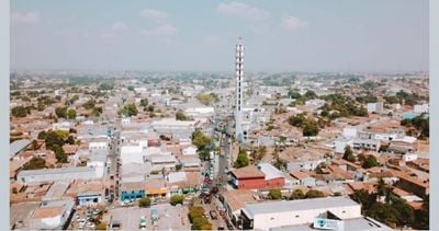
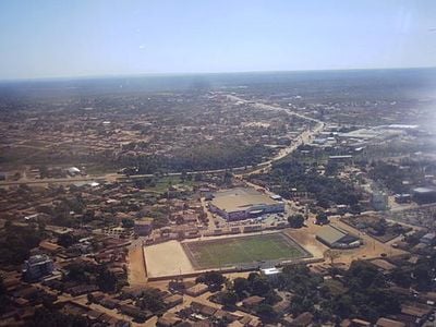
Balsas, Administrative region in Maranhão, Brazil.

Balsas is a municipality in southern Maranhão that spreads across agricultural plains and natural Cerrado vegetation. The landscape consists primarily of farming areas mixed with patches of native scrubland and grassland formations.

The region developed into an agricultural hub during the late 1900s through expansion of soybean farming. This shift transformed the economy and established it as a major production center in the state.

The population of Balsas maintains traditional festivals that combine indigenous practices with Portuguese colonial influences throughout the calendar year.

Daily bus connections link the region to major cities in Maranhão state from the central terminal. Regular transportation services make arriving and leaving straightforward for visitors and commuters.

The area sits within the MATOPIBA agricultural frontier, one of Brazil's most productive grain-growing zones in the Northeast. This location makes it a key farming center outside the country's traditional southern agricultural heartland.

The community of curious travelers

AroundUs brings together thousands of curated places, local tips, and hidden gems, enriched daily by 60,000 contributors worldwide.

Start exploring
Location
Elevation above the sea
535 m
Shares border with
Riachão, Tasso Fragoso, São Raimundo das Mangabeiras, Alto Parnaíba, Campos Lindos, Fortaleza dos Nogueiras, Lizarda, Nova Colinas, Recursolândia, Sambaíba
GPS coordinates
-7.53278,-46.03583
Latest update
December 14, 2025 18:59
« Balsas - Administrative region in Maranhão, Brazil » is provided by Around Us (aroundus.com). Images and texts are derived from Wikimedia project under a Creative Commons license. You are allowed to copy, distribute, and modify copies of this page, under the conditions set by the license, as long as this note is clearly visible.

Discover hidden gems everywhere you go!

From secret cafés to breathtaking viewpoints, skip the crowded tourist spots and find places that match your style. Our app makes it easy with voice search, smart filtering, route optimization, and insider tips from travelers worldwide. Download now for the complete mobile experience.

Around Us App Screenshot

A unique approach to discovering new places

Le Figaro

All the places worth exploring

France Info

A tailor-made excursion in just a few clicks

20 Minutes

Around Us
Travel Guide & Maps
Download

Send to your phone

QR Code
1

Open the camera app on your mobile.

2

Point at the QR code with your camera. A notification will appear.

3

Tap the notification to open the link.