Enable Location

We need your location to show you interesting places around you

Discover nearby places

Find interesting locations and hidden gems around you

Precise directions

Get accurate directions and distances to places

Your location is never shared with other users. It's only used when you tap the location button.

Codó

Log in to your account

Start exploring — it's free

Trusted by 62,860 travelers worldwide

Continue with Google
Continue with Apple
or

We will send you a code to connect

By continuing, you accept our Terms and Conditions and our Privacy Policy

Check your inbox

We've sent a pincode in your inbox. Please enter the code below.

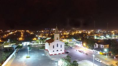
Codó, Municipal administrative division in Maranhão, Brazil

Codó is a municipality in eastern Maranhão and sits in an area of tropical vegetation where small rivers run through the landscape. The city connects to the state capital by major road and functions as a regional center.

The settlement emerged at the end of the 1700s when Portuguese immigrants arrived and began farming, with the area developing from there. In the 1800s, the place gained official city status through state law.

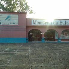
This place is known as a center for Afro-Brazilian religious practices, with local spiritual sites that draw believers from across the region. These communities and their traditions form an important part of daily life here.

The city is easily reached by a modern highway and offers good connections to larger neighboring towns in the region. The flat surroundings make getting around and finding your way simple.

The area sits within a forest-rich zone with abundant vegetation that people have long used and shaped over time. This woodland is a defining feature of the natural surroundings where the city grew.

The community of curious travelers

AroundUs brings together thousands of curated places, local tips, and hidden gems, enriched daily by 60,000 contributors worldwide.

Start exploring
Location
Inception
April 16, 1896
Elevation above the sea
47 m
Shares border with
Timbiras, Afonso Cunha, Aldeias Altas, Capinzal do Norte, Caxias, Chapadinha, Coroatá, Dom Pedro, Gonçalves Dias, Governador Archer, Peritoró, Santo Antônio dos Lopes, São João do Soter
GPS coordinates
-4.45500,-43.88583
Latest update
December 17, 2025 08:48
« Codó - Municipal administrative division in Maranhão, Brazil » is provided by Around Us (aroundus.com). Images and texts are derived from Wikimedia project under a Creative Commons license. You are allowed to copy, distribute, and modify copies of this page, under the conditions set by the license, as long as this note is clearly visible.

Discover hidden gems everywhere you go!

From secret cafés to breathtaking viewpoints, skip the crowded tourist spots and find places that match your style. Our app makes it easy with voice search, smart filtering, route optimization, and insider tips from travelers worldwide. Download now for the complete mobile experience.

Around Us App Screenshot

A unique approach to discovering new places

Le Figaro

All the places worth exploring

France Info

A tailor-made excursion in just a few clicks

20 Minutes

Around Us
Travel Guide & Maps
Download

Send to your phone

QR Code
1

Open the camera app on your mobile.

2

Point at the QR code with your camera. A notification will appear.

3

Tap the notification to open the link.