Enable Location

We need your location to show you interesting places around you

Discover nearby places

Find interesting locations and hidden gems around you

Precise directions

Get accurate directions and distances to places

Your location is never shared with other users. It's only used when you tap the location button.

Palmeira dos Índios

Log in to your account

Start exploring — it's free

Trusted by 62,585 travelers worldwide

Continue with Google
Continue with Apple
or

We will send you a code to connect

By continuing, you accept our Terms and Conditions and our Privacy Policy

Check your inbox

We've sent a pincode in your inbox. Please enter the code below.

Palmeira dos Índios, Regional municipality in western Alagoas, Brazil

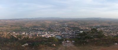
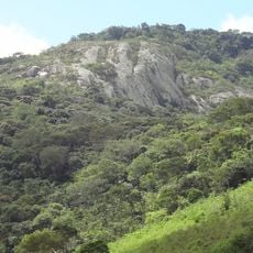
Palmeira dos Índios is a municipality in the western highlands of Alagoas, situated at an elevation of about 290 meters. The city covers approximately 460 square kilometers and serves as an important administrative center for the region.

The settlement began in 1821 when the Provincial Government distributed land to indigenous groups, and it became a city in 1889. This transition marked an important shift in the development of what would become a regional administrative center.

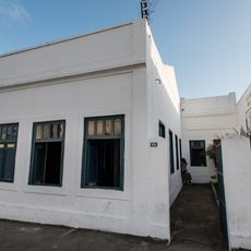
The municipality holds significance as a place connected to the Xucuru indigenous peoples, whose history is preserved through displays in the local Rosário Church. The community maintains this heritage as part of its identity and local traditions.

The city sits in a highland area with moderate to warm temperatures, with the rainiest period from May through August. Visitors should plan their activities based on the season and be aware of the elevation.

The well-known Brazilian writer Graciliano Ramos served as mayor here in 1927 and drew inspiration from the local life for his first novel, Caetés. This literary connection makes the place of interest to readers of Brazilian modernist fiction.

The community of curious travelers

AroundUs brings together thousands of curated places, local tips, and hidden gems, enriched daily by 60,000 contributors worldwide.

Start exploring
Location
Inception
1835
Elevation above the sea
290 m
Shares border with
Belém, Paulo Jacinto, Mar Vermelho, Quebrangulo, Tanque d'Arca, Estrela de Alagoas, Igaci, Bom Conselho, Taquarana
GPS coordinates
-9.40694,-36.62778
Latest update
December 20, 2025 00:52
« Palmeira dos Índios - Regional municipality in western Alagoas, Brazil » is provided by Around Us (aroundus.com). Images and texts are derived from Wikimedia project under a Creative Commons license. You are allowed to copy, distribute, and modify copies of this page, under the conditions set by the license, as long as this note is clearly visible.

Discover hidden gems everywhere you go!

From secret cafés to breathtaking viewpoints, skip the crowded tourist spots and find places that match your style. Our app makes it easy with voice search, smart filtering, route optimization, and insider tips from travelers worldwide. Download now for the complete mobile experience.

Around Us App Screenshot

A unique approach to discovering new places

Le Figaro

All the places worth exploring

France Info

A tailor-made excursion in just a few clicks

20 Minutes

Around Us
Travel Guide & Maps
Download

Send to your phone

QR Code
1

Open the camera app on your mobile.

2

Point at the QR code with your camera. A notification will appear.

3

Tap the notification to open the link.