Enable Location

We need your location to show you interesting places around you

Discover nearby places

Find interesting locations and hidden gems around you

Precise directions

Get accurate directions and distances to places

Your location is never shared with other users. It's only used when you tap the location button.

Tianguá

Log in to your account

Start exploring — it's free

Trusted by 62,031 travelers worldwide

Continue with Google
Continue with Apple
or

We will send you a code to connect

By continuing, you accept our Terms and Conditions and our Privacy Policy

Check your inbox

We've sent a pincode in your inbox. Please enter the code below.

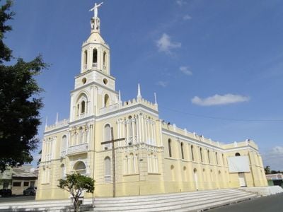
Tianguá, Administrative municipality in Serra da Ibiapaba, Ceará, Brazil

Tianguá is a municipality in Serra da Ibiapaba located at 775 meters elevation within Ceará state. The town covers 909 square kilometers in the Noroeste Cearense mesoregion.

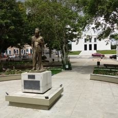
Tianguá became a city through Decree-Law No. 448 on September 20, 1938, marking its transition from a town to a municipality. This change was a turning point in the administrative development of the region.

The name Tianguá comes from Portuguese with Tupi roots, combining 'Tyanha' meaning hook and 'Guaba' meaning water, after the local river. People here maintain strong connections to local traditions and the natural surroundings that shape daily life.

The municipality maintains local offices where residents and visitors can access information and document services. The elevated location means the climate is cooler compared to lower areas of the surrounding region.

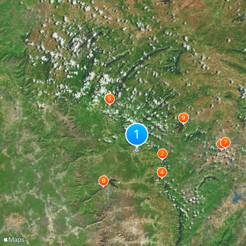
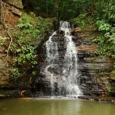
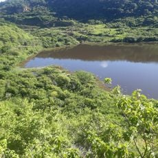
The territory encompasses three distinct geographical zones - cuesta slope, carrasco vegetation, and dry inland sertão - all within the Serra da Ibiapaba protection area. This variety of landscapes in one place offers a surprising view of how different ecosystems meet in the Brazilian highlands.

The community of curious travelers

AroundUs brings together thousands of curated places, local tips, and hidden gems, enriched daily by 60,000 contributors worldwide.

Start exploring
Location
Elevation above the sea
775 m
Shares border with
São João da Fronteira, Coreaú, Frecheirinha, Granja, Moraújo, Ubajara, Uruoca, Viçosa do Ceará
GPS coordinates
-3.73194,-40.99194
Latest update
December 17, 2025 08:37
« Tianguá - Administrative municipality in Serra da Ibiapaba, Ceará, Brazil » is provided by Around Us (aroundus.com). Images and texts are derived from Wikimedia project under a Creative Commons license. You are allowed to copy, distribute, and modify copies of this page, under the conditions set by the license, as long as this note is clearly visible.

Discover hidden gems everywhere you go!

From secret cafés to breathtaking viewpoints, skip the crowded tourist spots and find places that match your style. Our app makes it easy with voice search, smart filtering, route optimization, and insider tips from travelers worldwide. Download now for the complete mobile experience.

Around Us App Screenshot

A unique approach to discovering new places

Le Figaro

All the places worth exploring

France Info

A tailor-made excursion in just a few clicks

20 Minutes

Around Us
Travel Guide & Maps
Download

Send to your phone

QR Code
1

Open the camera app on your mobile.

2

Point at the QR code with your camera. A notification will appear.

3

Tap the notification to open the link.