Sobral

Log in to your account

AroundUs is a community-driven map of interesting places, built by curious explorers like you. It grows with every review, story, and photo you share.
Connect to save your favorite spots, contribute locations, and create personalized routes.
Continue with Google
Continue with Apple
Continue with X
Continue with Facebook
Continue with email
By continuing, you accept our Terms and Conditions and our Privacy Policy
Create an account
Add to collection
Map
Suggest a change
Share

Sobral, Commercial center in Ceará, Brazil

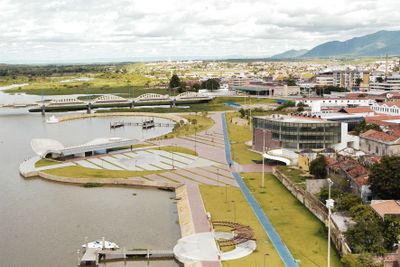
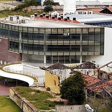
Sobral is a commercial city in Ceará, Brazil, extending along the banks of the Acaraú River at about seventy meters elevation. Streets link residential zones with industrial areas, with a denser center gradually opening toward agricultural lands on the outskirts.

The settlement gained town status in 1773 and grew into an important hub for cotton and agricultural trade during the 19th century. The arrival of the railway in the 20th century reinforced that role by enabling the transport of goods over longer distances.

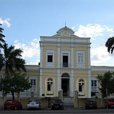
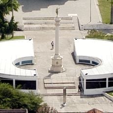
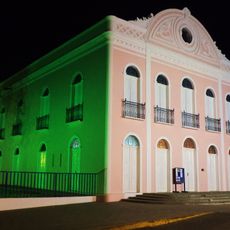
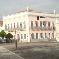
The name comes from a Portuguese surname given during the official founding, and today the settlement is known for its public squares where residents gather in the evening to walk and exchange news. Throughout the central districts, small cafés and market stalls come alive on weekends, reflecting the rhythm of social life common to the region.

The railway station and highway connections provide direct links to Fortaleza and surrounding towns, making it easy to arrive by public transport or by car. Walking through the center offers shaded streets and squares that allow a rest during the heat of the day.

The surrounding countryside is known for mango and coffee cultivation as well as cattle ranching, and visitors on market days can notice the influence of this agriculture in daily life. In some neighborhoods, old warehouses that once stored cotton remain visible, now repurposed for other uses.

Location: Ceará

Inception: July 5, 1773

Elevation above the sea: 70 m

Shares border with: Mucambo, Alcântaras, Cariré, Coreaú, Forquilha, Groaíras, Irauçuba, Massapê, Meruoca, Miraíma, Santa Quitéria, Santana do Acaraú

Website: http://sobral.ce.gov.br

GPS coordinates: -3.68556,-40.34417

Latest update: December 13, 2025 01:42

Photos
Reviews

Visited this place? Tap the stars to rate it and share your experience / photos with the community! Try now! You can cancel it anytime.

« Sobral - Commercial center in Ceará, Brazil » is provided by Around Us (aroundus.com). Images and texts are derived from Wikimedia project under a Creative Commons license. You are allowed to copy, distribute, and modify copies of this page, under the conditions set by the license, as long as this note is clearly visible.

Discover hidden gems everywhere you go!

From secret cafés to breathtaking viewpoints, skip the crowded tourist spots and find places that match your style. Our app makes it easy with voice search, smart filtering, route optimization, and insider tips from travelers worldwide. Download now for the complete mobile experience.

Around Us App Screenshot

A unique approach to discovering new places

Le Figaro

All the places worth exploring

France Info

A tailor-made excursion in just a few clicks

20 Minutes