Chest opened
+${chestReward.xp} XP
Explorer
NOUVEAU ×${chestReward.collectible.quantity}
tapez pour fermer
Chest locked

Open chests in the app

Around Us is built for your phone — chests unlock when you walk, explore and capture nearby places.

Enable Location

We need your location to show you interesting places around you

Discover nearby places

Find interesting locations and hidden gems around you

Precise directions

Get accurate directions and distances to places

Your location is never shared with other users. It's only used when you tap the location button.

35th parallel south

Log in to your account

Start exploring — it's free

Trusted by 72,888 travelers worldwide

Continue with Google
Continue with Apple
or

We will send you a code to connect

By continuing, you accept our Terms and Conditions and our Privacy Policy

Check your inbox

We've sent a pincode in your inbox. Please enter the code below.

35th parallel south
Discussion Reviews 1 Photos
18.4k Popularity

35th parallel south, circle of latitude

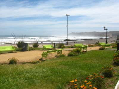
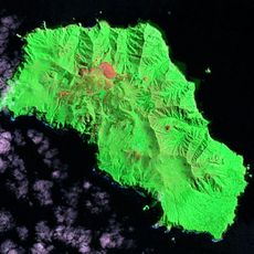
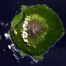
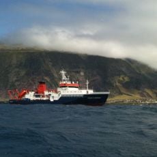
The 35th parallel south is an imaginary circle of latitude running 35 degrees south of the equator around the Earth. It passes through Australia, New Zealand, Chile, and Argentina, crossing dry plains, green hills, farmland, and coastal areas along its path.

Lines of latitude like the 35th parallel south have been used for navigation and mapmaking since ancient times. Explorers and sailors relied on such reference lines to chart routes and understand continents; today GPS uses them as positioning references.

The 35th parallel south is not a named cultural landmark or gathering place. For people living near it, it remains an invisible geographic reference rather than a site with local meaning or traditions.

The 35th parallel south cannot be visited as a single location since it is an invisible line circling the globe. In some places, visitors may find small markers or signs indicating the exact latitude, particularly where the line crosses roads or notable landmarks.

In Argentina, the 35th parallel south marks the border between Córdoba and La Pampa provinces. This geographic line has been used to define political boundaries on the South American continent, showing how imaginary latitude lines serve practical administrative purposes.

The community of curious travelers

AroundUs brings together thousands of curated places, local tips, and hidden gems, enriched daily by 60,000 contributors worldwide.

Start exploring
GPS coordinates
-35.00000,0.00000
Latest update
February 16, 2026 23:41
Around this place
Gough Island
United Kingdom

Gough Island

1056.3 km
Tristan da Cunha
United Kingdom

Tristan da Cunha

1129.5 km
Saint Helena, Ascension and Tristan da Cunha

Sandy Point, Tristan da Cunha

1123.5 km
Saint Helena, Ascension and Tristan da Cunha

Edinburgh Peak

1056.1 km
Mount Olav
United Kingdom

Mount Olav

1129.8 km
Saint Helena, Ascension and Tristan da Cunha

Halfway Beach

1123.8 km
Saint Helena, Ascension and Tristan da Cunha

Carlisle Beach

1123.6 km
Saint Helena, Ascension and Tristan da Cunha

False Peak

1057.9 km
Saint Helena, Ascension and Tristan da Cunha

South Peak

1055.1 km
Saint Helena, Ascension and Tristan da Cunha

Seal Beach

1063.9 km
Saint Helena, Ascension and Tristan da Cunha

Elephant Beach

1062.4 km
Saint Helena, Ascension and Tristan da Cunha

North Rowett

1055.8 km
The Peak
Saint Helena, Ascension and Tristan da Cunha

The Peak

1129.1 km
Saint Helena, Ascension and Tristan da Cunha

Big Beach

1127.6 km
Saint Helena, Ascension and Tristan da Cunha

Long Beach

1053.2 km
Saint Helena, Ascension and Tristan da Cunha

Sea-hen Crag

1057.8 km
Saint Helena, Ascension and Tristan da Cunha

The Bakers Oven

1057.3 km
Saint Helena, Ascension and Tristan da Cunha

Triple Peak

1057.3 km
Saint Helena, Ascension and Tristan da Cunha

Little Beach

1128.9 km
Saint Helena, Ascension and Tristan da Cunha

Tavistock Crag

1054.3 km
Saint Helena, Ascension and Tristan da Cunha

Nigels Cap

1056.4 km
Saint Helena, Ascension and Tristan da Cunha

Noisy Beach

1125.3 km
Saint Helena, Ascension and Tristan da Cunha

South Rowett

1055.9 km
Saint Helena, Ascension and Tristan da Cunha

Kern Crag

1054.1 km
Saint Helena, Ascension and Tristan da Cunha

Centre Rowett

1055.8 km
Saint Helena, Ascension and Tristan da Cunha

West Rowett

1056.5 km
Saint Helena, Ascension and Tristan da Cunha

Spire Crag

1058.3 km
Saint Helena, Ascension and Tristan da Cunha

Phoenix Beach

1123.6 km
Show the full map
Reviews
Share your experience

No review yet

Discussions
Start a discussion...

No discussion yet

« 35th parallel south - circle of latitude » is provided by Around Us (aroundus.com). Images and texts are derived from Wikimedia project under a Creative Commons license. You are allowed to copy, distribute, and modify copies of this page, under the conditions set by the license, as long as this note is clearly visible.

Discover hidden gems everywhere you go!

From secret cafés to breathtaking viewpoints, skip the crowded tourist spots and find places that match your style. Our app makes it easy with voice search, smart filtering, route optimization, and insider tips from travelers worldwide. Download now for the complete mobile experience.

Around Us App Screenshot

A unique approach to discovering new places

Le Figaro

All the places worth exploring

France Info

A tailor-made excursion in just a few clicks

20 Minutes

Around Us
Travel Guide & Maps
Download

Send to your phone

QR Code
1

Open the camera app on your mobile.

2

Point at the QR code with your camera. A notification will appear.

3

Tap the notification to open the link.