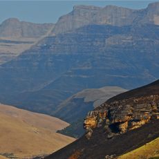
Drakensberg, Mountain range in KwaZulu-Natal, South Africa.
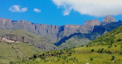
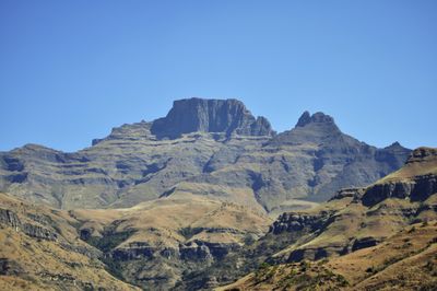
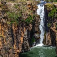
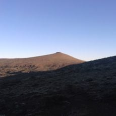
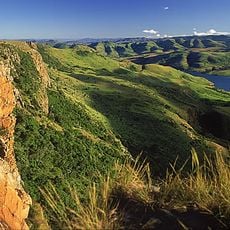
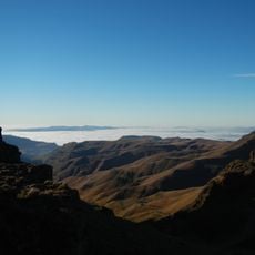
The Drakensberg stretches over 1000 kilometers (620 miles) through eastern South Africa and Lesotho, with basalt and quartzite formations reaching heights of 3482 meters (11 424 feet). The range forms a natural boundary between provinces and is cut by deep valleys, waterfalls, and highland plateaus.
The San people lived here for over 40 000 years and left more than 35 000 artworks in rock shelters. European settlers reached the region in the 19th century and named it Drakensberg after the dragon-like appearance of the peaks.
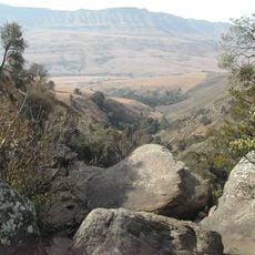
The Zulu people call these mountains uKhahlamba, meaning barrier of pointed spears, which describes the sharp peaks. Inside sandstone caves you can find thousands of San rock paintings showing hunting scenes and spiritual motifs.
Marked hiking trails run throughout the range, from short day walks to multi-day routes with overnight stays in mountain huts. Camping sites and accommodation are available year-round, though winter months are colder and can bring snowfall at higher elevations.
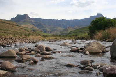
The range supplies drinking water to several South African provinces through its highland springs and rivers. Alpine grasslands host 299 bird species, including the rare bearded vulture that can be seen here.
Location: KwaZulu-Natal
Elevation above the sea: 3,482 m
Made from material: basalt, quartzite
Address: Drakensberg, Lesotho
GPS coordinates: -29.47799,29.26732
Latest update: December 4, 2025 19:02
From the windy tip of the Cape to the blue line of the Drakensberg, South Africa stacks landscapes that do not resemble each other. A morning on Table Mountain, an evening facing the whales of Hermanus, and between them red trails, deep canyons, lagoons, vineyards, and reserves where large animals pass through. Kruger opens its roads at dawn, Pilanesberg sketches an ancient crater, iSimangaliso blends reefs and wetlands. Further afield, the rugged coast preserves its cliffs, the Richtersveld its succulent deserts, and the Valley of Desolation its frozen lava columns. Here, travel is at eye and light level, to the rhythm of a vast land that changes its face at every turn.
Tugela Falls
88.5 km
Thabana Ntlenyana
1.1 km
Mafadi
31.8 km
Amphitheatre
86.7 km
Howick Falls
94.1 km
UKhahlamba / Drakensberg Park
26 km
Royal Natal National Park
93.3 km
Giant's Castle
25.6 km
Mont-Aux-Sources
87.4 km
Sehlabathebe National Park
50 km
Champagne Castle
43.2 km
Statue of Mahatma Gandhi
108.5 km
Cathedral Peak
62.9 km
Maloti-Drakensberg Park
12.3 km
Spion Kop
95.4 km
Pietermaritzburg City Hall
108.6 km
Spion Kop Battlefield Memorials
95.5 km
Wagendrift Dam
73 km
Spioenkop Dam Nature Reserve
93.5 km
Popple Peak
30.9 km
Cathedral of the Holy Nativity, Pietermaritzburg
108.3 km
Mandela Capture Site
87.5 km
Cathkin Peak
45.3 km
Pig & Pony
41.9 km
Riserva naturale di Spioenkop
91.6 km
Woodstock Dam Reservoir
82.6 km
Hart's Hill Falls
103.2 km
Kamberg Nature Reserve
40.5 kmReviews
Visited this place? Tap the stars to rate it and share your experience / photos with the community! Try now! You can cancel it anytime.
Discover hidden gems everywhere you go!
From secret cafés to breathtaking viewpoints, skip the crowded tourist spots and find places that match your style. Our app makes it easy with voice search, smart filtering, route optimization, and insider tips from travelers worldwide. Download now for the complete mobile experience.
A unique approach to discovering new places❞
— Le Figaro
All the places worth exploring❞
— France Info
A tailor-made excursion in just a few clicks❞
— 20 Minutes