Upper Nsiza Dam, reservoir in Zimbabwe
Location: Matabeleland South Province
Elevation above the sea: 1,240 m
GPS coordinates: -20.00139,29.19694
Latest update: November 17, 2025 13:51
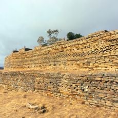
Naletale
37.4 km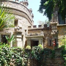
Nesbitt Castle
63.5 km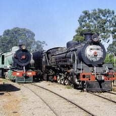
Bulawayo Railway Museum
67.6 km
Natural History Museum of Zimbabwe
65.1 km
National Library of Zimbabwe
65.7 km
James McNeillie Circuit
63.3 km
Mzingwane Dam
49.4 km
Borrow Street Swimming Pool
65.8 km
Embalabala
42.9 km
Fundisi Dam
57.2 km
Selborne Park
62.2 km
Upper Ncema Dam
38.2 km
Insiza Dam
37.3 km
Ngezi Dam
64.2 km
Inyankuni Dam
38.9 km
Lions Golf Driving Range
65.1 km
Canella Gardens
63.4 km
Bulawayo Golf Course
65.5 km
Amphi Theatre
65.3 km
The Bulawayo Theathre
65.5 km
National Art Gallery Bulawayo
66.4 km
Chinganga
60.3 km
Asher Duvura
59.9 km
Joshua Nkomo Statue
66.5 km
Wayside cross
67.9 km
Charles Frederick Lendy
65.3 km
Nesbitt
63.5 km
Nesbitt Castle
63.5 kmReviews
Visited this place? Tap the stars to rate it and share your experience / photos with the community! Try now! You can cancel it anytime.
Discover hidden gems everywhere you go!
From secret cafés to breathtaking viewpoints, skip the crowded tourist spots and find places that match your style. Our app makes it easy with voice search, smart filtering, route optimization, and insider tips from travelers worldwide. Download now for the complete mobile experience.

A unique approach to discovering new places❞
— Le Figaro
All the places worth exploring❞
— France Info
A tailor-made excursion in just a few clicks❞
— 20 Minutes