Mbarara City, Commercial center in Western Region, Uganda
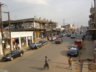
Mbarara is a city in Western Uganda spanning six boroughs at about 1,470 meters elevation, where modern commercial areas sit alongside traditional markets. The landscape mixes multi-story buildings with residential neighborhoods and busy market squares that form the heart of daily activity.
Founded in 1901 as an administrative center, the city grew from a small settlement into a major commercial hub. Official city status came in 2020, marking its rise in regional importance.
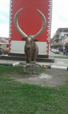
Local craftspeople continue traditional woodcarving, pottery, and weaving that reflect the heritage of Bakiga and Bantu communities. You can see these crafts being made and sold in markets throughout the city, where artisans pass their skills to younger generations.
The city connects to Kampala, Bushenyi, Masaka, and Kikagati via road networks, with a local airfield for smaller flights. Most visitors get around on foot or by local taxi, especially in the central markets and business districts.
Mbarara University of Science and Technology leads regional medical research initiatives that draw attention from across East Africa. The city also houses industries producing textiles, beverages, and processed foods that supply markets beyond the immediate region.
The community of curious travelers
AroundUs brings together thousands of curated places, local tips, and hidden gems, enriched daily by 60,000 contributors worldwide.