South Solok, Administrative region in West Sumatra, Indonesia
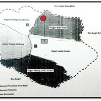
South Solok is an administrative region in West Sumatra comprising multiple districts with varied terrain ranging from flat plains to hilly areas. The territory is organized into traditional village units called nagari, each maintaining its own local administrative structure.
South Solok was established as an independent regency on January 7, 2003, marking a turning point in West Sumatra's territorial reorganization. This creation allowed the region to develop its own administrative structures and manage local affairs independently.
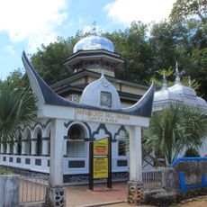
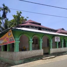
The region preserves Minangkabau traditions through its distinctive architecture, especially the Rumah Gadang houses with their curved roofs and intricate wooden carvings. This building style shapes the landscape and reflects the cultural identity of local people.
The administrative capital in Padang Aro serves as the main hub for regional services and coordinates the seven districts. Visitors should know that the region comprises multiple nagari, meaning local services may be organized at the village level.
The nagari within the region function as traditional administrative units that preserve their own regulations while operating within Indonesia's modern governmental system. This dual structure shows how ancient local systems and contemporary governance coexist in the same territory.
The community of curious travelers
AroundUs brings together thousands of curated places, local tips, and hidden gems, enriched daily by 60,000 contributors worldwide.