Chest opened
+${chestReward.xp} XP
Explorer
NOUVEAU ×${chestReward.collectible.quantity}
tapez pour fermer

See the monuments around you in AR Open chests in the app

Around Us is built for your phone — point your camera at the streets and discover the monuments and places around you in augmented reality. Around Us is built for your phone — chests unlock when you walk, explore and capture nearby places.

•

Enable Location

We need your location to show you interesting places around you

Discover nearby places

Find interesting locations and hidden gems around you

Precise directions

Get accurate directions and distances to places

Your location is never shared with other users. It's only used when you tap the location button.

Lesueur National Park

Log in to your account

Start exploring — it's free

Trusted by 94,426 travelers worldwide

Continue with Google
Continue with Apple
or

We will send you a code to connect

By continuing, you accept our Terms and Conditions and our Privacy Policy

Check your inbox

We've sent a pincode in your inbox. Please enter the code below.

Lesueur National Park, Nature reserve in Shire of Coorow, Australia.

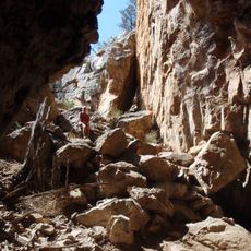
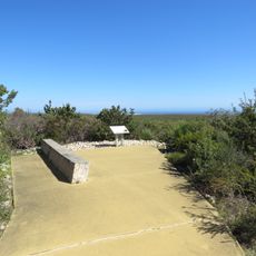
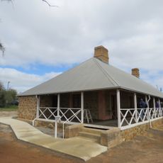
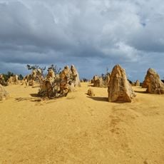
Lesueur National Park is a nature reserve in Western Australia that combines coastal dunes, heathlands, and woodlands across a large area. The varied terrain creates many different environments to discover.

The park takes its name from French explorer Charles Lesueur, who traveled along this coast in the early 1800s. His expeditions helped map this part of Australia.

The low shrubland around Mount Lesueur is known as kwongan, the Noongar word for this heath. The Amangu people are the Traditional Owners of the country the park occupies. The German source notes that this kwongan, only about a metre tall, holds more plant species per area than any other vegetation type in Western Australia.

The park lies about 210 km north of Perth and 100 km south of Geraldton, reached via the Brand Highway near Jurien Bay. Phytophthora dieback kills plants and spreads through infected soil and water, so clean footwear and vehicle tyres before entering and stay on marked paths. The western side holds sand dunes, swamps and low limestone hills.

On the laterite plain around Mount Lesueur, up to 80 plant species can be counted in ten square metres, and a few hundred metres away a different plant community takes over. Botanists compare this kwongan shrubland, rarely more than a metre tall, to tropical rainforest for species richness. About 200 of the park's 820 plant species are specially protected.

The community of curious travelers

AroundUs brings together thousands of curated places, local tips, and hidden gems, enriched daily by 94,426 contributors worldwide.

Start exploring
Location
GPS coordinates
-30.12368,115.19271
Latest update
October 29, 2026 03:34
Reviews
Share your experience

No review yet

Discussions
Start a discussion...

No discussion yet

« Lesueur National Park - Nature reserve in Shire of Coorow, Australia » is provided by Around Us (aroundus.com). Images and texts are derived from Wikimedia project under a Creative Commons license. You are allowed to copy, distribute, and modify copies of this page, under the conditions set by the license, as long as this note is clearly visible.

Discover hidden gems everywhere you go!

From secret cafés to breathtaking viewpoints, skip the crowded tourist spots and find places that match your style. Our app makes it easy with voice search, smart filtering, route optimization, and insider tips from travelers worldwide. Download now for the complete mobile experience.

Around Us App Screenshot
❝

A unique approach to discovering new places❞

— Le Figaro

❝

All the places worth exploring❞

— France Info

❝

A tailor-made excursion in just a few clicks❞

— 20 Minutes

Around Us
Travel Guide & Maps
Download

Send to your phone

QR Code
1

Open the camera app on your mobile.

2

Point at the QR code with your camera. A notification will appear.

3

Tap the notification to open the link.