MacDonnell Ranges

Log in to your account

AroundUs is a community-driven map of interesting places, built by curious explorers like you. It grows with every review, story, and photo you share.
Connect to save your favorite spots, contribute locations, and create personalized routes.
By continuing, you accept our Terms and Conditions and our Privacy Policy

MacDonnell Ranges

Add to collection
Map
Suggest a change
Share

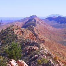
MacDonnell Ranges, Mountain range in Northern Territory, Australia.

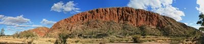
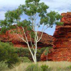
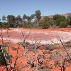
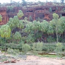
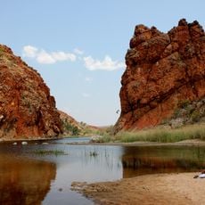
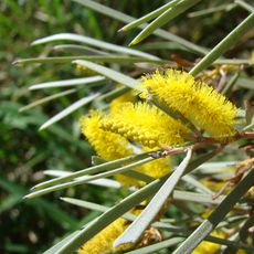
The MacDonnell Ranges form a mountain system in Central Australia marked by red quartzite peaks and deep gorges. The ridges stretch across hundreds of kilometers, with the highest point exceeding 1500 meters and permanent waterholes filling many of the valleys.

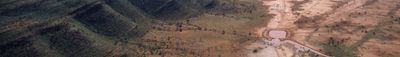
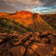
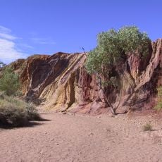
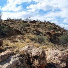
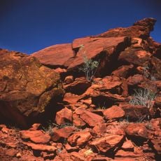
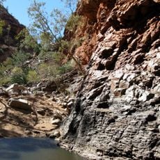
John McDouall Stuart first explored this mountain system in 1860 and named it after Richard MacDonnell, who was Governor of South Australia at the time. The rock layers tell a story reaching back more than 300 million years, shaped by forces that folded and lifted the quartzite.

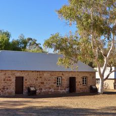
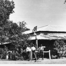
The mountain range holds many sacred places and rock art sites that remain deeply important to Aboriginal communities today. Walking through these areas, visitors encounter tangible connections to long-established traditions and spiritual practices.

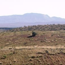
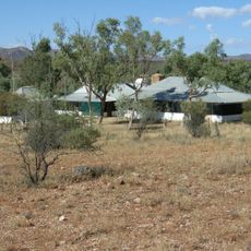
This mountain range is best explored on foot, with multiple walking trails and camping areas scattered throughout. The longest trail extends over 200 kilometers and allows for multi-day treks across different sections of the range.

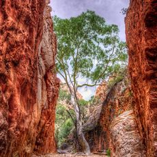
The folded rock layers here reveal ancient geological processes that visitors can actually see in the twisted and layered formations. These structures show how powerful forces once pushed and bent the stone into the shapes we see today.

Location: Northern Territory

Elevation above the sea: 1,531 m

Part of: Central Australia, Central Ranges xeric scrub

GPS coordinates: -23.96026,132.77575

Latest update: December 6, 2025 16:01

Photos
Australian outback: natural landmarks, geology, desert landscapes

The Australian outback encompasses a vast territory featuring distinctive geological characteristics, including ancient sandstone formations, deep canyons, and expansive salt lakes. This region contains some of Earth's oldest landscapes, from the red monoliths of the Northern Territory to the...

Reviews

Visited this place? Tap the stars to rate it and share your experience / photos with the community! Try now! You can cancel it anytime.

« MacDonnell Ranges - Mountain range in Northern Territory, Australia » is provided by Around Us (aroundus.com). Images and texts are derived from Wikimedia project under a Creative Commons license. You are allowed to copy, distribute, and modify copies of this page, under the conditions set by the license, as long as this note is clearly visible.

Discover hidden gems everywhere you go!

From secret cafés to breathtaking viewpoints, skip the crowded tourist spots and find places that match your style. Our app makes it easy with voice search, smart filtering, route optimization, and insider tips from travelers worldwide. Download now for the complete mobile experience.

Around Us App Screenshot

A unique approach to discovering new places

Le Figaro

All the places worth exploring

France Info

A tailor-made excursion in just a few clicks

20 Minutes