Enable Location

We need your location to show you interesting places around you

Discover nearby places

Find interesting locations and hidden gems around you

Precise directions

Get accurate directions and distances to places

Your location is never shared with other users. It's only used when you tap the location button.

Gogeldrie Weir

Log in to your account

Start exploring — it's free

Trusted by 63,385 travelers worldwide

Continue with Google
Continue with Apple
or

We will send you a code to connect

By continuing, you accept our Terms and Conditions and our Privacy Policy

Check your inbox

We've sent a pincode in your inbox. Please enter the code below.

Discussion Reviews 1 Photos
1.4k Popularity

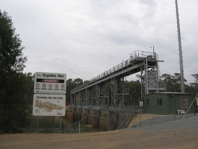
Gogeldrie Weir, Irrigation weir in Leeton Shire, Australia

Gogeldrie Weir is a dam crossing the Murrumbidgee River in Leeton Shire, fitted with six sluice gates that allow operators to control water flow for irrigation purposes. The structure uses steel sheet piling, concrete piers, and reinforced concrete floors to direct water reliably.

The weir was built between 1958 and 1959 to redirect water from the Murrumbidgee River toward the Coleambally Irrigation Area. This infrastructure became important for supporting agricultural growth in the region.

The New South Wales State Heritage Register listed this structure in April 1999, recognizing its role in agricultural development and water management.

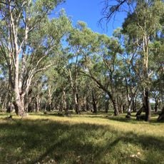
The weir is situated roughly 63 kilometers south of Narrandera and can be viewed from nearby roads. It is best visited during operational hours when the sluice gates are active.

The weir was added to the New South Wales State Heritage Register in 1999, recognizing its importance to the region. This heritage status reflects how significant the water infrastructure is to local history.

The community of curious travelers

AroundUs brings together thousands of curated places, local tips, and hidden gems, enriched daily by 60,000 contributors worldwide.

Start exploring
Location
Inception
1959
Elevation above the sea
134 m
Part of
Murrumbidgee Irrigation Area
GPS coordinates
-34.61520,146.25120
Latest update
December 14, 2025 17:02
Reviews
Share your experience

No review yet

Discussions
Start a discussion...

No discussion yet

« Gogeldrie Weir - Irrigation weir in Leeton Shire, Australia » is provided by Around Us (aroundus.com). Images and texts are derived from Wikimedia project under a Creative Commons license. You are allowed to copy, distribute, and modify copies of this page, under the conditions set by the license, as long as this note is clearly visible.

Discover hidden gems everywhere you go!

From secret cafés to breathtaking viewpoints, skip the crowded tourist spots and find places that match your style. Our app makes it easy with voice search, smart filtering, route optimization, and insider tips from travelers worldwide. Download now for the complete mobile experience.

Around Us App Screenshot

A unique approach to discovering new places

Le Figaro

All the places worth exploring

France Info

A tailor-made excursion in just a few clicks

20 Minutes

Around Us
Travel Guide & Maps
Download

Send to your phone

QR Code
1

Open the camera app on your mobile.

2

Point at the QR code with your camera. A notification will appear.

3

Tap the notification to open the link.