Chest opened
+${chestReward.xp} XP
Explorer
NOUVEAU ×${chestReward.collectible.quantity}
tapez pour fermer
Chest locked

Open chests in the app

Around Us is built for your phone — chests unlock when you walk, explore and capture nearby places.

Enable Location

We need your location to show you interesting places around you

Discover nearby places

Find interesting locations and hidden gems around you

Precise directions

Get accurate directions and distances to places

Your location is never shared with other users. It's only used when you tap the location button.

Stewart Island/Rakiura

Log in to your account

Start exploring — it's free

Trusted by 73,062 travelers worldwide

Continue with Google
Continue with Apple
or

We will send you a code to connect

By continuing, you accept our Terms and Conditions and our Privacy Policy

Check your inbox

We've sent a pincode in your inbox. Please enter the code below.

Stewart Island/Rakiura
Discussion Reviews 3 Photos
75k Popularity

Stewart Island/Rakiura, National park island in South New Zealand.

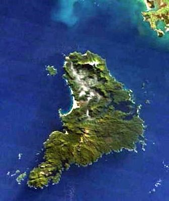
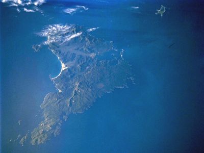
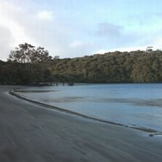
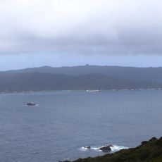
Stewart Island, also known as Rakiura, is an island in the Southland District of New Zealand that covers 1,746 square kilometers (674 square miles) with native forests, deep coastal inlets, and granite peaks reaching up to 980 meters (3,215 feet). The island sits south of the South Island and is shaped by dense vegetation and a deeply indented coastline.

Māori settlers established communities during the 14th century, using the marine and forest resources found along the coast and in the interior. European explorers arrived in the late 18th century, naming the place after William Stewart, an officer aboard an early survey vessel.

The name Rakiura means glowing skies in Māori and refers to the natural light displays that appear throughout the year, from southern auroras to extended twilight periods. This naming reflects the deep connection between Māori observers and the distinctive patterns of light that mark the island's position at the edge of the Pacific.

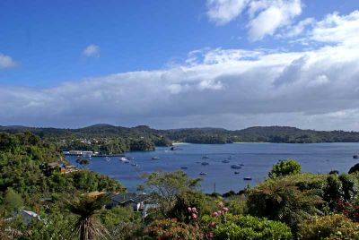
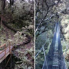
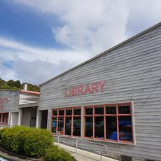
Ferries run regularly from Bluff, and small aircraft land at Ryan's Creek Aerodrome near Oban, the only settlement with visitor facilities. Most people stay in Oban and join guided walks or boat tours, as much of the island remains roadless and requires experience to navigate independently.

Rakiura received Dark Sky Sanctuary designation in 2019, joining a small group of places worldwide with this recognition. The remoteness and absence of artificial lighting allow nighttime observations with a clarity rarely found in populated regions.

The community of curious travelers

AroundUs brings together thousands of curated places, local tips, and hidden gems, enriched daily by 60,000 contributors worldwide.

Start exploring
Elevation above the sea
980 m
Part of
New Zealand
GPS coordinates
-47.00000,167.90000
Latest update
March 5, 2026 18:55
Reviews
Share your experience

No review yet

Discussions
Start a discussion...

No discussion yet

« Stewart Island/Rakiura - National park island in South New Zealand » is provided by Around Us (aroundus.com). Images and texts are derived from Wikimedia project under a Creative Commons license. You are allowed to copy, distribute, and modify copies of this page, under the conditions set by the license, as long as this note is clearly visible.

Discover hidden gems everywhere you go!

From secret cafés to breathtaking viewpoints, skip the crowded tourist spots and find places that match your style. Our app makes it easy with voice search, smart filtering, route optimization, and insider tips from travelers worldwide. Download now for the complete mobile experience.

Around Us App Screenshot

A unique approach to discovering new places

Le Figaro

All the places worth exploring

France Info

A tailor-made excursion in just a few clicks

20 Minutes

Around Us
Travel Guide & Maps
Download

Send to your phone

QR Code
1

Open the camera app on your mobile.

2

Point at the QR code with your camera. A notification will appear.

3

Tap the notification to open the link.