Chest opened
+${chestReward.xp} XP
Explorer
NOUVEAU ×${chestReward.collectible.quantity}
tapez pour fermer

See the monuments around you in AR Open chests in the app

Around Us is built for your phone — point your camera at the streets and discover the monuments and places around you in augmented reality. Around Us is built for your phone — chests unlock when you walk, explore and capture nearby places.

•

Enable Location

We need your location to show you interesting places around you

Discover nearby places

Find interesting locations and hidden gems around you

Precise directions

Get accurate directions and distances to places

Your location is never shared with other users. It's only used when you tap the location button.

Bridle Path, New Zealand

Log in to your account

Start exploring — it's free

Trusted by 94,512 travelers worldwide

Continue with Google
Continue with Apple
or

We will send you a code to connect

By continuing, you accept our Terms and Conditions and our Privacy Policy

Check your inbox

We've sent a pincode in your inbox. Please enter the code below.

Bridle Path, New Zealand

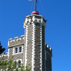
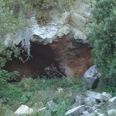
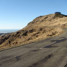
Bridle Path, New Zealand, Historic trail in Christchurch, New Zealand.

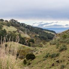
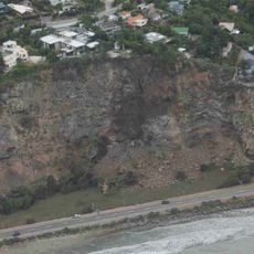
The Bridle Path is a 2.4 km shared-use track that climbs 333 metres from Bridle Path Road in Lyttelton to the Summit Road on the crater rim, then descends to the Heathcote Valley near the road tunnel. The upper section is a dirt and gravel path edged with dry grass, marked by a wooden post with a white sign bearing a red symbol and the number 20.

European settlers in Canterbury created this path in 1850 as the main connection between Lyttelton port and the growing town of Christchurch. It served as a vital route for transporting goods and people during the region's early development.

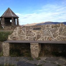
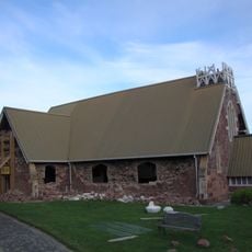
The stone shelter at the summit, beside Summit Road, is a 1940 centennial memorial to the Pioneer Women of Canterbury. Seven commemorative stone seats stand along the path, most built for the 1950 Canterbury centenary. The name comes from riders dismounting to lead horses by the bridle over the steepest sections.

The climb takes about an hour and a half and is steadily uphill, so expect a good physical workout on your way up. Wear sturdy shoes and bring water, especially on warmer days when the sun exposure increases.

The path is a legal road, not a park, so trail bikes may legally use it, though walkers regard them as a nuisance; attempts to change its status date from the 1970s. The white sign with the red symbol and the number 20 on a wooden post marks the route for users.

The community of curious travelers

AroundUs brings together thousands of curated places, local tips, and hidden gems, enriched daily by 94,512 contributors worldwide.


Start exploring
GPS coordinates
-43.59330,172.70800
Latest update
October 31, 2026 13:42
Reviews
Share your experience

No review yet

Discussions
Start a discussion...

No discussion yet

« Bridle Path, New Zealand - Historic trail in Christchurch, New Zealand » is provided by Around Us (aroundus.com). Images and texts are derived from Wikimedia project under a Creative Commons license. You are allowed to copy, distribute, and modify copies of this page, under the conditions set by the license, as long as this note is clearly visible.

Discover hidden gems everywhere you go!

From secret cafés to breathtaking viewpoints, skip the crowded tourist spots and find places that match your style. Our app makes it easy with voice search, smart filtering, route optimization, and insider tips from travelers worldwide. Download now for the complete mobile experience.
Around Us App Screenshot
❝

A unique approach to discovering new places❞

— Le Figaro

❝

All the places worth exploring❞

— France Info

❝

A tailor-made excursion in just a few clicks❞

— 20 Minutes

Around Us
Travel Guide & Maps
Download

Send to your phone

QR Code
1

Open the camera app on your mobile.

2

Point at the QR code with your camera. A notification will appear.

3

Tap the notification to open the link.