Whangaehu River, Large river in Manawatū-Whanganui, North Island, New Zealand
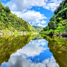
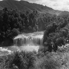
The Whangaehu River rises at the southeastern edge of the crater lake of Mount Ruapehu in Tongariro National Park and runs about 161 kilometres south-southwest to the Tasman Sea near Whangaehu, southeast of Whanganui. Its upper course begins as meltwater from a small glacier, and when hot lake water spills it melts ice and snow into a cave-like tunnel.
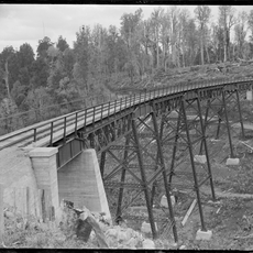
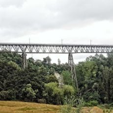
The river's recorded history includes a flood on 13 December 1859 that washed away its bridge, and further floods in 1889 and 1895 caused by Ruapehu eruptions. On 24 December 1953 a crater-wall collapse sent a lahar down the river, weakening the Tangiwai railway bridge, which collapsed under the Wellington–Auckland express; 151 of the 285 people aboard died. A lahar on 18 March 2007 released an estimated 1.29 billion cubic metres of water, mud and sludge, and the ERLAWS alarm prevented accidents.
In February 1862 James Coutts Crawford recorded old songs and "various accounts of the taniwha, one of whom we were told overthrew the Wangaehu bridge." The river's name appears in this early written record of local Māori tradition, where a taniwha is linked to the destruction of a bridge over the Whangaehu.
The river is accessible at several points along its course for short walks and nature exploration. Water levels can rise suddenly due to volcanic activity upstream, so visitors should exercise caution when approaching the water.
The crater lake's water is so acidic that the Tongariro Power Scheme diverts no water from the Whangaehu headwaters; instead the river bypasses the Waihianoa Aqueduct via a ford. The upper river starts as meltwater from a small glacier, and hot lake water spilling out melts ice and snow into a cave-like tunnel.
The community of curious travelers
AroundUs brings together thousands of curated places, local tips, and hidden gems, enriched daily by 93,599 contributors worldwide.