Waipoua Forest, Conservation park in Northland Region, New Zealand.
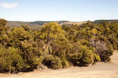
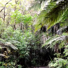
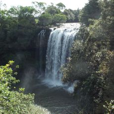
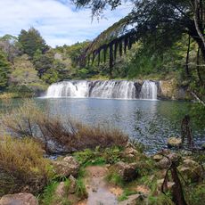
Waipoua Forest is a conservation park on the western coast of Northland that protects the largest remaining expanse of native forest in the northern region. The land spans several kilometers with thick vegetation, flowing streams, and maintained walking tracks that allow visitors to move through the different forest zones.
The forest was acquired from Maori landowners in 1876 and designated as a State Forest Reserve in 1885. Its reclassification as a sanctuary in 1952 secured permanent protection for the woodland and its inhabitants.
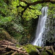
The Te Roroa people have deep roots in this valley, where their ancestors once fished and farmed in these lands. Today, visitors can sense this ongoing relationship with the forest and its waterways.
The nearest fuel stations are located roughly 28 kilometers to the south and 20 kilometers to the north, so plan ahead and fill up before arriving. There are no shops inside the forest, so bring supplies with you or stock up from nearby towns beforehand.
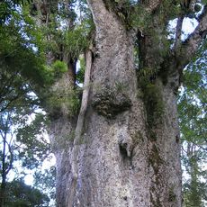
The forest is home to Tane Mahuta, New Zealand's largest kauri tree, which stands among many other ancient specimens with massive trunks throughout the woodland. These towering giants shape the entire character of the place.
Location: Kaipara District
Location: Northland Region
GPS coordinates: -35.65300,173.55600
Latest update: December 6, 2025 19:08
New Zealand provides photographic subjects ranging from the Southern Alps to sand beaches on both coastlines. The landscape includes thermal springs in Rotorua, glaciers like Franz Josef and Tasman, and fjords in Fiordland. Mount Cook dominates the alpine region while the Coromandel Peninsula holds...
Tane Mahuta
6.3 km
Hundertwasser Toilets
55.4 km
Te Matua Ngahere
5.6 km
Waipoua Forest
2.6 km
Kamo Wildlife Sanctuary
59.4 km
Ruapekapeka
57.5 km
Stone Store
60.9 km
Rainbow Falls
60.1 km
Church of St John the Baptist
47.3 km
St. James Church, Kerikeri
60.8 km
Kohukohu wharf
32.5 km
Wharepoke Falls
60.8 km
Central Hotel
42.9 km
War Memorial Band Rotunda (World War One)
42.7 km
Kerikeri Basin historic precinct
60.8 km
Aperahama Church
33.5 km
Holy Trinity Church
42.4 km
Procter Library
59.3 km
Bank of New Zealand building
32.9 km
Rawene Library
29.3 km
Historic Municipal Chambers
42.6 km
Stone Bridge
32.6 km
Bank Manager's House
32.9 km
Dargaville Post Office
42.7 km
Otiria Marae
49.5 km
Te Pakanga o Ōhaeawai
40.9 km
Te Waimate Mission House
47.4 km
Doctor's Residence and Surgery
42.5 kmVisited this place? Tap the stars to rate it and share your experience / photos with the community! Try now! You can cancel it anytime.
Discover hidden gems everywhere you go!
From secret cafés to breathtaking viewpoints, skip the crowded tourist spots and find places that match your style. Our app makes it easy with voice search, smart filtering, route optimization, and insider tips from travelers worldwide. Download now for the complete mobile experience.
A unique approach to discovering new places❞
— Le Figaro
All the places worth exploring❞
— France Info
A tailor-made excursion in just a few clicks❞
— 20 Minutes