Enable Location

We need your location to show you interesting places around you

Discover nearby places

Find interesting locations and hidden gems around you

Precise directions

Get accurate directions and distances to places

Your location is never shared with other users. It's only used when you tap the location button.

Lithgow

Log in to your account

Join the adventure

Create your free account and start exploring (like 60k+ others)

We will send you a code to connect

or
Continue with Google
Continue with Apple
By continuing, you accept our Terms and Conditions and our Privacy Policy

Check your inbox

We've sent a pincode in your inbox. Please enter the code below.

Lithgow, Administrative center in New South Wales, Australia

Description

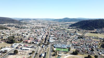
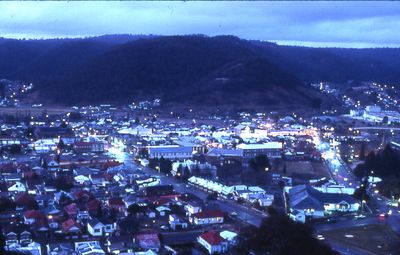
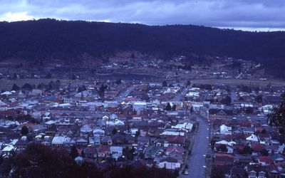
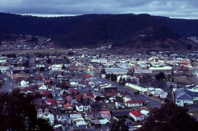
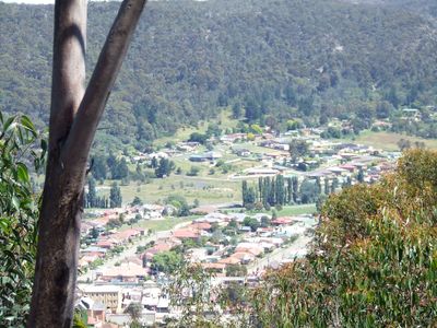
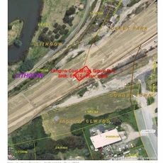
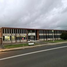
Lithgow is an administrative center in the Central Tablelands region of New South Wales, spreading across seven valleys approximately 150 kilometers (93 miles) northwest of Sydney. The city sits at an elevation of 950 meters (3,117 feet) and functions as a significant regional transport hub.

History

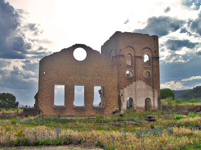
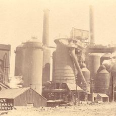
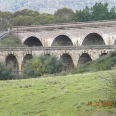
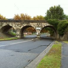
The opening of coal mines and the Lithgow Valley railway line in 1869 transformed the settlement into a major industrial center for New South Wales. This development established the city as a key location for steel production in Australia.

Culture

The Lithgow Show draws together regional farmers, artisans, and performers each year to display farm goods, traditional crafts, and local entertainment. This gathering shows how the community values its agricultural heritage and skilled trades.

Practical

Visitors can reach Lithgow via the Great Western Highway or regular NSW TrainLink services, with the railway station serving as a major regional transport hub. The location is well connected for travelers exploring the Central Tablelands region.

Did you know?

The Lithgow Valley Colliery and Pottery Site preserves remnants from Australia's first commercially successful steel mill, now displayed at Blast Furnace Park. This location reveals how industrial innovation shaped the region's identity and development.

Location
Location
Elevation above the sea
917 m
Shares border with
Marrangaroo, Vale of Clwydd, Oaky Park, Morts Estate, Cobar Park, McKellars Park, Hermitage Flat, Bowenfels, Hartley, Hassans Walls, Sheedys Gully, Littleton, Pottery Estate, Doctors Gap
GPS coordinates
-33.48167,150.15111
Latest update
December 17, 2025 08:19

AroundUs brings together thousands of curated places, local tips, and hidden gems, enriched daily by 60,000 contributors worldwide. Discover all places nearby (City of Lithgow).

« Lithgow - Administrative center in New South Wales, Australia » is provided by Around Us (aroundus.com). Images and texts are derived from Wikimedia project under a Creative Commons license. You are allowed to copy, distribute, and modify copies of this page, under the conditions set by the license, as long as this note is clearly visible.

Discover hidden gems everywhere you go!

From secret cafés to breathtaking viewpoints, skip the crowded tourist spots and find places that match your style. Our app makes it easy with voice search, smart filtering, route optimization, and insider tips from travelers worldwide. Download now for the complete mobile experience.

Around Us App Screenshot

A unique approach to discovering new places

Le Figaro

All the places worth exploring

France Info

A tailor-made excursion in just a few clicks

20 Minutes

Around Us
Travel Guide & Maps
Download

Send to your phone

QR Code
1

Open the camera app on your mobile.

2

Point at the QR code with your camera. A notification will appear.

3

Tap the notification to open the link.